Eight archipelagos where the boat still matters
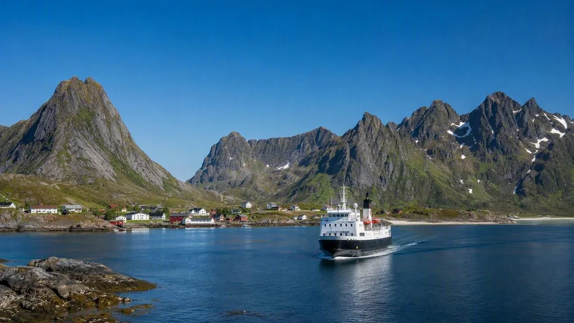
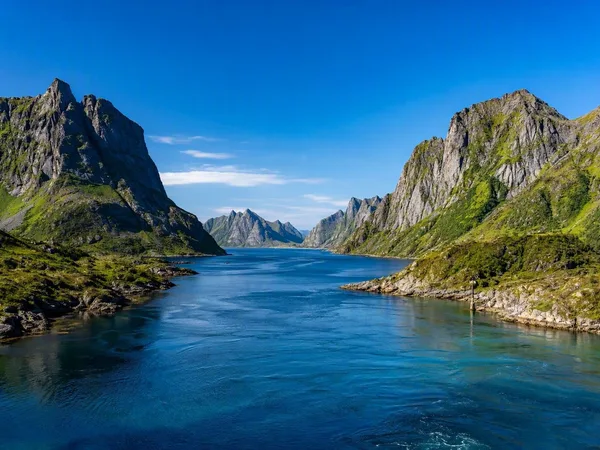
A ferry from Bodø reaches Lofoten beneath granite ridges that rise almost straight from the Norwegian Sea. Across these eight archipelagos, ferries, island flights, small launches and expedition ships make arrival part of the place.
The Azores: paths across volcanic ground
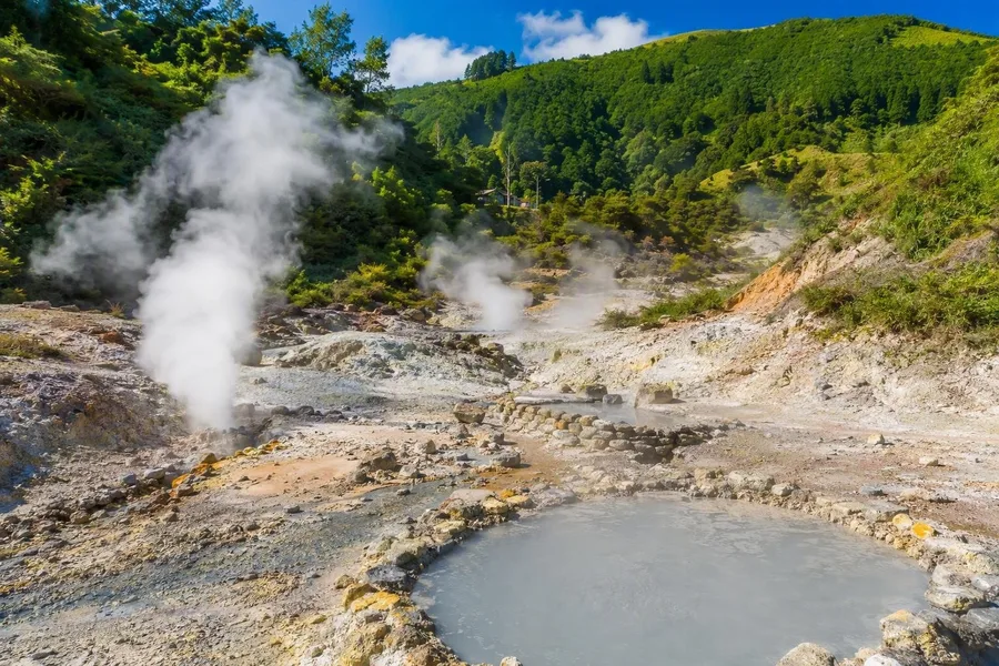 Fumaroles and thermal springs steam in Furnas on São Miguel.
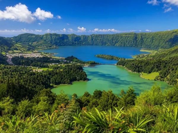
On São Miguel, paths run along caldera rims above deep-blue crater lakes and descend towards Furnas, where fumaroles and thermal springs show that volcanism still works beneath the ground. Cooks lower cozido into geothermal earth to cook the stew.
The same geology shapes quieter islands. Low basalt walls protect Pico’s tiny vineyard plots from Atlantic wind and salt, while green slopes meet dark beaches and low coastal fajãs. Flights reach São Miguel, Terceira and Faial, then regional aircraft cover the wider gaps between the nine islands and ferries take shorter crossings. Weather can rearrange that plan. The Atlantic crossing remains part of the day rather than a transfer to forget.
Lofoten: arriving beneath granite
The ferry from Bodø approaches narrow peaks, deep fjords and strips of sand below granite and syenite walls. Ice cut the ridges during the ice ages, while the ancient hard rock resisted erosion better than softer mountains farther inland.
Fishing explains why villages and rorbuer, the former fishermen’s cabins, stand close to the water. Winter brings skrei cod to the spawning grounds, and harbours and drying racks still mark that seasonal trade. Ferries can call at Røst and Værøy before Moskenes, while a passenger boat runs to Svolvær. Walkers and kayakers meet steep ground and cold water beyond the harbour.
The Outer Hebrides: crofts, causeways and Barra’s beach runway
Lewis, Harris and the Uists form a long chain of peat, lochs, shell-sand beaches and crofting land. On Uist, machair grassland spreads behind dunes, where shell-rich soil, grazing and cultivation support seasonal flowers and birdlife.
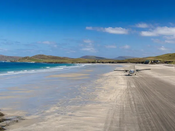
At Arnol on Lewis, blackhouses have thick double walls and rounded corners. Families once shared them with livestock, and smoke from a central peat fire passed through the thatch; later white houses added windows, chimneys and tiled roofs. Ferries and causeways join much of the island chain. Barra offers the sharper arrival: scheduled aircraft land on the beach, with tides and weather setting the terms.
Stockholm: from city quay to outer skerry
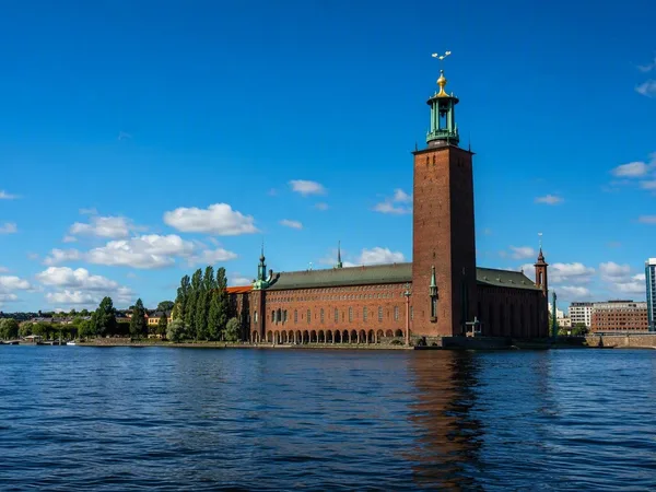
Public boats leave central Stockholm for islands with red wooden houses, small farms and landing stages, then continue towards bare outer skerries and more exposed Baltic water. Many routes through the central and northern archipelago pass Vaxholm.
Farmers and fishers shaped these islands before city residents built summer houses beside older villages. Herring and cod fishing supported Baltic trade from the Viking period through the Middle Ages, which explains the dense pattern of harbours and jetties. On larger inhabited islands, walking and cycling work well. Kayaks and sailing boats reach narrower passages farther out, where a missed departure carries more weight.
The Cyclades: dry paths and working ports
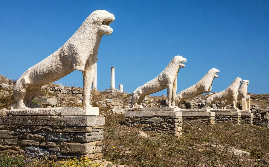
The Cyclades take their name from the imagined circle around Delos, once a sanctuary and later a trading city on Aegean sea lanes. Its quays, markets and houses remain on an island now without permanent residents.
On Sifnos and Amorgos, paths cross dry terraces between compact villages. White stone houses, narrow lanes and settlements gathered around castles answered heat, wind, scarce space and danger from the sea. The islands do not all look alike: Sifnos keeps its pottery tradition, while Milos has coastal sirmata, boat sheds built at water level. Ferries from Athens link the main islands, but smaller islands receive fewer calls. The timetable and the wind decide whether a detour fits.
Dalmatia: stone fields behind Adriatic ports
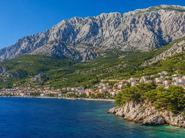
From Split, ferries and catamarans pass Brač and Hvar before continuing towards Vis, Korčula or Dubrovnik. Car ferries use broad ramps outside some old centres, while passenger catamarans can call closer to historic harbour fronts.
Greek settlers established communities on Vis, Hvar and Korčula. Roman and Venetian periods later left further marks on coastal towns. Behind Stari Grad on Hvar, farmers still grow grapes and olives in an ancient Greek grid of plots divided by dry-stone walls. Islanders used the same mortarless craft to clear stony ground and make terraces, shelters and field boundaries. Small boats reach the coves around Vis and the caves and beaches of Biševo.
Raja Ampat: the last transfer by small boat
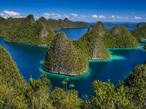
A flight to Sorong reaches only the edge of Raja Ampat. A ferry continues to Waisai, and homestays or lodges usually arrange the last boat transfer to islands such as Kri, Gam and Arborek. Longer liveaboard voyages connect remote reefs and limestone islets around Waigeo, Wayag and Misool.
Erosion has cut the limestone into steep walls, caves and narrow channels; some coastal niches on Misool contain prehistoric rock art. Coral reefs, seagrass beds, mangroves and rainforest meet along the shore, with exceptionally rich communities of reef fish below the surface. Snorkelling and diving dominate, while kayaks can enter lagoons and mangrove passages. Boats from Papuan villages such as Arborek and Yenbuba link local stays to the surrounding water. Distance has a plain physical meaning here: another hull, another transfer, another stretch of open sea.
Practical: May, June and September generally suit the Azores; Lofoten has midnight sun in summer and a chance of northern lights from September to April. Spring and early summer suit the Outer Hebrides, where summer car places on ferries need early booking. Stockholm’s public boats run year-round, though departures thin outside summer. The Cyclades and Dalmatian islands have their fullest ferry networks in summer, when popular crossings fill fastest. Raja Ampat requires visitor and marine-park access arrangements. Galápagos passengers need a Transit Control Card, baggage inspection and park admission, and protected sites require an authorised naturalist guide.
Galápagos: landing on young lava
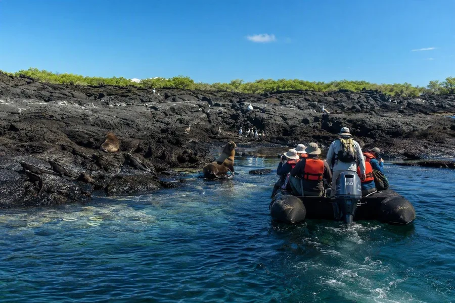 A zodiac approaches a Galápagos lava shore where iguanas and sea lions gather.
Flights from mainland Ecuador reach Baltra or San Cristóbal. From Baltra, buses and a short ferry cross the Itabaca Channel towards Santa Cruz; passenger boats, small aircraft and expedition vessels then extend the journey among the islands.
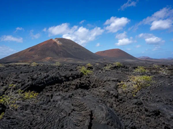
Isabela and Fernandina in the west are younger and volcanically active, while older eastern islands show more erosion. Three ocean currents bring warm- and cold-water species into the same seas, including corals, sharks, penguins and marine mammals. At protected sites, visitors follow marked paths with guides and keep their distance from giant tortoises, sea lions and marine iguanas.
A small inflatable boat can finish the passage at a bare lava shore. Marine iguanas lie on dark rock, sea lions occupy the landing and birds gather at the waterline as passengers step ashore behind their guide.
Keep exploring
Places in this story
South America
3 landen en gebieden
Ecuador
Azores
Lofoten
Outer Hebrides
Stockholm
Cyclades
The Cyclades are a Greek archipelago in the central Aegean, spread around the sacred island of Delos. Their dry, stone-built islands range from ferry hubs and large villages to small, sparsely served ports.
Dalmatia, Croatia
Raja Ampat
Galápagos Islands
Quito