Eight islands for taking the long way round
On Schiermonnikoog, low tide exposes the mudflats. On Yakushima, rain feeds cedar forest above the ferry ports. These eight islands suit travellers who would rather follow a path, a shore or a working harbour than race between sights.
Schiermonnikoog: dunes behind the village
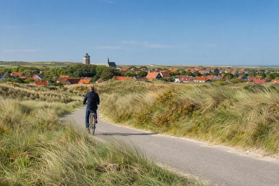 A cyclist follows a dune route on Schiermonnikoog, with the village beyond.
Schiermonnikoog sets out the Dutch coast in layers: mudflats at low tide, beach, dunes, damp hollows and woodland. Walking and cycling routes cross this ground, and steps climb into the Kobbeduinen. Wind and drifting sand still shape the island, much of which lies within the national park.
The village stands where it does because storm floods in 1717 and 1720 forced residents to abandon the older settlement farther west; rebuilding began on the present site in 1756. Along Middenstreek and Langestreek, low, deep houses carry bent gables and sometimes a projecting lytj hús, a summer room. The compact streets give the open shore a useful counterpoint.
Bornholm: old rescue paths above the Baltic
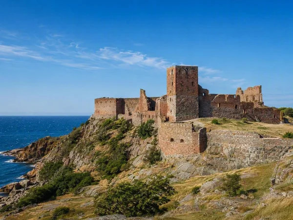
Bornholm suits a proper cycling trip rather than a hurried lap. National Cycle Route 10 forms a 104.5-kilometre loop through harbours, cliffs, beaches and coastal towns. The mostly paved southern stretch rolls gently towards Dueodde. In the north, gravel, forest tracks and short steep climbs around Gudhjem and Hammershus slow the day down.
Walkers can follow sections of paths once built for rescue crews heading to wrecked ships or moving between rescue stations. The paths now link rocky shore, woods, beaches and fishing places. Inland, four medieval round churches at Østerlars, Olsker, Nyker and Nylars served as worship spaces and defensible refuges in a sea exposed to attack. In Hasle, the harbour and smokehouse keep the island's fishing history close to the water.
Île de Bréhat: from gardens to granite
The crossing from Arcouest lands at Port-Clos, then walking takes over. Cars are absent on Bréhat, although tractors and service vehicles use the lanes shared by walkers and cyclists. The Pont Vauban dike has joined the archipelago's two main islands since the late seventeenth century.
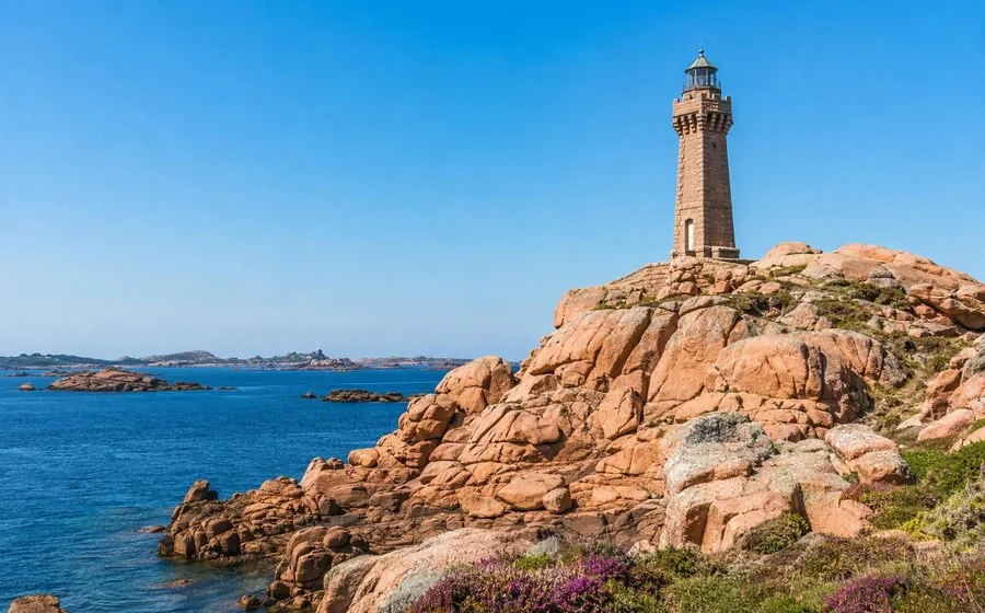
The route from the southern tip to the Paon lighthouse measures only 3.5 kilometres, yet it shifts from inhabited, flower-rich ground to exposed rock and open coast. Stone quays, lighthouses and small rescue buildings mark a shore used for fishing, trade and navigation through difficult waters. At the Birlot tidal mill, islanders used the sea's rise and fall to grind grain. The citadel, built for defence in 1860-62, now houses glassblowers.
La Gomera: footpaths across ravines
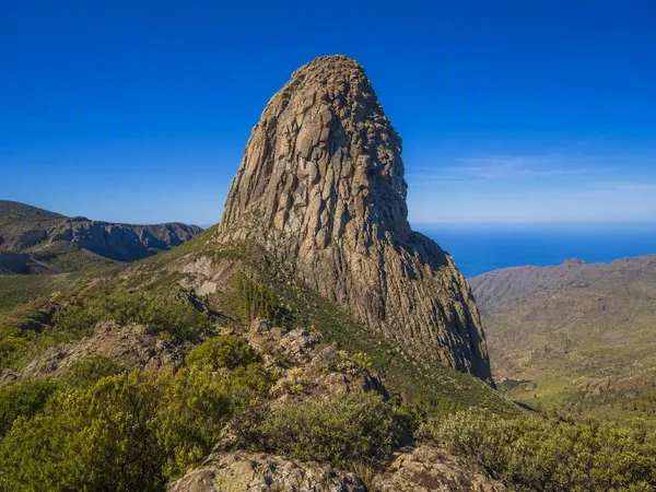
La Gomera's old paths climb volcanic slopes, cross ravines and connect hamlets, terraces and palm groves. In Garajonay National Park, mist, springs and streams sustain laurel forest, a remnant of warm forests that once spread across parts of Europe and North Africa. Short marked loops work for a wet forest morning, while longer routes over steep ground need more time and steadier legs.
The route through Arure, Las Hayas, El Cercado and Chipude shows how residents farmed broken volcanic terrain. Waterworks supported terraces for potatoes, grain and vines. Women in El Cercado continue a hand-formed pottery practice that predates the Spanish conquest. Around Igualero, signs recall silbo gomero, the whistled language used to communicate across ravines.
Gozo: limestone steps down to the sea
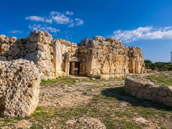
Outside Victoria, Gozo breaks into villages gathered around church squares. Local limestone shapes the houses, carved-stone balconies and painted wooden balconies along their lanes. In Ta' Sannat, former globigerina-limestone quarries now hold fields. A walk from the baroque church can continue to the Ta' Ċenċ cliffs, then descend a narrow valley to the rocky cove at Mġarr ix-Xini for swimming or snorkelling.
Marsalforn remains a fishing harbour. Colourful luzzus lie in the small port, while crews handle nets and land catches around Il-Menqa. The waterfront path continues towards Qbajjar and Xwejni, past salt pans. One village and one bay easily fill a day.
Vis: walls, boats and sheltered water
On Vis, farmers cleared stony hillsides for vines and used the removed rock to build kilometres of dry-stone walls, terraces, enclosures and stone heaps. These lines still cross the slopes. Cyclists can take the hilly road between Vis town and Komiža through vineyards and olive groves, while buses link the two settlements.
Komiža built its living on fishing as well as wine and trade; a fish-canning factory operated there by 1870. The local falkuša fishing boat remained in use into the mid-twentieth century, and organised outings sometimes draw on that tradition today. Srebrna has rounded silvery pebbles, Stončica has sand, and cliffs enclose Stiniva's pebble shore.
São Miguel: tea paths and crater water
At Sete Cidades, a high path follows the rim of a 5.3-kilometre-wide caldera. It passes a nine-arched stone aqueduct, crosses pumice and descends past a cattle trough towards Lagoa Azul and the village. The crater holds several lakes, while water infrastructure and grazing tie the landscape to daily work.
Lagoa do Fogo provides a wetter walk. The marked route follows water channels and intakes in the steep Ribeira da Praia valley, where the ground beside the levada can turn muddy. For an easier day, the 3.3-kilometre loop at Chá Gorreana runs through tea fields. The factory has processed Camellia sinensis into green and black tea since 1883, and its production rooms show leaves being withered, rolled, oxidised and dried. At Rabo de Peixe, wooden fishing boats return to a working harbour where crews unload catches and free nets for the next departure.
Ferries, flights and reservations
Schiermonnikoog has daily ferries from Lauwersoog, and foot and bicycle passengers reserve both outward and return sailings. Bornholm's main ferry runs from Ystad to Rønne, with extra summer departures. Bréhat has year-round boats from l'Arcouest, though times change with the season. Daily direct ferries connect Tenerife's Los Cristianos with La Gomera; vehicle space requires booking. Gozo's year-round ferry from Ċirkewwa takes vehicles and foot passengers without reservations, boarding in arrival order. Vis has year-round sailings from Split, while flights for São Miguel arrive at Ponta Delgada, often via Lisbon or Porto. From Kagoshima, Yakushima is reached by jetfoil or conventional ferry; jetfoil sales open two months ahead, and weather can disrupt crossings.
Yakushima: from harbour to rain forest
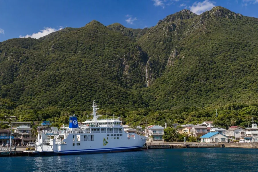 A ferry berths at Miyanoura below Yakushima’s low houses and forested slopes.
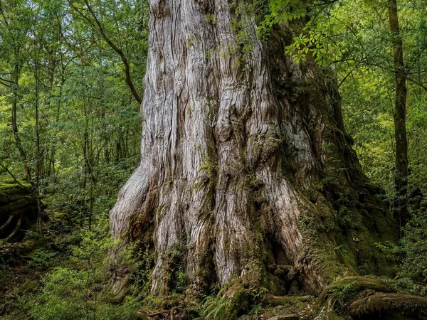
Yakushima rises sharply behind the ports of Miyanoura and Anbo. Forested mountains occupy most of the interior, and Miyanoura-dake reaches 1,936 metres. More than 8,000 millimetres of annual rain on the mountain slopes, poor soil and slow growth give the island's ancient cedars dense rings and resin-rich wood that resists decay. Only natural cedars older than a thousand years are called yakusugi.
Shiratani Unsuikyō has shorter paths through mossy mixed forest beside granite streams. Yakusugi Land offers routes of varying lengths among old cedars and stumps left by earlier logging. The longer trek to Jōmon-sugi ends at a viewing platform because erosion and exposed roots made closer access damaging; seasonal vehicle restrictions also control access to the trailhead.
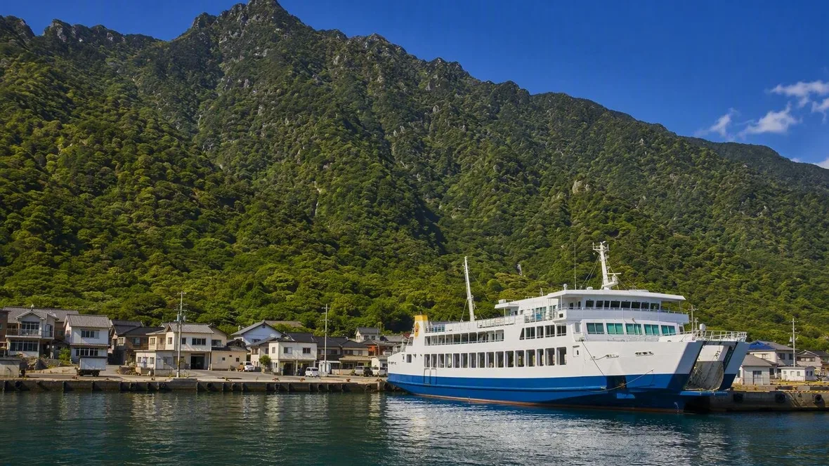
At Miyanoura or Anbo, the ferry comes alongside a low line of houses. Behind the harbour, wet green slopes rise almost straight from the salt water, while rain-fed streams cut down the dark mountain flank.
Keep exploring
Places in this story
Europe
10 landen en gebieden

Asia
Netherlands
Denmark
Schiermonnikoog
Bornholm
Île de Bréhat
Île de Bréhat is a car-free Breton island archipelago off Ploubazlanec, near Paimpol in Côtes-d’Armor. Its inhabited south is gardened and sheltered; the north ends in pink granite, heath and the Phare du Paon.
La Gomera
Gozo
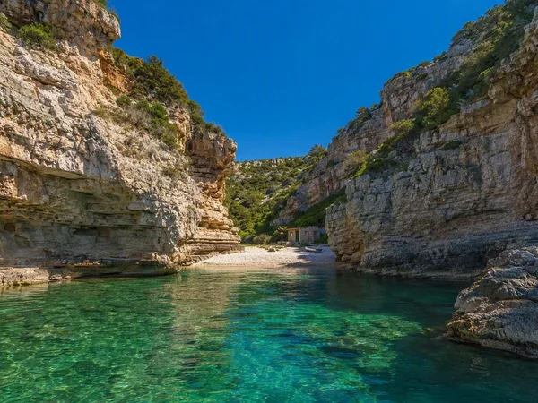
Vis
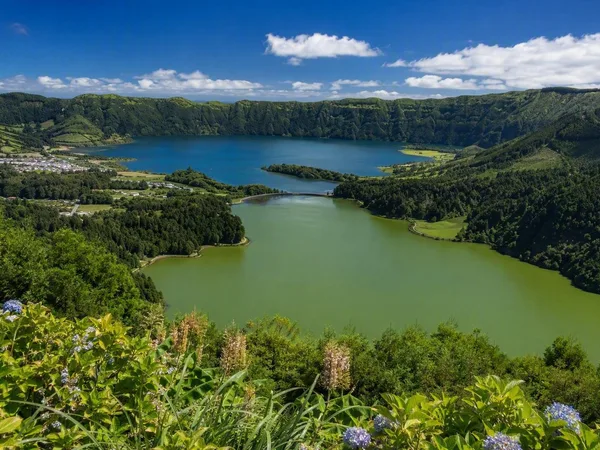
São Miguel