From São José Market to Recife’s Tidal River
Inside Mercado de São José, a covered passage runs between iron columns, box stalls and two separate pavilions. Outside, a short walk to the Capibaribe shows why trade in central Recife has long relied on islands, quays and bridges.
Iron, daylight and trade in São José
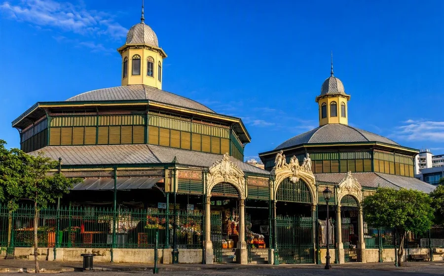
Mercado de São José stands on Praça Dom Vital, where traders were already selling fruit and vegetables along the former Ribeira de São José in the late eighteenth century. The iron market opened in 1875 and gathered that scattered riverside trade under one roof.
The building still explains its purpose clearly. Two rectangular pavilions stand on either side of a central covered passage, while cast-iron columns and pierced arch girders support the roofs. Glass lanterns above the trusses bring in daylight and ventilation. Hollow columns carry rainwater down from the French roof tiles. The design drew on the Marché de Grenelle in Paris, but builders adapted the metal structure to Recife’s tropical climate.
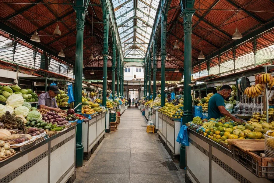 Food traders work beneath cast-iron columns in Mercado de São José in Recife.
Imported iron gave permanent order to an older local trade. The regular stalls gathered fish and other goods that had once been sold more diffusely along the ribeira. Seafood and food stalls remain in the market, alongside craftwork in clay, rope and palm fibre.
The hall has changed rather than survived untouched. Concrete cobogós replaced wooden and glass louvres, and repairs followed a major fire before the market reopened in the 1990s. Restoration that began in 2024 was still under way in August 2026. Food traders continued inside the historic building, while craft sellers used temporary premises behind it, between Rua da Praia and Cais de Santa Rita. Trucks use the Cais de Santa Rita side for loading and unloading, so the move toward the river begins among the work of supply.
Practical: Mercado de São José opens Monday to Saturday from 6am to 6pm and Sunday from 6am to noon.
Cais de Santa Rita and the water’s edge
From Praça Dom Vital, the direct line runs behind the market toward Cais de Santa Rita. São José does not end at a park-like promenade. Commercial streets meet a working quay, and the Capibaribe forms a water boundary beside traffic, deliveries and market buildings.
That meeting of trade and water predates the iron hall. The old riverside market occupied ground tied to the city’s supply, and the present market fixed that function in a permanent structure. Recife’s “Brazilian Venice” nickname can reduce a complicated geography to a postcard. The centre took shape among the Capibaribe, Beberibe and Tejipió river systems, while land reclamation enlarged natural islands and created ground for streets and buildings.
São José occupies the southern part of the historic Ilha de Antônio Vaz. Santo Antônio lies to the north on the same body of land, while Bairro do Recife, or Recife Antigo, occupies the separate port island across the water. That layout explains why a street ends at a quay and continues beyond a bridge in another neighbourhood.
Ponte Giratória crosses to the port island
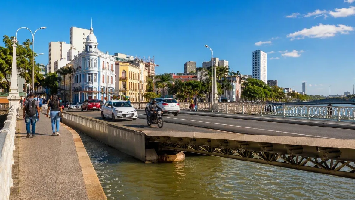
The Ponte Giratória, officially Ponte 12 de Setembro, carries pedestrians and traffic from Cais de Santa Rita to Bairro do Recife. Footways run along both sides of the present bridge, which reopened after structural repairs at the end of 2025.
Its popular name preserves a vanished piece of machinery. The bridge opened in 1923 with a rotating span that allowed sailing vessels to reach river quays such as Cais da Alfândega. Engineers later replaced the iron structure with concrete after ships no longer needed that passage. A fixed crossing now stands where road traffic once had to yield to masts and cargo.
The bridge also clarifies the water below. In central Recife, the Capibaribe forms part of an estuary where river water and seawater meet among islands and channels. The tide is semidiurnal, with broadly two high and two low phases each day. It can push water and salt inland through the lower river.
Along the central quays, the clearest sign is the changing waterline. At high water, the river rises against quay walls, steps and posts; at low water, lower edges become accessible. Workers who maintain mangrove banks at Cais da Alfândega and elsewhere must wait for sufficiently low water before descending to the edge. Tide affects ordinary access here, not only the view.
Warehouses and water at Cais da Alfândega
On the Recife Antigo side, Cais da Alfândega follows the waterfront past former port warehouses. Their position beside the quay marks the shift from São José’s market district to the old harbour district. Trade moved through both places, but each handled a different part of the city’s exchange: the market organised goods in stalls, while the port lined cargo and storage along navigable water.
The Capibaribe still works as transport and public space. Boat operators run sightseeing trips from Marco Zero past central bridges, including Ponte Maurício de Nassau, and the water frames Recife Antigo, Santo Antônio and Boa Vista from a single route. On land, festivals can also alter a bridge’s use. During Recife Capital do Brega, Ponte Maurício de Nassau and Ponte Buarque de Macedo have closed to vehicles and opened to pedestrians.
The river’s appearance changes with flow and tide. During ebb, resuspended material can increase sediment in the water, while the wet season generally brings greater turbidity and lower salinity to the estuary. Heavy rain adds river discharge to tidal movement, so water levels in Recife reflect rain, the Capibaribe and the ocean together.
Ponte Maurício de Nassau and Santo Antônio
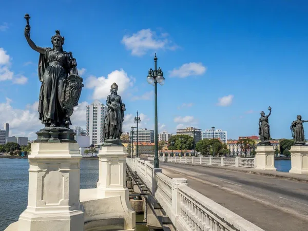
From Cais da Alfândega, Ponte Maurício de Nassau crosses northwest toward Santo Antônio. The present concrete bridge dates from 1917, but the crossing follows the line of an older link between the crowded port settlement and Antônio Vaz. Bridges made this divided ground usable, carrying people and goods between the harbour, Santo Antônio, São José and other central districts.
Four cast-iron figures stand at the bridge’s ends. They represent Agriculture, Commerce, Justice and Wisdom. Commerce has a particular force in this location: the figure stands above the crossing between a port island and the neighbourhoods that held markets and streets on Antônio Vaz.
From the bridge deck, the geography is plain. Recife Antigo occupies the port side, Santo Antônio begins across the span, and the tidal Capibaribe passes below. Farther south on the same historic island as Santo Antônio, Mercado de São José continues the old riverside trade inside its iron pavilions. Beneath the bridge, water rises and falls against the fixed quay walls.
Keep exploring
Places in this story
Recife
Recife is the capital of Pernambuco on Brazil’s northeastern Atlantic coast, shaped by the Capibaribe and Beberibe rivers, port channels and bridges. Its central districts combine working markets, colonial-era routes and a waterfront built on low estuarine ground.
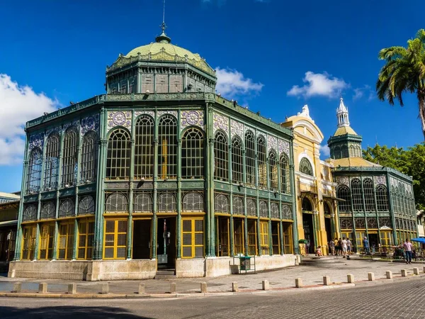
São José
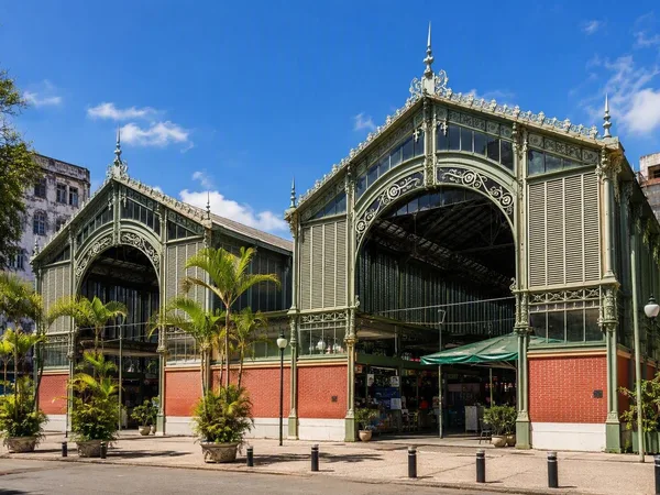
Mercado de São José
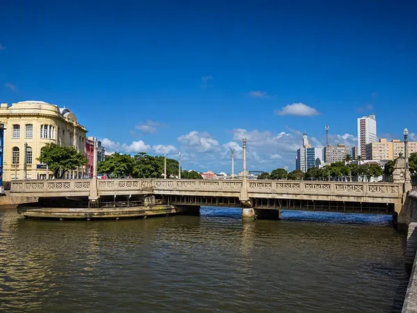
Capibaribe River
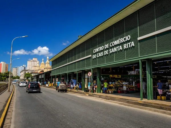
Cais de Santa Rita
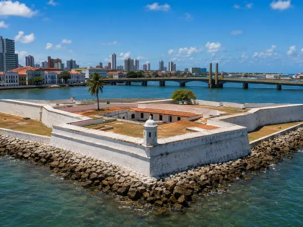
Ilha de Antônio Vaz, Recife
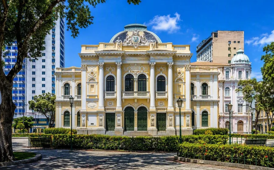
Santo Antônio, Recife
Santo Antônio is a historic central neighbourhood of Recife, on Ilha de Antônio Vaz beside the Capibaribe. It is the city’s bridge-and-square district, linking Recife Antigo with a dense concentration of churches, civic buildings and commercial streets.
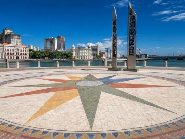
Bairro do Recife (Recife Antigo)
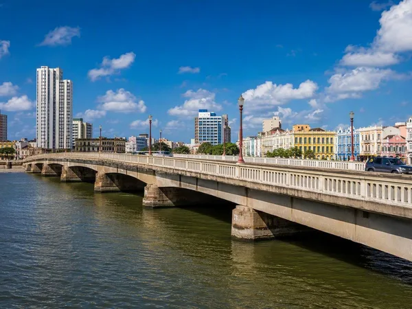
Ponte Giratória
Cais da Alfândega
Ponte Maurício de Nassau