Five South American beaches, ranked beyond the postcard
Red rock, ancestral monuments, city apartments, Caribbean forest and volcanic cliffs define these five very different shores. This ranking weighs landscape, local setting, nature value, the kind of visit each beach suits and a deliberate spread across South America; it makes no absolute claim about the continent’s “best” beaches.
How the ranking works
A beach can matter without being remote, tropical or ideal for swimming. This list weighs five things: a distinctive meeting of coast, sea and geology; the beach’s place in a protected, cultural or urban setting; its natural or heritage value; the visit it suits; and a spread across countries and coastlines. The five choices run from an Atlantic volcanic archipelago through the Caribbean and Pacific to Rapa Nui and the Río de la Plata.
The order is an editorial judgement, not a podium carved in stone. Pocitos earns a place because daily city life reaches its sand. Sancho takes first place because protected marine life, volcanic cliffs and a demanding descent occupy one compact bay.
5. Playa de los Pocitos, Uruguay: Montevideo goes to the water
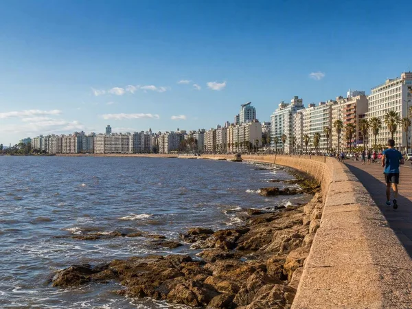
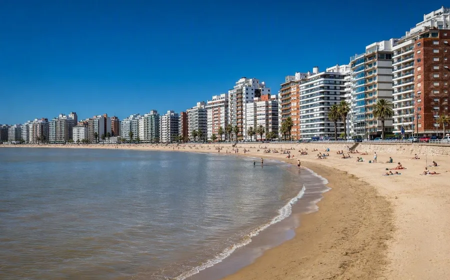
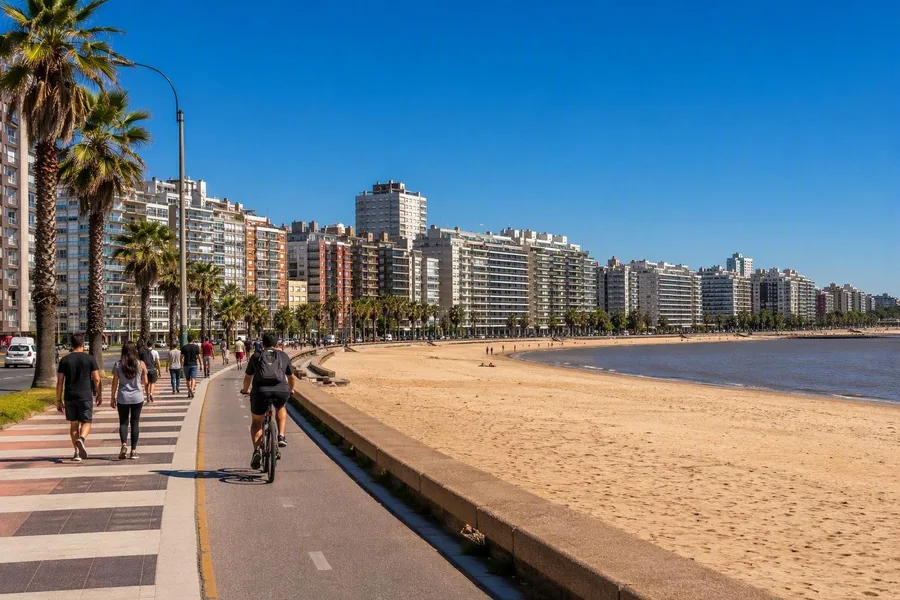 People walk and cycle beside Playa de los Pocitos along Montevideo’s Rambla República del Perú.
Pocitos curves around a broad inlet between rocky points on the Río de la Plata. Sand fills the foreground, but apartment blocks, the Rambla República del Perú and the surrounding neighbourhood remain firmly in view. This is not an escape from Montevideo. It is one of the places where the city gathers by the water.
People walk, run, cycle and fish along the rambla, while football, handball and rugby matches also take place on the sand. That steady public use gives Pocitos its distinction. It suits a visitor who wants a swim and a waterfront walk within a day of streets, cafés and city life, rather than an empty horizon.
The name reaches further back. Afro-Uruguayan washerwomen once dug small washing holes, or pocitos, beside a stream here; hotels and recreation clubs later turned the area into a bathing resort, and apartment buildings replaced most early chalets. The original dunes and stream disappeared beneath the modern city. Pocitos ranks fifth because its interest lies less in exceptional ecology than in the visible, ordinary life of a South American capital.
4. Anakena, Chile: swimmers share the shore with ancestors
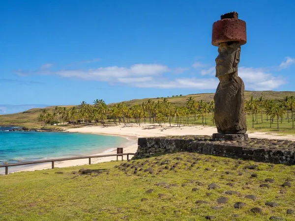
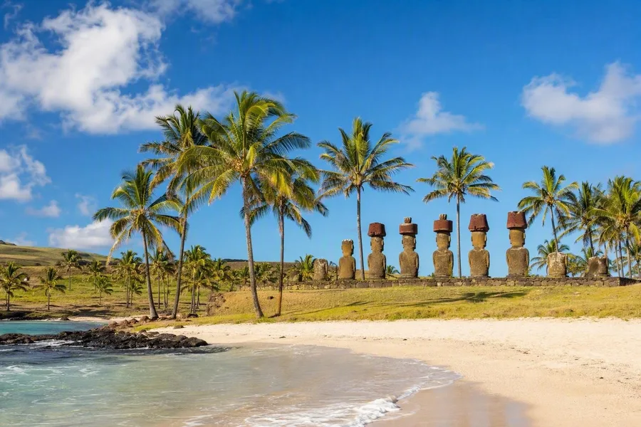 Restored moai at Ahu Nau Nau stand behind Anakena’s white coral sand on Rapa Nui.
Anakena is one of the few sandy beaches on volcanic Rapa Nui. White coral sand and palms edge water suitable for swimming, while Ahu Nau Nau stands just behind the shore with restored moai, some wearing red stone pukao. Beachgoers and archaeological visitors use the same small stretch of coast.
Rapa Nui tradition identifies Anakena as the landing place of the founding figure Hotu Matu’a, and the community marks that arrival at Haŋa Rau/Anakena each year. Archaeologists have also found some of the island’s earliest dated evidence of settlement nearby. The ahu honour ancestors. The moai remain part of living Rapa Nui heritage, not beach decoration.
The palms need context too. Plant remains show that palms once grew across the island, including the now-extinct Rapa Nui palm, before that older vegetation declined sharply centuries ago. Anakena suits travellers who want a calm swim alongside serious attention to Polynesian culture, and who accept the boundaries that protect the monuments.
3. Playa Roja, Peru: a beach made for looking
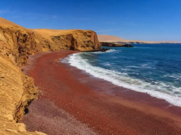
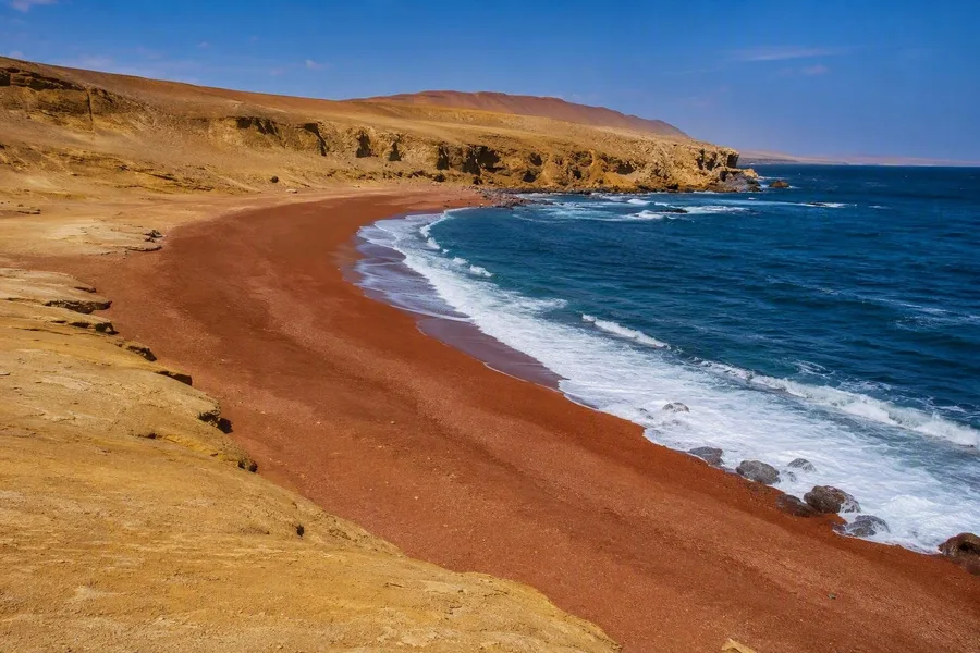 Playa Roja’s red-brown shore curves along Peru’s cold Pacific coast.
Playa Roja overturns the usual hierarchy of beach pleasures. Its red-brown arc lies between the blue Pacific and the ochre, sparsely vegetated coast of the Ica desert. Waves break fragments from Punta Santa María and deposit the reddish material along the shore. The colour comes from the coast’s rock, not a trick of sunset or photography.
Cold water arrives with the Humboldt Current. Wind erodes the exposed landscape and carries sediment, especially during stronger paracas winds. Pelicans and boobies occur along a reserve that joins desert, bays, islands and marine waters.
Human activity stays concentrated at marked viewpoints. Playa Roja officially functions as a mirador, so observation, photography and birdwatching fit better than a conventional day of swimming. It takes third place because few beaches show coastal geology with such directness. The open, cold shore is the point.
2. Cabo San Juan del Guía, Colombia: two bays beneath the forest
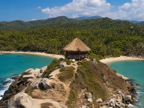
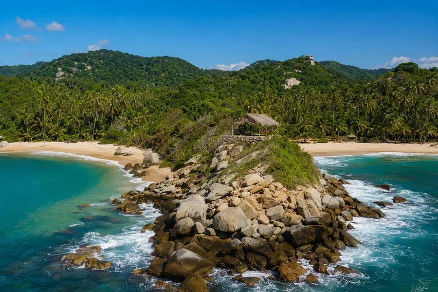 Granite headland divides two sandy bays at Cabo San Juan del Guía in Tayrona.
At Cabo San Juan del Guía, two sandy bays meet at a granite headland topped by a simple hammock shelter. Palms and coastal forest meet the sand, while large granite rocks divide exposed water from a more sheltered swimming area.
Walkers reach the beach through forest and along neighbouring shores. Swimmers gather in designated water, and campers stay in tents or hammocks near the headland. Cabo suits people who want a forest walk, basic overnight accommodation and beach time in one visit. The open side can carry powerful surf and currents; the south-western inlet is normally more protected.
Tayrona is ancestral and spiritual territory for the Kogui, Wiwa, Arhuaco and Kankuamo peoples. The park closes temporarily several times a year for ceremonies, rest and restoration. These closures reflect relationships with the land that predate modern tourism. Cabo ranks below Sancho because the available research documents less marine richness here, but its double bay, forest approach and Indigenous context carry far more weight than the familiar label “Caribbean paradise.”
Timing and access
At Pocitos, follow the daily flag and water-status information; lifeguards operate during the southern summer, and swimming is discouraged for a day after heavy rain. January to March generally brings warmer, drier weather for Anakena, where the archaeological area requires an accredited local guide. Playa Roja lies on Paracas’s marked northern circuit, and winds are often stronger from August to October. Cabo can be reached on foot through forest or by sea; December to April is usually drier, and swimmers should remain in designated water. At Sancho, calmer conditions are more common from May to July, while summer can bring heavy surf; visitors arrive by boat or through a narrow stairway in the rock.
1. Praia do Sancho, Brazil: the sea below the cliffs
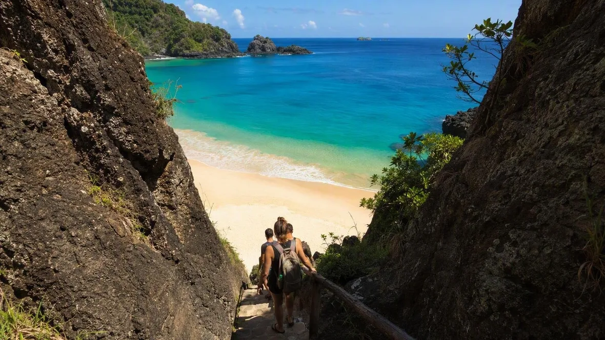
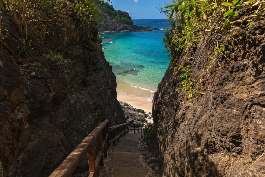 Stairs descend through a rock cleft toward Praia do Sancho on Fernando de Noronha.
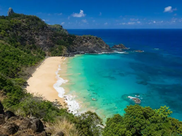
Praia do Sancho lies inside the marine national park of Fernando de Noronha, an isolated volcanic archipelago in the Atlantic. Erosion and changing sea levels formed its cliffs, beaches and reefs. The bay holds white bioclastic sand beneath layered volcanic rock, with green water enclosed by headlands.
Protection matters because the surrounding sea supports turtles, rays, sharks, spinner dolphins, about 230 fish species and fifteen coral species. Swimming and snorkelling belong to that larger marine setting rather than to a resort strip. Boats enter the bay, but no boulevard lines the sand.
Sancho suits a mobile nature visitor who accepts that access is part of the day. The landward route reaches the cliff edge and drops through a tight rock cleft, where stairs descend towards the bay. At the bottom, the passage opens onto white sand, with volcanic walls behind it and the protected Atlantic directly ahead.
Keep exploring
Places in this story
South America
3 landen en gebieden
Uruguay
Chile
Peru
Colombia
Brazil
Playa Pocitos
Playa Pocitos is the broad urban beach on Montevideo’s Río de la Plata waterfront, entirely within the Pocitos neighbourhood. Sand, the Rambla and a high-rise residential shoreline meet in one of the city’s defining public spaces.
Rapa Nui
Anakena
Playa Roja, Paracas
Cabo San Juan del Guía