Eight drives between high passes and open ocean
Austria’s Grossglockner road climbs from wooded valleys to bare Alpine ground through a tight stack of bends. Australia’s Great Ocean Road follows surf beaches, slips into wet forest and returns to a limestone coast. These eight routes stand apart through the shape of the road, the land around it and the views that arrive with each change in direction.
Grossglockner Hochalpenstrasse: a panorama built into the bends
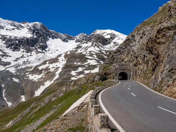
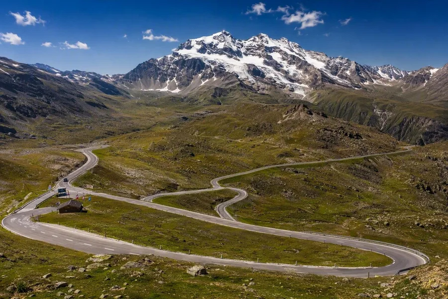 The Grossglockner Hochalpenstrasse winds through Alpine terrain below the Grossglockner at Fuscher Törl.
The 48-kilometre Grossglockner Hochalpenstrasse runs from Fusch to Heiligenblut and uses 36 hairpins to reach the 2,504-metre Hochtor pass. Its road climbs from valley woods and meadows into treeless Alpine ground, with snow and glacier views higher up. Engineer Franz Wallack chose a longer line over the high plateau so that each turn exposed different valleys and summits, rather than simply carrying traffic over a pass.
Natural-stone embankments keep the engineering close to the surrounding rock. Side roads lead to Edelweißspitze and Kaiser-Franz-Josefs-Höhe, both planned as part of the original scenic route. Fuscher Törl gives the first full view of the Grossglockner; farther along, the Pasterze glacier fills the view from Kaiser-Franz-Josefs-Höhe.
Trollstigen: eleven bends above Stigfossen
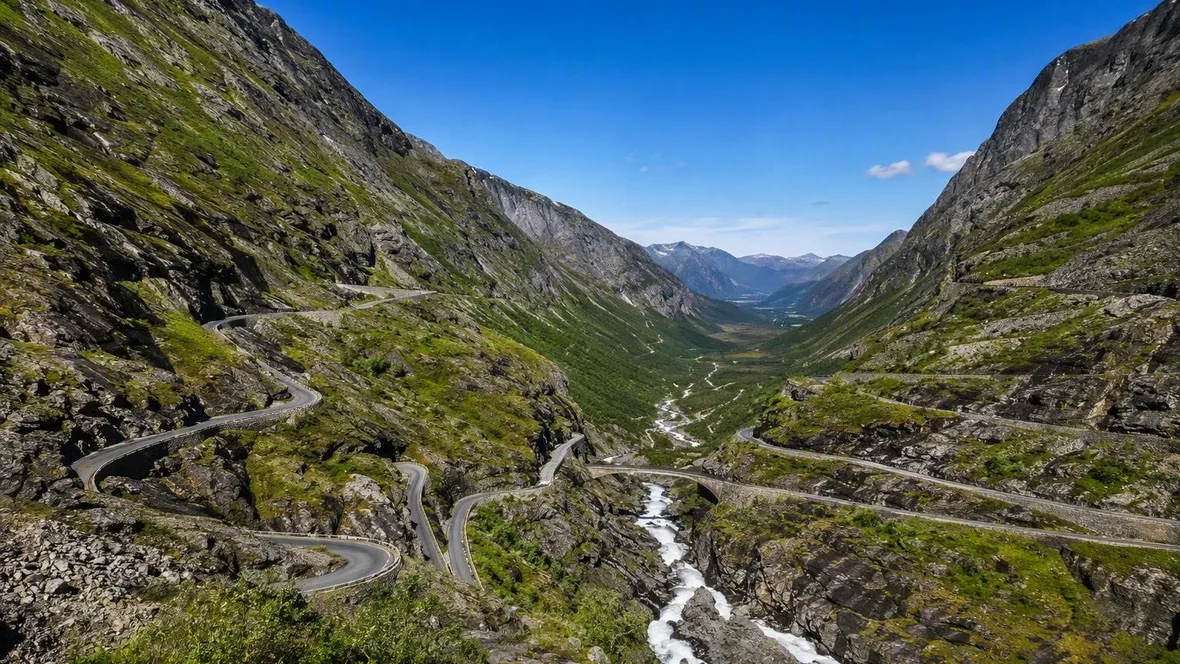
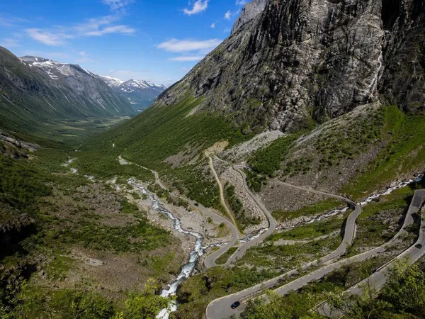
Trollstigen forms the steep centrepiece of Norway’s 104-kilometre Geiranger–Trollstigen scenic route, which runs from Sogge Bru in Romsdalen to Langvatnet at Strynefjellet and includes the Eidsdal–Linge ferry. Eleven tight hairpins climb the Isterdalen mountainside beside Stigfossen. A stone arch bridge crosses the waterfall halfway up.
For centuries, people used the crossing between Valldal and Romsdalen as a mountain and packhorse route before the motor road opened in 1936. The road is narrow, so vehicles share limited space on the bends. Beyond the climb, Valldal brings green fields and strawberry growing. Ørnesvingen then rises above Geirangerfjord, where steep rock walls and waterfalls drop to the water.
North Coast 500: single track around the Highlands
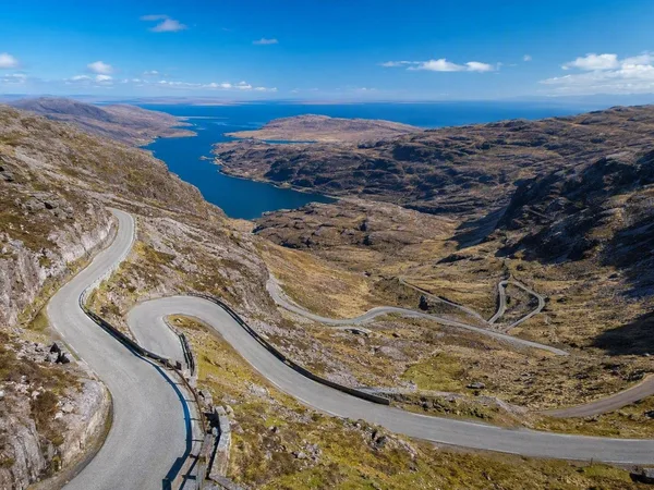
The 516-mile North Coast 500 loops from Inverness through Applecross, Torridon and Ullapool, around Caithness and John o’ Groats, then back through Dingwall. Rural A-roads alternate with single-track lanes and passing places, especially on the west coast. Bealach na Bà provides the sharpest climb, with tight bends above Applecross and views towards Skye.
Elsewhere, the road settles into longer coastal stretches. Torridon’s mountains give way to Ullapool’s harbour, pale beaches near Durness and Caithness’s open northern shore. Small fishing settlements and harbours punctuate the Sutherland coast, while the Black Isle returns the loop to cultivated farmland. Rain can arrive in every season.
Wild Atlantic Way: many roads along one ocean
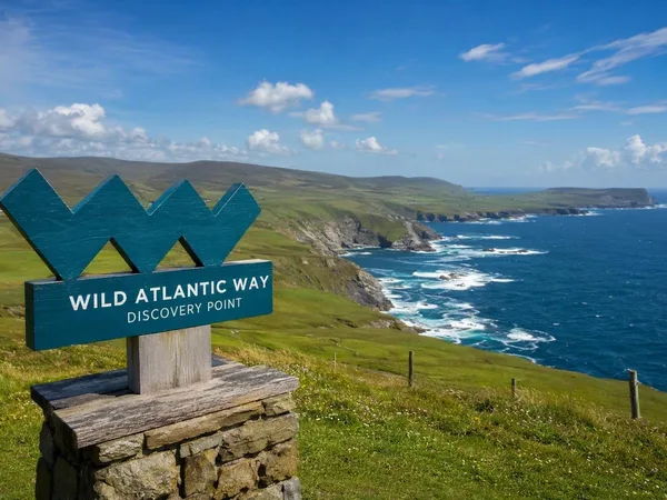
Ireland’s 2,500-kilometre Wild Atlantic Way runs from Inishowen in Donegal to Kinsale in Cork through a chain of existing coastal roads. W-shaped Discovery Point signs tie the route together, but the driving changes constantly: national roads give way to regional lanes, grass-edged tracks and single-lane approaches to beaches and headlands.
Donegal combines beaches, rocky capes and the high cliffs of Sliabh Liag. Connemara adds Killary Harbour and mussel rafts on the water. In County Clare, cracked limestone pavement in the Burren replaces softer green ground before the Cliffs of Moher. Kerry follows with Dingle’s narrow streets, Slea Head and the Blasket Islands offshore. Fishing ports, ferries and surf beaches remain part of the roadside scene.
Route des Grandes Alpes: Lake Geneva to Menton
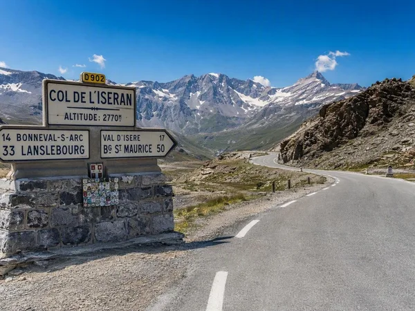
The classic Route des Grandes Alpes runs roughly 720 kilometres from Thonon-les-Bains on Lake Geneva to Menton on the Mediterranean. It links sixteen passes, including Roselend, Iseran, Télégraphe, Galibier, Izoard, Vars, Cayolle and Turini. The route combines old valley roads, military approaches and later pass roads rather than following one uniform highway.
Northern sections run through meadows, reservoirs and ski villages. Iseran, Galibier and Izoard bring bare high slopes and long descents into valley towns. Roads around Vars and Izoard still follow approaches that once connected frontier forts. Farther south, limestone, pines and gorges replace glacier views. Tight bends around Turini lead down towards the roofs and Mediterranean light of Menton.
Transfăgărășan: across the Făgăraș Mountains
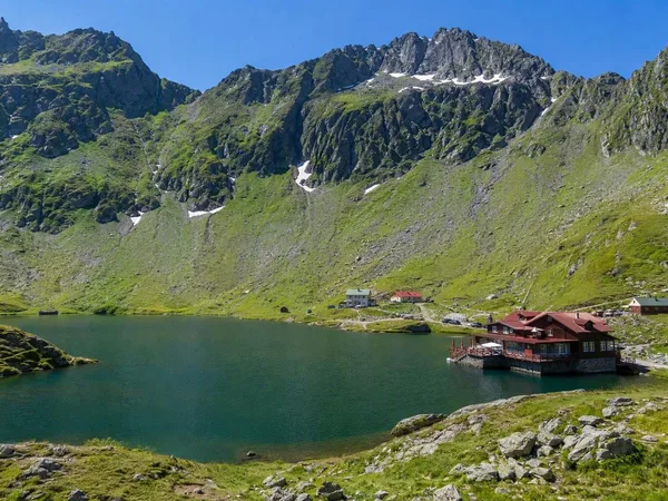
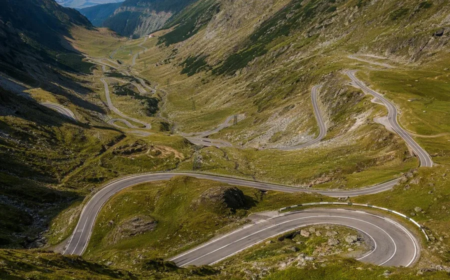
Romania’s high DN7C crossing runs about 90 kilometres from Curtea de Argeș to Cârțișoara, crossing the Făgăraș Mountains from Wallachia to Transylvania. Romania built the Transfăgărășan as a military connection after the 1968 invasion of Czechoslovakia. Engineers expanded an early forest-road plan and cut a national road across slopes without an easy existing passage.
Hairpins, retaining walls, bridges and avalanche protection carry traffic towards Bâlea Lake. The upper road is narrow, with steep drops and some unprotected edges. Near the crest, the 887-metre Capra–Bâlea tunnel passes beneath the ridge. On the southern side, successive loops of asphalt cross the open mountainside below.
Practical: seasons, tolls and larger vehicles
Grossglockner is a toll road and closes in winter; camper and caravan charges depend on vehicle weight. Trollstigen is free but seasonal, and its narrow bends leave little room for broad vehicles. The North Coast 500 has no route booking, though large motorhomes should avoid Bealach na Bà and take signed alternatives. The Wild Atlantic Way has no route charge, although ordinary Irish toll roads may appear on the approach. High passes determine the summer season on the Route des Grandes Alpes, and the upper Transfăgărășan also closes for winter. Great Ocean Road traffic drives on the left. Snow, rockfall and avalanche conditions can close Trollstigen and Milford Road at short notice.
Great Ocean Road: surf, forest and limestone
Victoria’s Great Ocean Road runs about 240 kilometres from Torquay to Allansford near Warrnambool. Between Torquay and Apollo Bay, it curls around headlands above the Southern Ocean. Westbound traffic keeps the water and most viewpoints on the left. At Bells Beach, surfers use the point break below the coastal road.
After Apollo Bay, the asphalt turns inland through the cool, wet Otway rainforest, among tree ferns and mountain ash. It returns to open water on the Shipwreck Coast, where waves have cut the Twelve Apostles from limestone headlands. Returned servicemen built the road between 1919 and 1932 as a memorial to Australians killed in the First World War; Memorial Arch records that history beside the present road.
Milford Road: through granite to the fjord
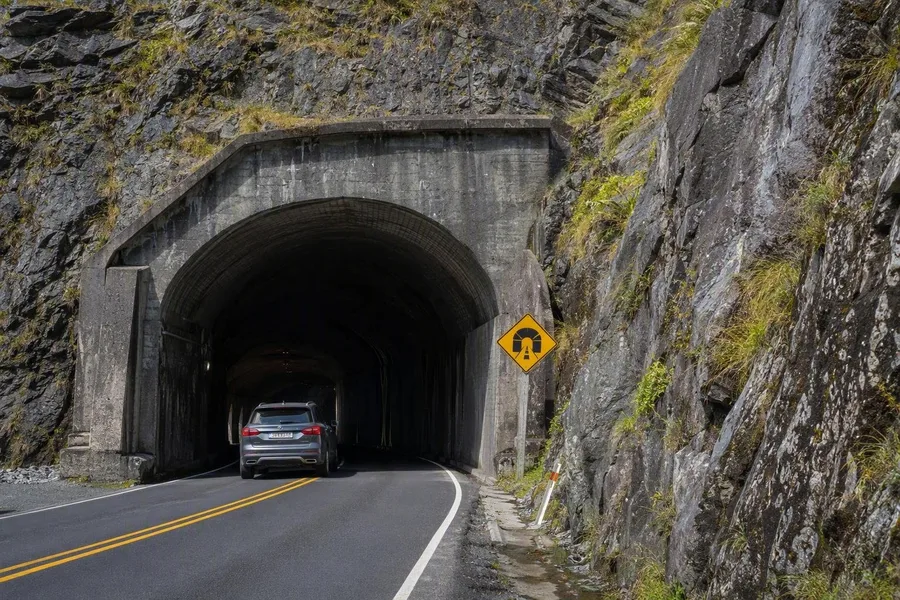 A car enters the granite Homer Tunnel on Milford Road in Fiordland.
State Highway 94 runs 120 kilometres north from Te Anau to Piopiotahi/Milford Sound in Fiordland National Park. The road follows Lake Te Anau, then enters broad U-shaped glacial valleys, beech forest and increasingly bare mountain ground. Buses, campervans and cars share sections of the narrow, winding carriageway.
Glaciers carved the Eglinton Valley and exposed walls of gneiss, diorite and granite. At the head of the climb, the Homer Tunnel cuts through granite; work began in 1935 and finished in 1954, making road access to Milford possible. The tunnel’s dark interior gives way to a descent towards sea level between steep rock basins. Heavy rain feeds mosses, ferns and waterfalls on the slopes. At Piopiotahi/Milford Sound, Mitre Peak rises 1,692 metres almost directly from the water.
Keep exploring
Places in this story
Europe
10 landen en gebieden
Grossglockner Hochalpenstrasse
Trollstigen
North Coast 500
Wild Atlantic Way
Route des Grandes Alpes
Transfăgărășan
Transfăgărășan is Romania’s DN7C mountain road across the Făgăraș Mountains, linking Wallachia and Transylvania via Bâlea Lake. Its high section climbs to 2,042 metres and is defined by tight hairpins, tunnels and long valley descents.