
Mountain · El Salvador
San Salvador volcano
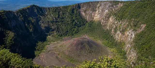
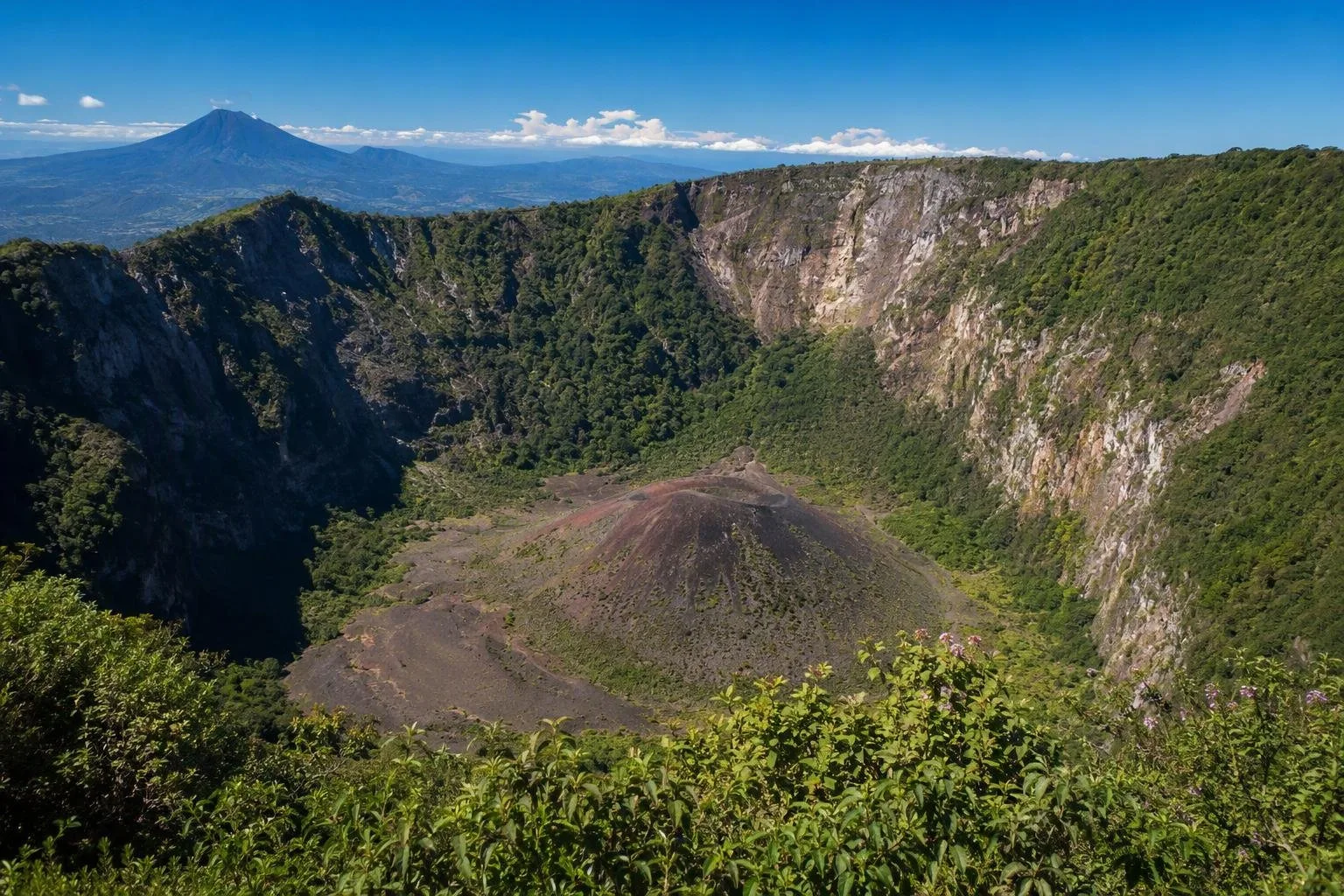
San Salvador volcano is a compound volcanic massif immediately west of El Salvador’s capital. Its accessible summit area, El Boquerón National Park, looks into a vast crater with a younger cone on its floor.
Read the landscape
San Salvador volcano is a volcanic complex, not a single intact cone. An older edifice partly collapsed roughly 40,000 years ago; El Picacho and El Jabalí are surviving parts of that earlier rim. The younger, largely andesitic Boquerón stratovolcano then grew inside the broad collapse caldera.
The summit landmark is El Boquerón—Spanish for “the big mouth.” Its steep-sided crater is about 1.5 km across and roughly 500 m deep. From the rim, look for Boqueroncito, the small cinder cone on the crater floor. It formed during the volcano’s most recent known eruption in 1917.
The crater experience
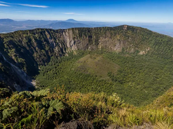
El Boquerón National Park occupies the upper part of the volcano at about 1,800 m. A short signed walk reaches three rim viewpoints in around 20 to 25 minutes. Each frames the crater differently; clear conditions reveal the scale of the walls and the cone below.
The crater is the essential view, not a summit-bagging route. Its walls expose the layered record of lava, ash and other volcanic deposits, while the green interior softens the stark geometry. Do not expect to descend into the crater from the public rim walk.
Best approach: arrive early for the strongest chance of open views. Cloud and mist can move in quickly, turning a wide panorama into a close-up of forest and crater wall.
Road up from the city
Calle al Boquerón climbs from the Santa Tecla side towards the park. The route is part of the outing: cafés, pupuserías, restaurants and roadside miradores occupy the cooler upper slopes, alongside flower and fruit cultivation. Plaza Volcán, around kilometre 16½, is one established stop for food, terraces and city views.
A car, taxi or arranged transport makes the approach simplest. The road is winding, and the summit is notably cooler than San Salvador; take a light layer and rain protection even when the city is warm.
Why the volcano matters
The present crater was created by a major explosive eruption around 800 years ago. In 1917, activity at the summit and north flank produced ash, lava and Boqueroncito; a crater lake that existed before the eruption disappeared.
This is an active volcanic system with a long record of flank eruptions, not a dormant landscape park detached from its geology. Stay on marked paths and behind viewpoint barriers: the crater walls are steep, and official restrictions take priority over any planned route.
From the magazine
Stories about San Salvador volcano
Editorial stories linked directly to San Salvador volcano.
No stories about San Salvador volcano have been published yet.
Routes from our editors
Travel through San Salvador volcano
Editorial routes connecting San Salvador volcano with other countries, cities and hotspots.
No routes through San Salvador volcano have been published yet.
More in El Salvador
Related hotspots
Other cities, nature areas and places within El Salvador.
San Salvador
1 linked stories and routes
El Boquerón National Park
1 linked stories and routes
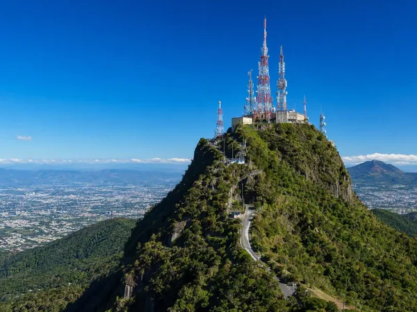
El Picacho
1 linked stories and routes
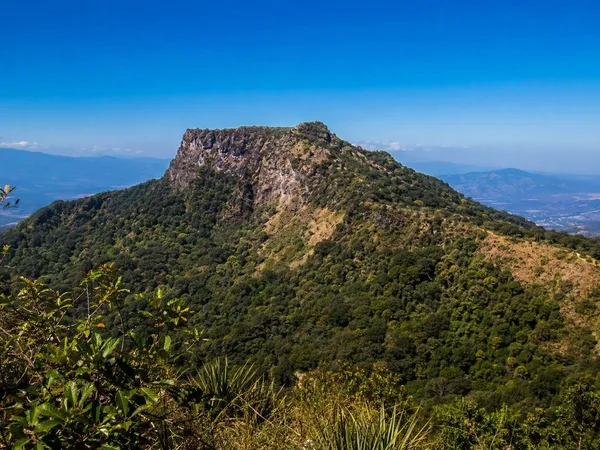
El Jabalí
1 linked stories and routes
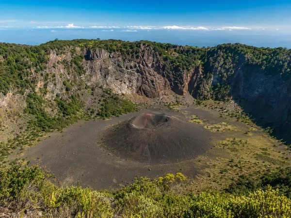
Boqueroncito
1 linked stories and routes
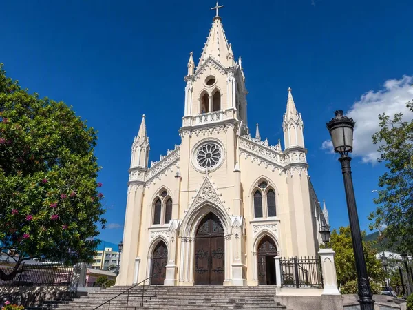
Santa Tecla
1 linked stories and routes