
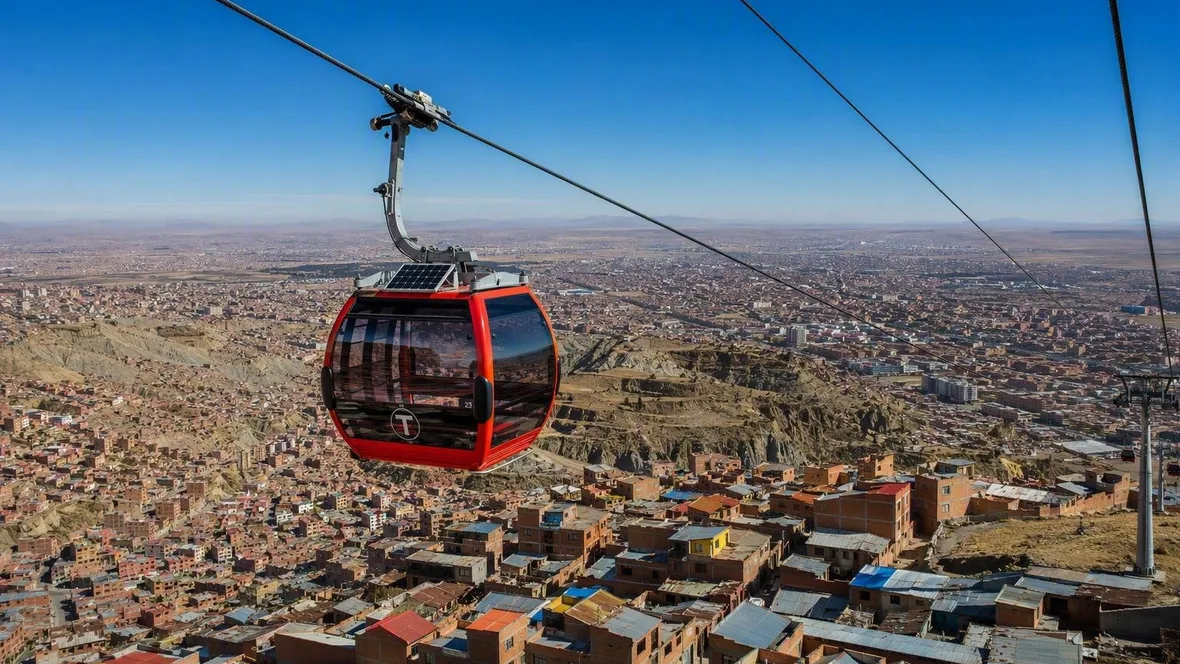
La Paz and El Alto, Joined by a Red Line
Mi Teleférico’s Red Line runs from La Paz’s former railway grounds to the commercial streets of El Alto in 11 minutes. Its three stations trace a sharp change in ground: from the built-up bowl of La Paz, across a steep rise, to the flatter Altiplano.
Central: a railway arrival becomes a cable-car departure
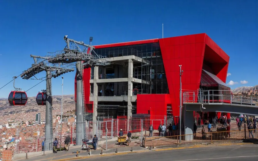
The Red Line starts at Estación Central, also called Taypi Uta, beside Avenida Manco Cápac in La Paz. The station occupies the site of the former railway terminal and links directly to the Orange Line.
That address matters. La Paz grew from the Choqueyapu valley, where it was founded in 1548, and later spread up the steep slopes that rise towards the Altiplano. The old railway grounds once marked an arrival point at the lower edge of that climb. Red cabins now leave from the same area for El Alto.
The building keeps the earlier railway complex in view. Glass walls reveal the surviving historic structures, while a long canopy shades the façade and a curved roof covers the cable machinery. Red blocks contain stairs, lifts and maintenance areas; plainer volumes hold technical rooms. The architecture shows where passengers move and where the cable system works, rather than sealing both behind a heavy terminal wall.
At ground level, Central belongs to the street as much as to the cable. Minibuses stop along Avenida Manco Cápac, and the complex includes bicycle parking, shops, food outlets, an apothecary, financial services and public toilets. The former rail site also contains the Parque de las Culturas y la Madre Tierra. Entrances collect people from the pavement and channel them through the station’s public spaces.
This is not a cable car placed above an empty viewpoint. It begins in a working part of La Paz, where a former transport site now combines street traffic, services, walking routes and an aerial connection.
The climb above the bowl
The route runs Central, Cementerio and 16 de Julio, with no required change between La Paz and El Alto. The Red Line opened on 30 May 2014 as Mi Teleférico’s first line, establishing a direct route between the old railway district below and El Alto’s 16 de Julio area above.
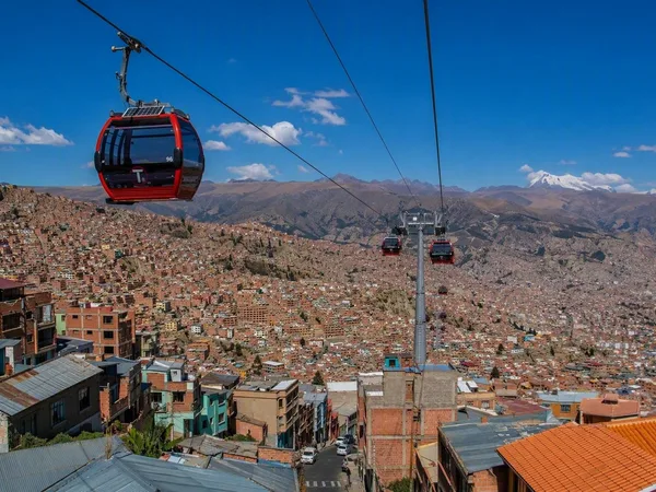
The terrain explains its force. La Paz sits in a deeply cut bowl at the edge of the Altiplano, with buildings climbing its slopes. El Alto spreads across the more open, relatively level plateau above it. About 400 metres separate the two.
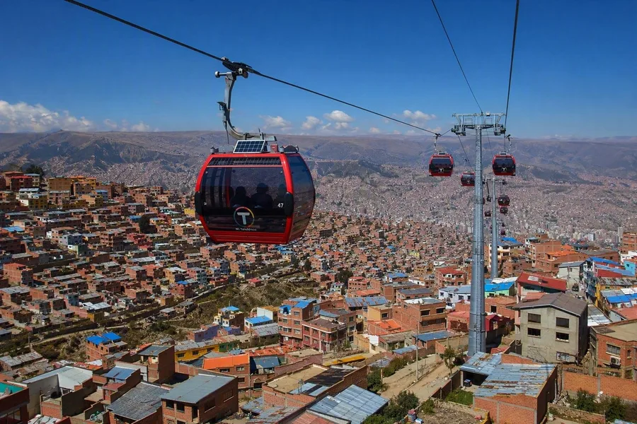 Red Line cabins climb from La Paz’s steep bowl toward El Alto’s plateau.
Road traffic must work with that terrain. Streets climb through bends, junctions and narrower side roads, shared by minibuses, taxis and other vehicles; congestion can make a journey’s duration uncertain. The cabins follow a different geometry. They hang from a fixed cable between stations and towers, rising across the slope without hairpin turns, traffic lights or a search for road space.
Below the line, the dense fabric of La Paz covers the bowl and its sides. As the cabins gain height, the edge of the valley comes into focus and the street pattern broadens across El Alto’s plateau. Research on the network notes that this elevated route reveals parts of the city that street level does not show in the same way.
The view has a practical origin. The slope separates two cities that share work, trade, services and transport, even though El Alto became a separate municipality in 1985 and a city in 1988. The Red Line cuts directly across the physical break between them.
Cementerio, halfway up the slope
Estación Cementerio, or Ajayuni, stands behind Cementerio General near Avenida Entre Ríos. It is the Red Line’s only intermediate stop, between Central and 16 de Julio.
A cabin enters the station, passes through its platform area and continues on the same cable. The stop gives the hillside a connection of its own; it does not turn the slope into empty territory between two terminals.
The Red Line has become part of daily movement rather than a detached aerial attraction. In its first 12 commercial years, it carried 116 million trips. Research on the first three cable-car lines found that people living nearer stations used the system more often, while use of Mi Teleférico was associated with greater use of public transport and lower spending on private transport. Those findings do not mean that the cabins replaced streets. They show a different choice within journeys that still begin and end on foot or by road.
At Central, the line meets minibuses and the Orange Line. At 16 de Julio, it reaches a larger interchange with street transport and further cable lines. The three Red Line stations therefore turn a difficult climb into a regular crossing between neighbourhoods and cities.
Practical details
A full Red Line trip from Central to 16 de Julio, via Cementerio, takes about 11 minutes and requires no transfer. A standard first-line ticket costs Bs 3; payment is possible in cash, with a rechargeable physical card or through the official Yala app’s QR code. Regular hours are 06:30–22:30 from Monday to Saturday and 07:00–21:00 on Sundays and public holidays. At 16 de Julio, passengers can change inside the system to the Blue or Silver lines; Central connects with the Orange Line.
16 de Julio: El Alto at street level
The upper terminal, Jach’a Qhathu or Estación 16 de Julio, has a markedly different shape from Central. A pixelated red volume sits above the cabin garage and the commercial and service spaces. A folded concrete entrance element rises from the access plaza towards the main boarding hall, where a tall staircase cuts through the building.
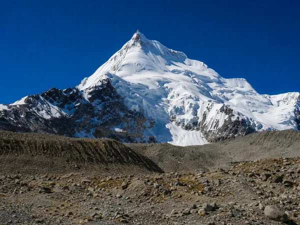
The material change fits the shift in setting. Central uses glass to keep the former railway buildings visible. At 16 de Julio, translucent façade sections bring daylight into a more solid terminal, while a large glazed plane faces Huayna Potosí. Separate entries distinguish the cable-car facilities from the shops and services inside the building.
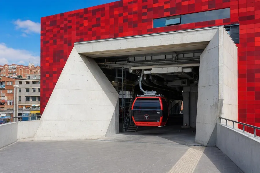 A Red Line cabin enters Jach’a Qhathu station beneath its pixelated red volume in El Alto.
Outside, Avenida Panorámica Norte returns the journey to El Alto’s street network. Minibuses and trufi shared taxis serve surrounding districts, while the Blue and Silver lines continue from within the station. The Feria 16 de Julio begins within a short walk and extends over dozens of blocks on Thursdays and Sundays. La Ceja, another concentration of shops and transport towards the Altiplano, lies nearby.
The route ends where El Alto’s commercial life takes over. Red cabins disappear into the garage above the terminal, and the station’s broad concrete entrance opens back onto the plateau streets.
Keep exploring
Places in this story
South America
3 landen en gebieden

Bolivia
La Paz
El Alto
Bolivian Altiplano
Huayna Potosí
La Ceja
La Ceja is El Alto’s commercial and transport core, on the high plateau above La Paz. This dense district joins shops, street food, local transport and the vast Feria 16 de Julio market.