High Ground, Open Water
Hegebeintum rises sharply above flat clay fields. Wierum stands where a village mound, a sea wall and the Wadden Sea lie close together. Walking between them shows how Frisian communities raised their homes above the tide long before continuous dikes fixed a boundary between land and sea.
Hegebeintum begins at the bottom
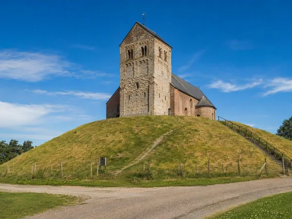
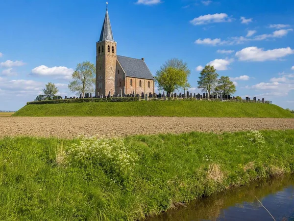
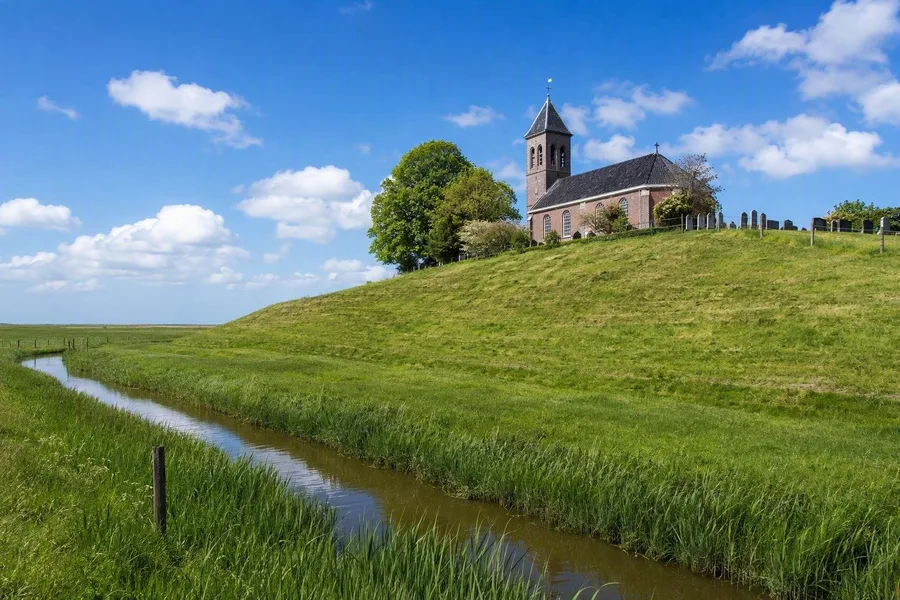 Hegebeintum’s church and graveyard rise above clay fields and drainage ditches.
Hegebeintum makes most sense from the foot of its terp. Drainage ditches cross the low clay fields, while the church and graveyard hold the summit, about 8.6 metres above NAP. That makes this the highest terp in Friesland.
The climb is brief but steep. Its sharp edge is not the original shape of the mound: workers removed fertile terp soil during the nineteenth and early twentieth centuries, leaving much of the abrupt slope seen today. On the north-eastern side, rails and tipping wagons mark a reconstruction of that extraction. The old village soil proved useful as fertiliser elsewhere; it was not granted a sentimental retirement.
Walk around the base and parts of the old ossengang, the ring road around the terp, remain visible. Sections of the ring ditch survive too. Parcel ditches run outward from the centre, and three old paths still lead from the ring towards the remaining core of the village. Together, they show the radial layout of a settlement built around a raised centre.
That plan began in a landscape with no permanent line between land and sea. People occupied Hegebeintum from the fifth century BC, on an undiked salt marsh that flooded regularly. The inhabitants first put combined homes and byres on small platforms of marsh material and manure. They filled the spaces between those platforms with clay, manure and household waste over many generations. A communal mound slowly rose from ordinary work.
A church on accumulated ground
The Romanesque church stands on the highest part of the terp. Its early-twelfth-century nave and chancel use tuff, while later brickwork forms the western end and the saddle-roofed tower. The church came long after the first settlement, yet its placement on the summit followed the practical geography that shaped the village.
Beneath the churchyard, borings have recorded manure-rich deposits, clay layers and recognisable turf. Those layers show that residents raised Hegebeintum in stages, using materials from homes, stables and the surrounding marsh. The mound was not built to make a landmark. It kept people and livestock above salt water when floods came.
Fresh water posed another daily problem. Residents collected rainwater in drinking pits, protected by banks against seawater. They used lower ground for grazing and cultivation when conditions allowed. Low summer embankments sometimes protected fields through the growing season while allowing winter floods to lay down new, fertile silt.
From the eleventh and twelfth centuries, higher continuous dikes began to exclude the sea more reliably. The terp gradually lost its role as the settlement’s only safe refuge, and homes could spread to lower margins and surrounding land. Hegebeintum still holds that earlier arrangement in one steep rise above the fields.
Following the clay coast
A coastward walking line runs from Hegebeintum through farmland, terpdorpen and dike country around Holwerd and Ternaard before reaching Wierum. Route sections use farm tracks and natural or unpaved paths as well as surfaced village roads. The land stays broadly level. Its ditches, mounds and sea wall mark successive ways of dealing with water.
Before the large dikes, people grazed animals, grew crops where the soil permitted and gathered marsh material in land that flooded repeatedly. The raised terps kept homes and livestock above high water. Higher connected dikes later formed a continuous coastal barrier.
The route passes low fields beneath Hegebeintum’s churchyard, drainage ditches running from raised ground, and the long crest of the sea wall. Each feature has a practical origin: the mound supplied height, the ditches drained the land, and the dike held back the tide.
Practical: The coastal walk linking the Hegebeintum area with Wierum is about 18.1 kilometres and largely unpaved, so firm footwear and route navigation are sensible. Hegebeintum’s visitor centre at Pypkedyk 4 covers the archaeological presentation and church visits; check its current opening days, tickets and group arrangements before setting out. Wierum’s Mariakerk has limited announced opening days, while public transport from the village is more restricted at weekends.
Wierum and the missing corner
Wierum formed in the early Middle Ages on a rectangular terp laid on a salt-marsh ridge near the sea. Its raised ground remains clearest around the Mariakerk. But the village no longer has its original outline: storms and coastal erosion took away the north-eastern corner of the terp, along with streets and houses.
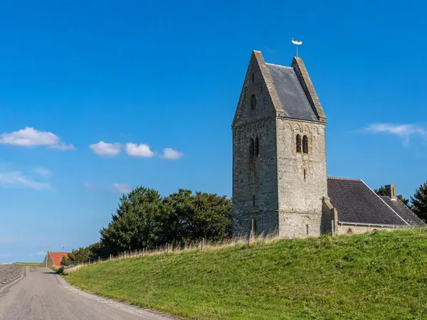
The church once stood close to the middle of the village. It now stands at the edge, almost against the sea wall, because the ground on its seaward side disappeared. Its tuff tower and westwork date from around 1200; the nave and chancel were rebuilt in 1912. The tower carries an aak, the flat-bottomed vessel used by Wierum fishermen, as its weather vane.
Former fishermen’s cottages stand close together on irregular plots. Near the church, the sculpture of the wjirmdolster recalls women who dug lugworms on the tidal flats for bait. Men sailed Wierumer aken, while families processed and sold the catch. This fishing life belongs to a later period than the first terp settlement, but it shows that the sea remained a source of work after the dike had separated the village from the mudflats.
The loss of Wierum’s north-eastern corner explains the unusual village plan better than a map can. The raised church ground stops near the dike instead of continuing towards the sea. The present village occupies the surviving side of the old rectangle.
The sea wall at Wierum
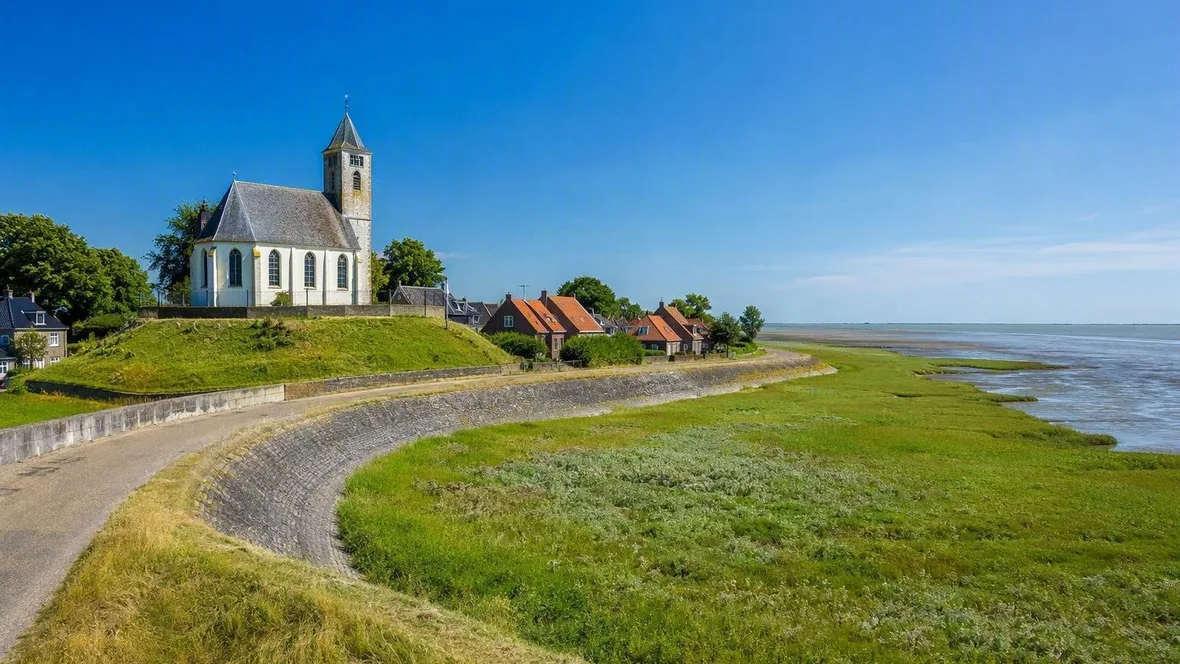
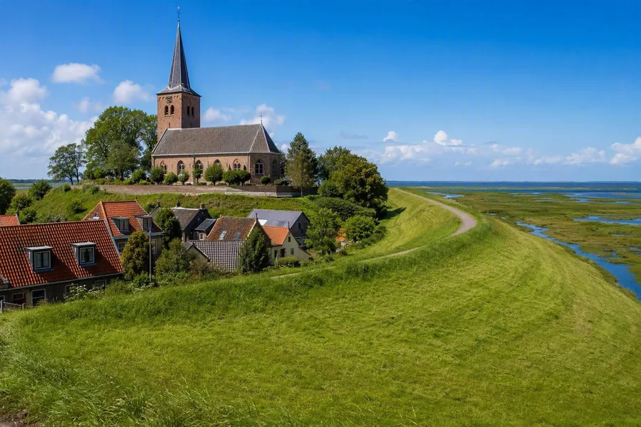 Wierum’s Mariakerk stands on the remaining terp beside the sea wall and Wadden Sea.
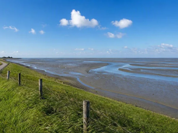
The sea wall curves around Wierum. Behind it stand the Mariakerk, the remaining mound and the compact village. Beyond it lie salt marshes and the Wadden Sea. The dike provided the collective defence that a village mound, however useful, could not guarantee.
A monument on the dike commemorates the 22 Wierum fishermen who died in a snowstorm in 1893. The memorial records the danger of offshore work in the village landscape. The dike protected houses and fields, but fishing families still depended on the water beyond it.
From the crest, the church stands on its raised ground close to the dike, with roofs gathered inland and tidal flats spread out on the seaward side. At low water, an old wreck may show offshore. In clear weather, Ameland and Schiermonnikoog can be visible across the Wadden Sea.
Keep exploring
Places in this story

Europe
10 landen en gebieden
Netherlands
Hegebeintum
Wierum
Wadden Sea, Netherlands
Friesland
Holwerd
Holwerd, officially Holwert in Frisian, is a terp village in northern Friesland, northwest of Dokkum and close to the Wadden Sea. It is the mainland departure point for Ameland ferries and a practical stop on the coastal walking country.
Ternaard