Eight Journeys Where the Way There Is the Point
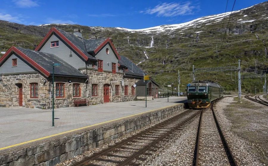
At Myrdal, the Flåm Railway leaves Norway’s main line and begins an 866-metre descent towards the fjord. Tunnels, ledges and tight curves make the movement downhill more compelling than the arrival.
Some journeys turn transport into the main event. These eight do it with ordinary rail, a working coastal ship and a road that holds a difficult shoreline. The destination can wait.
The Flåm Railway drops towards the fjord
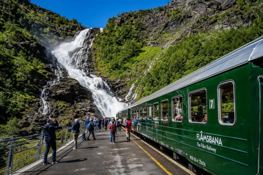 Passengers stand beside Kjosfossen waterfall during a Flåm Railway stop.
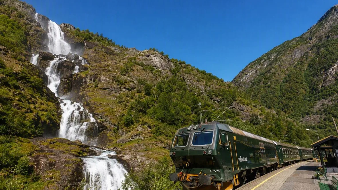
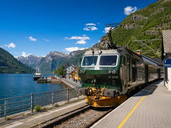
The Flåm Railway loses 866 metres between Myrdal and Flåm without a rack or cable. Ordinary adhesion wheels carry the train down gradients as steep as 1 in 18, through 20 tunnels; workers excavated 18 of those tunnels by hand after construction began in 1923.
The valley changes in quick cuts. Bare upland disappears inside dark rock, then the train emerges beside fast water, scattered farms and steep valley walls. At Kjosfossen, passengers can step onto the platform beside the waterfall before the carriages enter a tunnel that turns 180 degrees and continue to the Aurlandsfjord. The line does not merely cross the mountain. It shows exactly how engineers got a train down it.
The Bernina train stays above the Alps
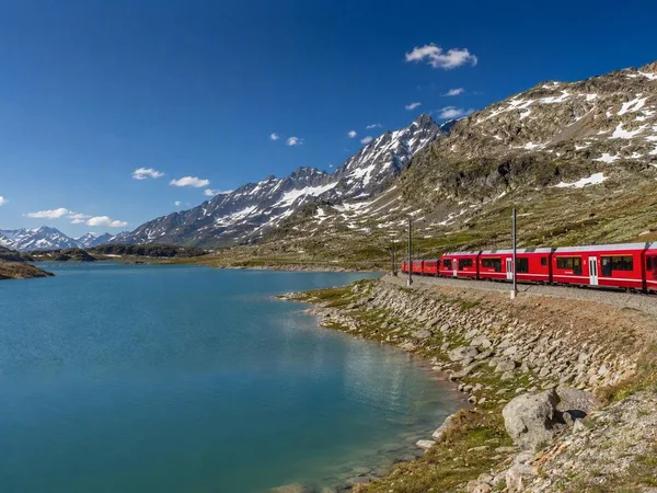
From St Moritz, the Bernina line crosses the Bernina Pass in view of glaciers and high mountain ground rather than avoiding them in a long summit tunnel. At Ospizio Bernina, the railway reaches 2,253 metres before descending through Alp Grüm and Poschiavo towards Italian-speaking Tirano.
Engineers built tunnels, galleries, bridges and sharp curves in the early twentieth century to connect isolated mountain settlements. At Brusio, the lack of space produced the route’s neatest answer: the train curls around an open stone spiral viaduct and crosses above its earlier path. The historic Bernina and Albula lines have held UNESCO World Heritage status since 2008. That is deserved, but the open curve at Brusio explains the case more clearly than any plaque could.
The West Highland Line crosses the moor
Glasgow’s suburbs thin out beside lochs before the train reaches Rannoch Moor, a wet expanse with stretches of railway but no neighbouring road. Victorian engineers could not set conventional foundations in the deep peat, so they laid the track on a mat of brushwood during construction between 1889 and 1894.
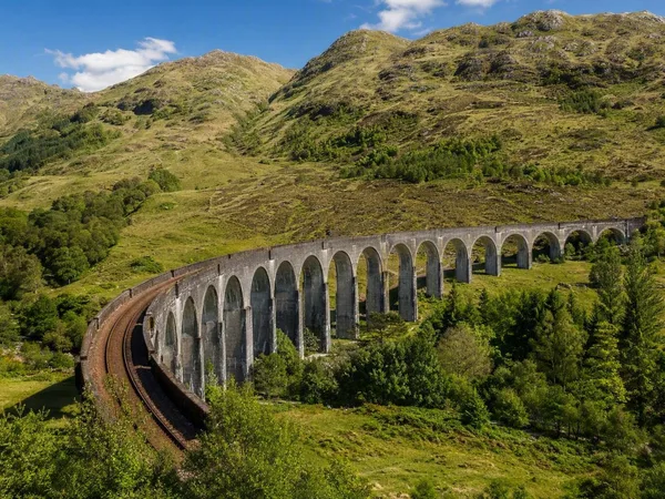
Small stations punctuate the moor. Rannoch still has chalet-like timber buildings on its island platform. Beyond Fort William, the train crosses the 21 arches of Glenfinnan Viaduct and follows sea lochs towards Mallaig. Fishing boats and ferries keep the terminus tied to the line’s original role: carrying fish and farm produce from the west coast towards Glasgow.
The Douro train keeps close to the water
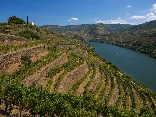
Outside Porto, the railway settles beside the Douro and follows its bends. Regional trains pass villages, quintas and terraces stacked above the river between Régua, Pinhão and Tua.
The line opened in stages from 1875 because poor roads and difficult river transport had isolated the wine country. It carried passengers, but wine freight gave the railway much of its purpose. At Pinhão station, 24 tiled panels show grape picking, farm labour and local customs. Farther east, the slopes grow rockier, yet the train keeps to the narrow strip shared by railway, river and settlement. The view is not a vineyard display arranged for visitors. It is a working valley with the track at its lowest usable edge.
The Kandy–Ella train works through tea country
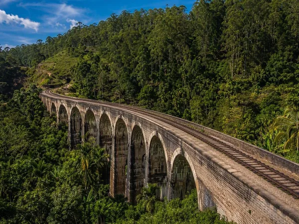
Open windows and doors, vendors carrying fruit and spiced cashews, and small stations painted pink or blue keep this train firmly in everyday Sri Lanka. Around Hatton and Nanu Oya, clipped tea bushes cover mountain bowls; eucalyptus, rhododendrons and waterfalls appear beside the track.
The railway began in 1864 to carry coffee from the highlands to Colombo. After disease struck the coffee crop in 1871, tea became its central freight. Sharp curves and restrained gradients reduced the need for costly cuttings across difficult slopes. The train still winds through the plantations rather than skirting them, with small fields, tea workers and station trade visible from the carriage.
Hurtigruten calls at the working coast
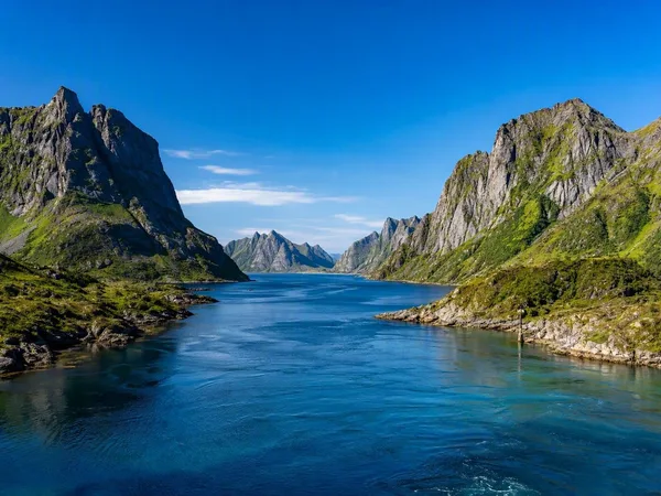
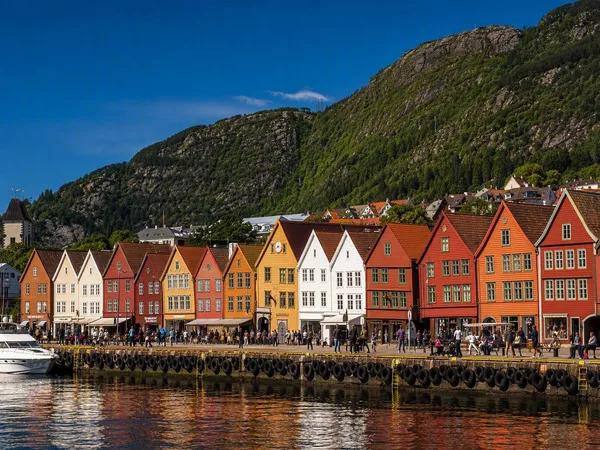
Hurtigruten began in 1893 as a service for post, passengers and express freight. Tourism now forms its main business, but the ships still carry cargo and connect 34 ports between Bergen and Kirkenes.
That task sets the rhythm aboard. Small quays get brief, practical calls; longer stops put Ålesund’s Art Nouveau façades, Trondheim’s riverside warehouses and Brønnøysund’s fishing harbour within reach. Farther north, sheltered islands and Trøndelag farmland give way to Lofoten’s peaks, fishing ports and Finnmark’s low rocky coast. In suitable weather and light, the captain may take the ship into narrow Trollfjord and turn beneath walls that rise almost vertically from the water.
The TranzAlpine crosses New Zealand’s divide
The TranzAlpine leaves Christchurch across the flat fields of the Canterbury Plains, with the Torlesse Mountains ahead. After Springfield, the railway enters the Waimakariri Gorge, using short tunnels and high viaducts to follow cliffs above the river.
The 8.5-kilometre Ōtira Tunnel takes the train beneath the Southern Alps. Engineers chose a long tunnel with a steadier gradient because a much steeper rack railway could not have handled heavy freight; its opening in 1923 completed the Christchurch–Greymouth rail link. On the western side, dense native forest, river valleys and Lake Brunner replace the dry eastern farmland. The tunnel makes the change abrupt. One side grows grain; the other grows wet and green.
The Great Ocean Road holds the cliff edge
Beyond Torquay and Bells Beach, drivers meet the road’s defining stretch between Eastern View, Lorne and Apollo Bay. Two lanes curve along the rock face beside the Southern Ocean.
More than 3,000 returned servicemen built the road between 1919 and 1932 with picks, shovels, explosives and horse-drawn carts. The work connected coastal communities that had depended heavily on boats, while the Memorial Arch records the road’s role as a monument to Australians killed in the First World War. Tool marks remain visible on some rock faces between Lorne and Kennett River.
After the forested Otways, the car returns to the coast near Princetown. Wind and waves have cut caves, arches and detached limestone stacks from the cliffs; despite the name, the Twelve Apostles never numbered twelve.
Practical choices
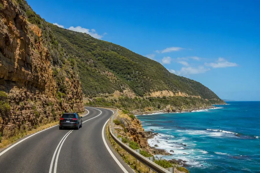 A car follows the cliffside Great Ocean Road between Eastern View and Apollo Bay.
For Flåm, reserve summer seats early; the Bernina Express also requires a separate reservation in addition to the ticket or rail pass. Spring to autumn suits the West Highland and Douro lines, and Douro regional trains run daily without compulsory reservations. Between Kandy and Ella, a reserved second-class seat is the sensible choice, particularly from December to April. Hurtigruten sails all year, with midnight sun in summer and northern-light season in winter; cabins and excursions cost considerably more than an ordinary ferry crossing. Book the TranzAlpine ahead, especially during the New Zealand summer. On the Great Ocean Road, car hire, fuel and accommodation form the main expense, and summer holidays and long weekends fill rooms early.
At Port Campbell, the driver can finally let go of the wheel. Beyond the cliff edge, broken arches and limestone pillars stand in moving water while the Southern Ocean continues cutting the coast.
Keep exploring
Places in this story
Myrdal
Myrdal is a high-mountain railway hamlet in Aurland, western Norway, where the Bergen Line meets the Flåm Railway. At 867 metres above sea level, it is the rail-only starting point for the descent to Flåm and the Aurlandsfjord.
Flåm
Bernina Pass
Tirano
West Highland Line
Douro
Kandy
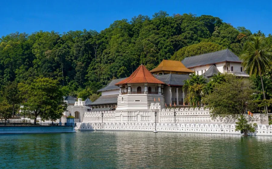
Kandy is Sri Lanka’s historic hill city in Central Province, built around Kandy Lake and the Temple of the Sacred Tooth Relic. It was the last capital of the Sinhala kings and remains a major Buddhist pilgrimage centre.
Ella
Bergen