Sight · Finland
South Harbour
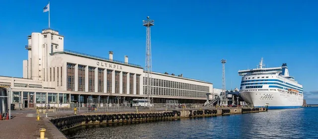
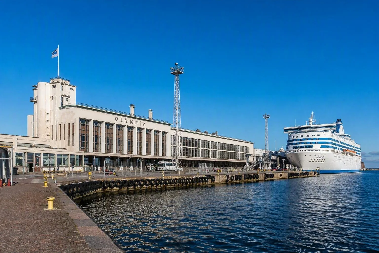
South Harbour, or Eteläsatama, is Helsinki’s historic waterfront port beside the Market Square and Kaivopuisto. Its southern quay is defined by the 1952 Olympia Terminal and the Stockholm ferry.
Orientation
South Harbour occupies the water’s edge immediately south-east of central Helsinki. It is not a sealed-off industrial port: the Market Square, Esplanadi, Katajanokka and Kaivopuisto all meet its quays, ferry basins and streets.
The southern end at Olympiaranta is the operational part to know if you are travelling to Stockholm. The Olympia Terminal stands beside Kaivopuisto, while the older harbour basin north of it frames the Market Square. This is a working waterfront, so distinguish public pavements from controlled quay and vehicle areas.
A harbour made by the city
Eteläsatama began as a shallow bay. In the early 19th century, Helsinki filled shallow water and straightened the shore to create quays from Ullanlinna towards Katajanokka. By the late 19th century it had become the city’s principal harbour for large vessels.
Cargo and passenger traffic shaped the area for generations. Car ferries expanded passenger travel from the 1970s, keeping international shipping directly beside the centre rather than moving it beyond the city.
Olympia Terminal
The key building on the southern quay is the functionalist Olympia Terminal, designed by Risto-Veikko Luukkonen and Aarne Hytönen for the 1952 Helsinki Olympics. It remains a protected building and a practical piece of port infrastructure rather than a museum.
Look for surviving details in the refurbished hall:
- leather benches in the original functionalist style
- stone window surrounds
- a large compass rose set into the floor
- distinctive O-shaped door handles
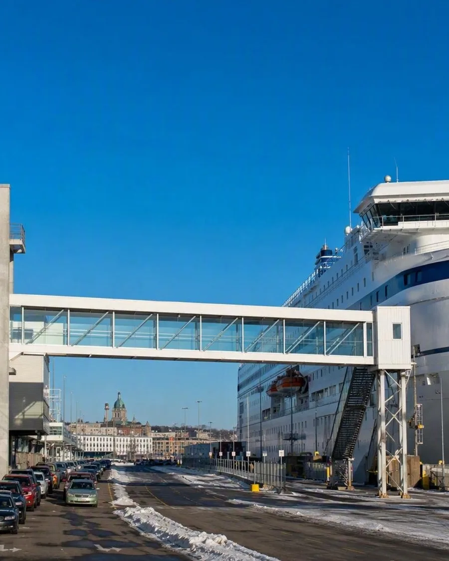
Tallink Silja’s Silja Serenade and Silja Symphony use the terminal for Stockholm sailings. Passengers move through the terminal and enclosed corridors to the ship; cars follow marked lanes along the quay between the building and the sea.
Getting there and using the quay
Trams 2 and 3 stop at the terminal. The central railway station is about 2.2 km away; Kaivopuisto begins beside the terminal, making the harbour easy to combine with a walk through the southern districts.
For ferry passengers, the terminal provides toilets, an accessible toilet, café or restaurant facilities, ticket sales, taxi access and an ATM. Vehicle passengers should follow port signs rather than navigation instructions alone: the check-in route runs along the quay and has three check-in booths.
Access rule: do not walk into vehicle lanes, loading areas or mooring zones. The public waterfront changes around ship movements, and port operations take priority.
Change ahead
South Harbour is entering a long redevelopment phase. Plans retain the protected Olympia Terminal and Harbour Building for new uses, while a new Architecture and Design Museum, public event space and a waterfront promenade are planned around Makasiiniranta. Construction preparation and port changes can alter routes around the quay.
From the magazine
Stories about South Harbour
Editorial stories linked directly to South Harbour.
Routes from our editors
Travel through South Harbour
Editorial routes connecting South Harbour with other countries, cities and hotspots.
No routes through South Harbour have been published yet.
More in Finland
Related hotspots
Other cities, nature areas and places within Finland.