City · Belgium
Bruges
Bruges is a compact historic city in West Flanders, Belgium, where canals, market squares and brick Gothic architecture preserve the form of a major medieval trading centre.
Read the city from the water
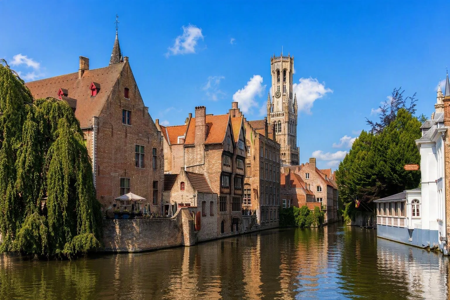
Bruges grew around the Reie and a canal network that once carried mercantile traffic. The water is not a decorative extra: it explains the city’s layout, its old harbour zones and the close relationship between warehouses, merchants’ houses and public squares.
The historic centre has retained its medieval street pattern. Main routes converge on major squares, while lanes, bridges and canals break the city into small, walkable districts. Brick Gothic buildings give the centre its particular northern-European character.
Start at the Markt, the broad market square beneath the Belfry and former market halls. Continue a few minutes east to the Burg, the older political and administrative centre. From there, take the lanes and quays rather than trying to follow a single straight route; Bruges works best as a sequence of short connections.
Trade, civic power and art
Between the 10th and 14th centuries, Bruges developed into an international trading town and then a leading commercial centre in north-western Europe. The Markt’s 13th-century Belfry and halls were a statement of urban autonomy and commercial wealth; merchants from northern and southern Europe met here.
Look for the physical record of that economy:
- The canals and Reien: former working waterways that tied the city together.
- The Belfry and Markt: the clearest expression of the market city.
- Brick Gothic façades: a defining architectural language of the historic centre.
- Flemish Primitive art: Bruges was a centre of patronage and painting in the 15th century, associated with Jan van Eyck and Hans Memling.
The historic centre is World Heritage not for one isolated monument, but for this surviving urban ensemble: streets, squares, waterways, Gothic fabric and later layers of building.
Get around efficiently
On foot: Make walking the default. The central sights sit close together, and the narrow streets reward a slower pace. The free Visit Bruges Route App includes discovery routes; the paid Oooh! Bruges walking guide offers several mapped walks in multiple languages.
By boat: Canal trips give a useful low-level reading of bridges, quays and rear façades. Treat one as a complement to walking, not a replacement for it.
Useful route: Begin at Markt, cross to Burg, follow the water south through the historic core, then return through the lanes. This links the principal civic spaces with the canal landscape without retracing much ground.
Beyond the core
For a longer, quieter circuit, follow part of the Brugse Vesten, the green former defensive belt around the historic centre. Its oval route is about 7 kilometres long and follows the line of the city’s later medieval fortifications. Four surviving gates, ramparts and water-defence features still make the old boundary legible.
Allow time to step away from the busiest square-and-canal circuit. Bruges is most intelligible when you alternate between its grand public spaces, tight residential streets and water edges.
From the magazine
Stories about Bruges
Editorial stories linked directly to Bruges.
Routes from our editors
Travel through Bruges
Editorial routes connecting Bruges with other countries, cities and hotspots.
No routes through Bruges have been published yet.
More in Belgium
Related hotspots
Other cities, nature areas and places within Belgium.