Eight mineral landscapes shaped by salt, iron and hot water
On Bolivia’s Salar de Uyuni, a hard white crust runs towards an empty horizon. Elsewhere, iron colours whole mountains red, hot springs build terraces, and Roman miners have left cliffs behind.
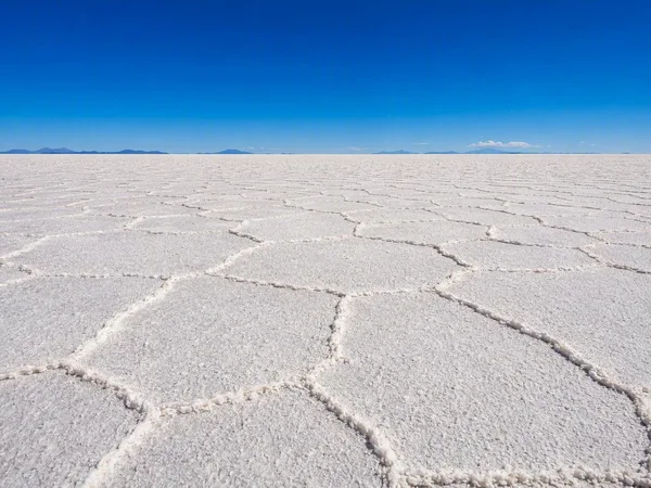
Salt polygons on Salar de Uyuni
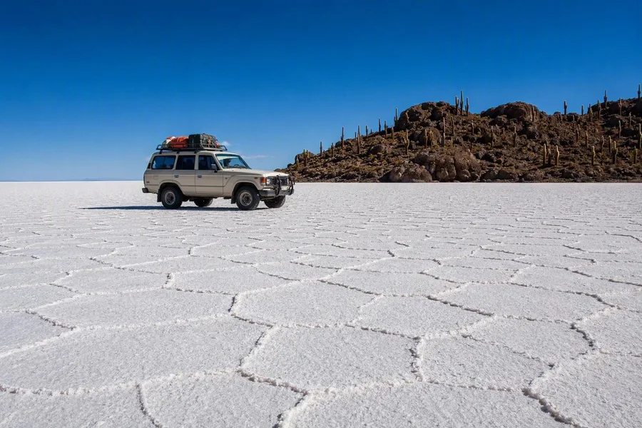 A local 4x4 crosses salt polygons on Bolivia’s Salar de Uyuni near Incahuasi.
Local 4x4 tours leave Uyuni and cross a plain so level and white that the dark rocks of Incahuasi rise sharply from the salt. In the dry season, the hard crust breaks into geometric polygons; from December to April, rainwater can cover it in a thin reflective layer.
The crust consists almost entirely of halite left by the prehistoric Lake Minchin, and annual flooding helps maintain its remarkable flatness. Near Colchani, a cooperative still extracts and processes salt, so the route can begin beside an active salt-working settlement.
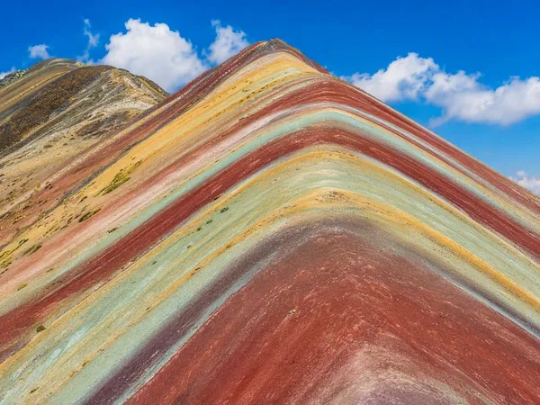
Exposed mineral bands on Vinicunca
Vinicunca rises above the treeless Peruvian Andes in tilted bands of red, mustard, green and lavender. Erosion has cut through sedimentary layers with different minerals: iron oxide and clay colour the red bands, limonite contributes yellow, copper oxide adds green and turquoise, and calcium carbonate with silicates produces paler purple tones.
The viewpoint stands at about 5,200 metres, reached over steep and unpaved ground. Rain can strengthen the colours, while snow can hide them; walkers and locally hired horses use the lower sections of the route. Communities around Pitumarca and Cusipata manage access, maintain facilities and rent horses, while the mountain remains connected to nearby Apu Ausangate, a sacred peak.
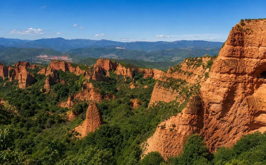
Rome’s broken hills at Las Médulas
The red pinnacles of Las Médulas in northwestern Spain did not take shape through ordinary erosion alone. Roman miners drove galleries into gold-bearing conglomerate, then released stored water into enclosed passages to fracture and wash away the rock.
That work left steep faces, half-open tunnels, drainage channels and heaps of stone. Gold settled in washing channels, while lighter material accumulated in spoil grounds that later supported agriculture. Little later industry altered the site, so today’s paths cross an unusually intact Roman mining landscape rather than a natural range of red peaks.
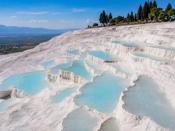
Pamukkale’s growing white terraces
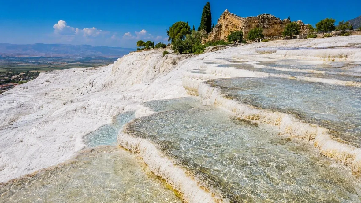
At Pamukkale, water runs over a white wall of shallow bowls and calcified rims. Rainwater descends through fractures, warms underground and absorbs calcium and magnesium from limestone; at the surface, it deposits calcium carbonate as travertine.
The deposits form terraces like frozen cascades, although warm spring water still fills selected pools. Water does not cover every terrace at once because staff direct the flow to protect the white deposits, and visitors may use only designated sections.
Above the terraces stand the baths, temples and other remains of Hierapolis. Mineral springs supported a thermal resort here from the late second century BC, linking the travertine slope directly to the ancient city.
Sandstone and inscriptions in Wadi Rum
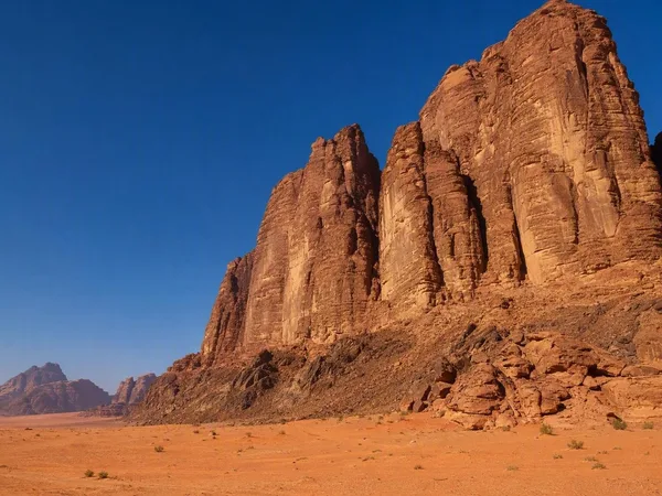
Wadi Rum’s sandy floors lie between sandstone massifs, narrow canyons, arches and high rock walls. Quartz sandstone sits above older granite, while uplift, fractures, water and salt weathering have cut the towers, cavities and straight-sided gorges. Iron-bearing minerals colour some bands rust red and yellow, while exposed sections can look almost white.
Petroglyphs, inscriptions and water-collection sites show long use by herders and settled communities. Wadi Rum protects both these cultural traces and the desert landforms, and local guides and camps take visitors into the sand by 4x4 rather than leaving them to drive freely across it.
Layered hills at Zhangye Danxia
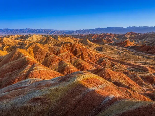
The bare hills of Zhangye Danxia show repeated bands of red, orange, yellow, greenish grey and dark stone. Sandstone, siltstone and mudstone accumulated in ancient rivers and lakes before tectonic movement folded the deposits; wind, water, frost and gravity later cut them into rounded ridges.
Different forms of iron account for much of the colour. Oxides and carbonates produce red, sulfides contribute yellow, and iron in clay minerals creates green-grey layers. Summer rain can deepen the colours, while winter snow sets white against the red and gold slopes. Visitors use boardwalks and viewing platforms in Zhangye UNESCO Global Geopark rather than walking across the protected hills.
Moving water at Wai-O-Tapu
At Wai-O-Tapu on New Zealand’s North Island, marked paths pass volcanic craters, silica terraces, mud pools and steaming ground. Its Māori name means “sacred waters”, and the geothermal field now operates as a self-guided visitor attraction.
Carbon-dioxide bubbles and convection stir the hot surface of Champagne Pool. Grey-white silica sinter lines its edge, while metal-rich sulfides colour a shallow underwater shelf orange. Elsewhere, the paths reach the green Devil’s Bath and the mineral-stained Artist’s Palette; staff trigger an eruption of Lady Knox Geyser at a fixed time each morning.
Access, tickets and bookings
Salar de Uyuni is normally visited on a local 4x4 tour from Uyuni, with day tours advertised from about US$59; November to April offers the best chance of shallow mirror water, while May to November usually shows dry polygons. Vinicunca charges foreign visitors S/25 and does not require a guide; April to October generally brings clearer conditions, though the altitude still requires proper acclimatisation. Las Médulas requires a reservation for the guided Senda de las Valiñas, which runs only with at least six participants; current routes avoid areas affected by the 2025 fire.
Pamukkale and Hierapolis share a paid entrance and are currently open daily from 08.00 to 18.45, with a separate evening session. Wadi Rum charges 5 JOD at the visitor centre unless entry is covered by a Jordan Pass; camps and 4x4 tours need separate arrangements. Zhangye Danxia uses a compulsory park shuttle, and visitors should check the official booking system for current prices, seasonal hours and busy-session reservations. Wai-O-Tapu currently charges NZ$47 for adults and NZ$17 for children up to 15, opens from 08.30 to 16.30, and presents Lady Knox at 10.15. Dallol is not a freely or reliably bookable attraction: an accredited operator must confirm permits, Afar guides, overland access and any required security shortly before departure.
Salt and acid at Dallol
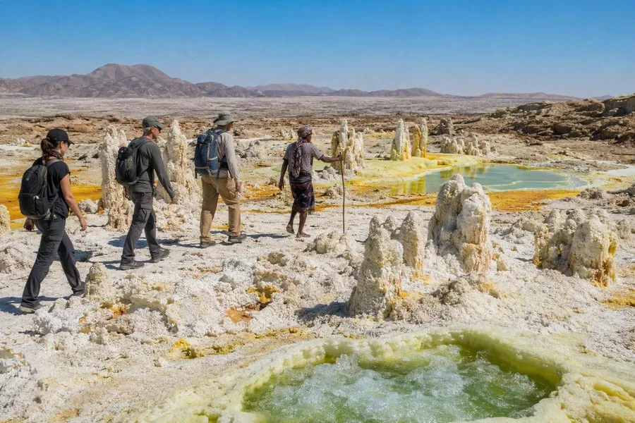 Visitors follow an Afar guide across Dallol’s brittle salt crust beside mineral brine pools.
Dallol lies in Ethiopia’s Danakil Depression on a salt dome of uplifted halite and anhydrite above a shallow magmatic heat source. Magma, groundwater and hydrated salts produce hot acidic brines, fumaroles, small geysers and terraced pools rather than a conventional lava cone.
The surrounding Afar region has supported salt extraction and caravan transport for more than a thousand years, and workers still cut salt blocks for transport towards the highlands. Visitors with confirmed permission follow their guides on foot because gas, acidic water and brittle salt crusts make independent movement unsafe.
Active brine builds cones, pillars and thin terraces, while older salt deposits dissolve or crumble. Iron, manganese and sulphur compounds colour the white salt with green, yellow and orange, around pools that can bubble through a changing crust.
Keep exploring
Places in this story
South America
3 landen en gebieden
Europe
Middle East
Asia
Salar de Uyuni
Vinicunca
Las Médulas
Las Médulas is a Roman gold-mining landscape in El Bierzo, in León province, north-western Spain. Its rust-red pinnacles, galleries and spoil heaps were shaped by hydraulic mining in the first two centuries AD.
Pamukkale
Wadi Rum