
City · Belize
Belmopan
Belmopan is Belize’s planned inland capital in Cayo District, built after Hurricane Hattie devastated Belize City in 1961. Its low-rise government core, arranged around Ring Road, makes the city’s purpose immediately legible.
A capital built inland
Belmopan was founded in 1970 as Belize’s new administrative centre, after Hurricane Hattie devastated the former capital, Belize City, in 1961. The move put government on higher inland ground, roughly 80 km from the Caribbean coast, while Belize was still British Honduras. Independence followed in 1981.
That origin explains the city’s character. Belmopan is not a colonial port or a compact commercial centre: it is a purpose-built capital of ministries, parks, residential areas and broad roads. Treat it as a place to understand modern Belizean statehood rather than as a dense sightseeing city.
Read the plan
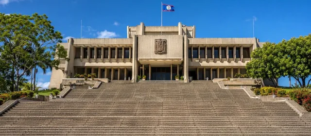
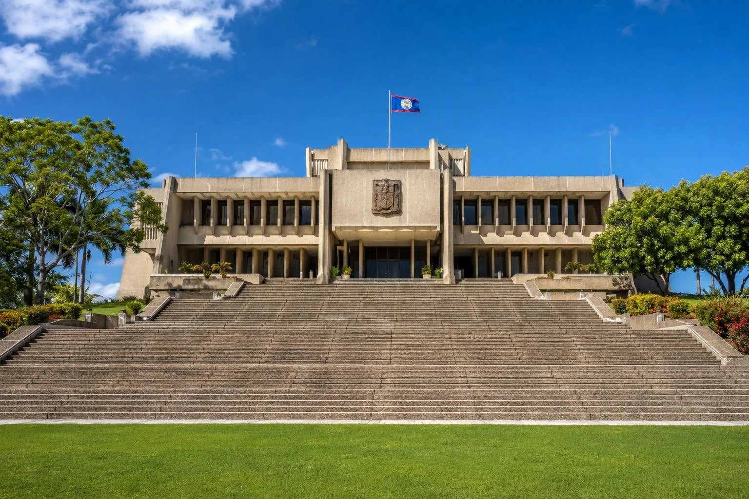
Start at Independence Plaza and Independence Hill, the formal civic core. The National Assembly Building is the visual anchor: broad steps rise to a severe, symmetrical structure whose stepped form deliberately recalls a Maya temple. It houses Belize’s bicameral legislature—the House of Representatives and Senate.
The city is organized around Ring Road, a loop enclosing government buildings and green space. Distances are generous and the skyline stays low, so the centre works best on foot in the cooler part of the day. The assembly, ministries and open lawns are the point: the plan gives the capital room, shade and clear sightlines rather than urban spectacle.
What to do in town
- Study the Assembly exterior. Walk the plaza and look at the stairs, deep recesses and heavy concrete massing. The building is the clearest expression of Belmopan’s 1970s civic design.
- Use Market Square as the everyday counterpoint. Shops and local food cluster here; Friday is the established market day for produce, cooked food, clothing and small goods.
- Combine civic and green space. Guanacaste National Park is at the edge of the city and offers a short nature break beside the Belize River.
Do not confuse Belmopan’s deliberately quiet centre with a lack of function: it is the national seat of government, not Belize’s main port or commercial city.
Visits, access and timing
The National Assembly offers scheduled tours and public access during parliamentary proceedings, subject to operational arrangements. For the public gallery, expect security screening and possible ID checks. Smart-casual dress is required; shorts, sleeveless tops, flip-flops and clothing with political slogans are not permitted. Recording in the chamber or public gallery is prohibited without authorization.
Belmopan is on Belize’s inland highway network and makes a logical stop between Belize City, the west and the Hummingbird Highway. Within the civic centre, walking is practical; use a taxi or local transport for outlying neighbourhoods. Allow a half-day for the plaza, market and a measured walk around the planned core.
From the magazine
Stories about Belmopan
Editorial stories linked directly to Belmopan.
No stories about Belmopan have been published yet.
Routes from our editors
Travel through Belmopan
Editorial routes connecting Belmopan with other countries, cities and hotspots.
No routes through Belmopan have been published yet.
More in Belize
Related hotspots
Other cities, nature areas and places within Belize.
Belize City
3 linked stories and routes
National Assembly Building, Belmopan
2 linked stories and routes
Cayo District
2 linked stories and routes
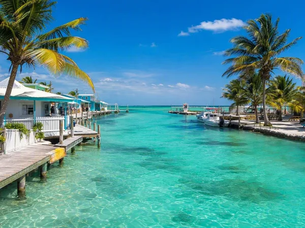
Caye Caulker
1 linked stories and routes
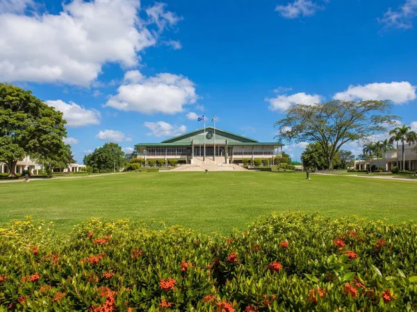
Independence Plaza, Belmopan
1 linked stories and routes
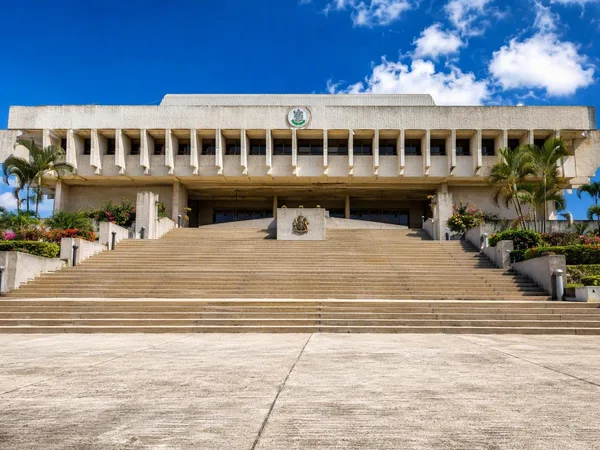
Independence Hill, Belmopan
1 linked stories and routes