Walking the Tablelands Trail in Gros Morne
The marked Tablelands Trail in Gros Morne National Park follows an old road beneath slopes of rust-orange mantle rock. The 4-kilometre walk stays low, but it brings an ancient ocean floor, thin mineral-rich soils and a remarkably spare plant community into clear view.
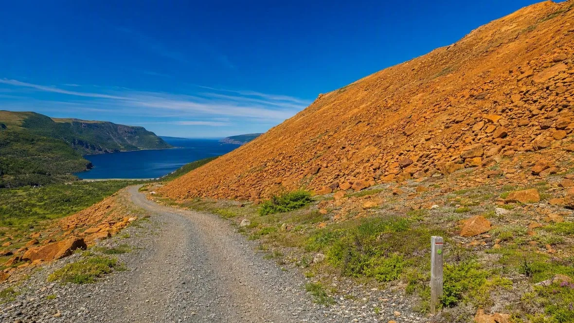
At the foot of the Tablelands, the colours make the first point plainly. Green hills descend towards the salt water of Bonne Bay on one side. Broken orange rock covers the broad mountainside on the other.
The Tablelands are not a recent volcanic range. Their slopes consist chiefly of peridotite, a dense rock from Earth’s upper mantle that normally lies far below the crust. Here, erosion and ice have left it exposed beside a marked, easy-going trail.
An old road below the Tablelands
 The marked old road follows rust-orange Tablelands rock above Bonne Bay.
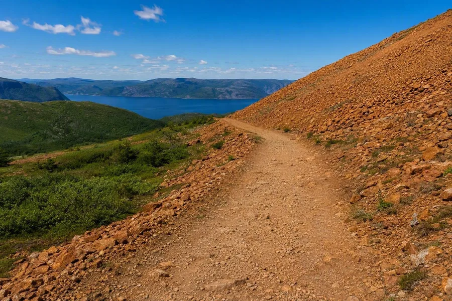
The Tablelands Trail begins at the designated parking area on Route 431, four kilometres west of the Discovery Centre in Woody Point. It follows an old road along the mountain’s base rather than climbing to the plateau. The marked out-and-back route covers 4 kilometres and runs at roughly 160 to 235 metres above sea level.
The ground is compacted but uneven. Sections of broken stone interrupt the old roadbed, and short wooden boardwalks cross wetter ground. The gentle rise makes this a very different proposition from an ascent of the Tablelands plateau, where there are no route markers.
The mountain remains close through most of the walk. Iron in the weathered peridotite oxidises at the surface, giving the rock its orange to rust-coloured skin. A newly broken piece can show dark green within. Water moving into the olivine-rich rock can form serpentine minerals, sometimes with pale veins across green stone.
The track rounds the flank at a steady level. Views then spread towards the vegetated hills and blue water around Bonne Bay, while the Tablelands hold their bare amber colour across the trail. The contrast comes from the rock underfoot, not from clearing or cultivation.
A piece of ocean floor on a continent
About 500 million years ago, the Iapetus Ocean began to close. One oceanic plate sank beneath another, and magma and rock formed a sequence that included mantle peridotite and dunite, then gabbro, dykes and basalt above them. Geologists call a slice of this former ocean floor and upper mantle an ophiolite.
About 475 million years ago, as the ocean closed and the precursors of the Appalachians formed, a still-hot slab of that ophiolite was pushed over the edge of the North American continent rather than dragged completely down into the Earth. Hundreds of millions of years of erosion removed overlying rock. Later glaciers cut the landscape again and helped uncover the peridotite that now forms the Tablelands.
Nearby exposures include parts of the Moho, the boundary between oceanic crust and mantle. That boundary usually lies 5 to 70 kilometres below the surface. Gros Morne brings parts of it into the open, alongside continental-margin sediments, deep ocean crust and mantle material.
That visible record of an ocean opening and closing earned Gros Morne National Park its UNESCO World Heritage status as an unusually clear demonstration of continental drift and plate tectonics. The Tablelands Trail does not reach the plateau, but it puts the mantle section at eye level.
Soil that selects its plants
Peridotite shapes more than the colour of the slope. As it weathers, it produces thin soil that lacks much of the nitrogen, phosphorus, potassium and calcium that most plants need. The same soil contains high levels of magnesium, iron, nickel, chromium and cobalt. Few species can tolerate that chemistry.
Sparse cover leaves loose material exposed to wind. Between the stones lie open patches of grit, bare rock and small pockets of soil rather than a continuous turf. This is a natural serpentine barren, not a landscape stripped by people.
The small plants matter precisely because they are hard to spot. Serpentine sandwort grows low to the ground, with evergreen needle-like leaves and small white flowers in June and July. It is tied to serpentine soils, where many competing plants fail. Juniper also grows close to the ground, while small alder and larch occur around Winter House Brook.
Water changes the picture in selected places. Moisture from the boggy top of the Tablelands can move beneath the surface gravel. Purple pitcher plants can grow in these damp pockets. Their tubular leaves catch and digest insects, supplying nutrients that the soil does not provide. Sundews and butterworts use the same method.
The apparently empty gravel therefore holds a specialised plant community. A footstep off the track can flatten a plant in one of the few patches where roots can take hold.
Practical notes for the marked trail
Use the designated Tablelands car park on Route 431, between Woody Point and Trout River; do not park overnight at the trailhead or roadside. Allow one to two hours for the return walk to Winter House Brook Canyon. The walk needs no separate hiking reservation or permit, though entry to Gros Morne requires a park pass; visitors aged 17 and under enter free. July and August are generally the warmer, drier months, with daytime temperatures of 16–25°C, but rain still falls on average every two days and moist southwesterly winds can change conditions quickly. Check the current trail report, carry water and a waterproof wind layer, and expect small streams across the gravel after sustained rain. Stay on the marked route and leave rocks and plants in place: park rules prohibit removing natural objects, and the low plants beside the path grow slowly in fragile soil.
Winter House Brook Canyon
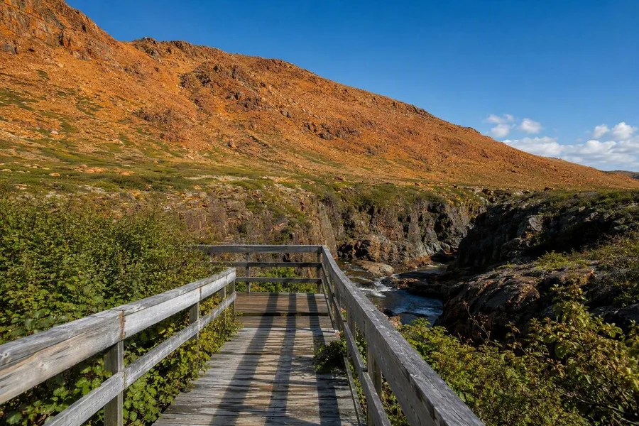 A wooden boardwalk reaches the viewpoint above Winter House Brook in the Tablelands canyon.
At the end of the route, the broad foot of the mountain closes into Winter House Brook Canyon. Glaciers carved this U-shaped valley, and the brook now runs through the rocky hollow. A final boardwalk reaches an enclosed viewpoint above the water.
The old road ends at the brook. Orange, weathered peridotite rises above the canyon, while water moves below through a channel cut by ice and time.
Keep exploring