From Fremantle Prison to Victoria Quay on Foot
Fremantle Prison stands above the old commercial streets, while ships, trains and ferries move through the harbour below. This walk follows the ground between them: from a convict-built prison down to the streets that served maritime trade, then across the railway to the working waterfront.
Behind the walls on The Terrace
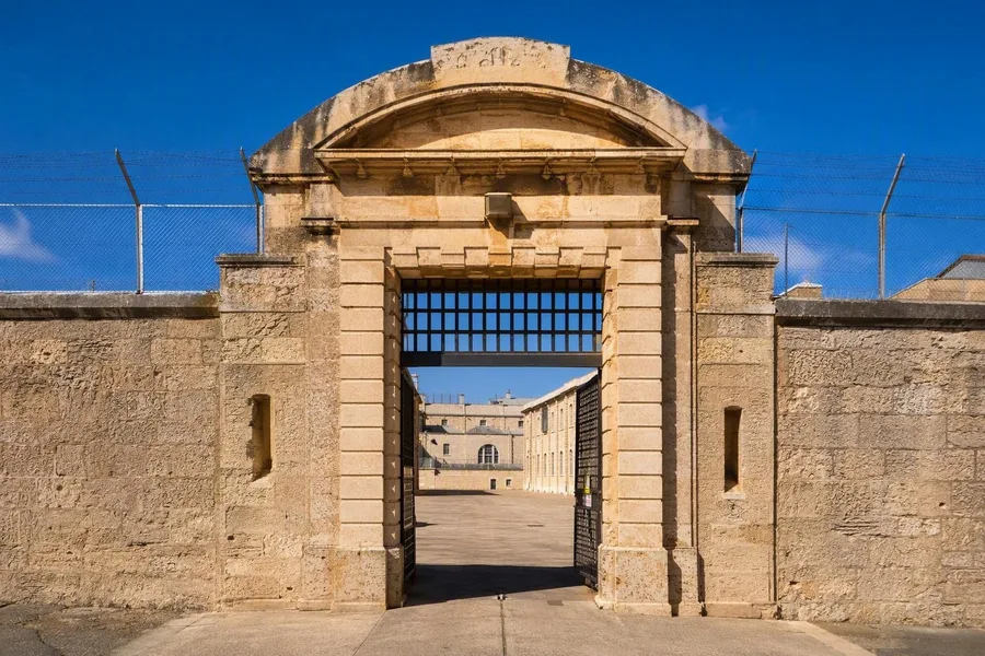 Fremantle Prison’s limestone gatehouse and enclosing walls stand on The Terrace.
High limestone walls separate Fremantle Prison from The Terrace. The gatehouse, enclosed entrance court and long central cell block belong to a complex designed for surveillance, separation and control.
The first 75 British convicts arrived in Fremantle in 1850 after the young Swan River Colony sought labour for public works. Edmund Henderson of the Royal Engineers selected a limestone ridge above the port and planned the prison on principles drawn from Britain’s Pentonville model. Convicts quarried and dressed local stone, then built the walls, cells, workshops, hospital and service buildings that confined them.
Their forced labour also built roads, bridges, jetties, footpaths and public buildings across the growing settlement. Fremantle’s colonial fabric therefore carries a difficult fact in plain sight: imprisonment supplied labour as well as punishment.
The Main Cell Block runs for about 145 metres and rises four storeys in regularly cut limestone, with an early Victorian chapel projecting from its centre. Its axis runs through the Wray Gates and Gatehouse. Individual cells, exercise yards, graffiti, paintings and signs record both the nineteenth-century regime and later prison life. The complex became the colony’s principal prison after 1886 and remained in use until 1991.
Practical details: Fremantle Prison opens daily from 9am to 5pm, except on Good Friday and Christmas Day. The Gatehouse, visitor centre, Convict Depot and shop are free to enter, but access to the main prison complex requires a guided tour. A standard daytime tour costs AU$25 for adults; Tunnels and Torchlight tours cost more, and the published prices apply through 30 June 2027. Buy day-tour tickets on site or reserve by phone. Tunnels and Torchlight tours can also be booked online. Allow time for the prison tour, then follow the Fairbairn Street Ramp, Parry Street, High Street, Cliff Street and Phillimore Street to Victoria Quay.
Down the Fairbairn Street Ramp
The Fairbairn Street Ramp drops from the prison precinct towards Parry Street. It once carried an access tramway and remains part of the heritage prison site. The descent shows Fremantle’s geography clearly: the prison occupies the higher eastern edge of town, while the commercial centre lies below, on the narrow ground between the Swan River and the Indian Ocean.
British settlers formally claimed the site at the river mouth in 1829, although the place already held longstanding significance for Whadjuk people. Colonial surveyors laid a rectangular street grid across the land. High Street became its main east–west line, with short cross streets running north towards the waterfront.
From Parry Street, turn west onto High Street. The prison ridge stays behind as the old business district closes around the road.
Shops, banks and hotels on High Street
High Street linked Fremantle’s administrative centre with Arthur Head and the coast. During the boom years of about 1890 to 1910, banks, shops and hotels filled its frontages. Shipping companies and warehouses clustered closer to Victoria Quay.
Red brick, limestone, verandas and moulded plaster still shape many facades. Shops and cafés now occupy many ground floors, with offices and homes above. The narrow plots and continuous building line still show the practical density of a port town where merchants, travellers and seafarers needed rooms, services and storage close together.
At the corner of Market Street, the Manning Buildings give the commercial strip a particularly clear example. Developers built the two-storey complex between 1902 and 1906, using a plastered corner facade with pilasters, gables, recessed entrances and a corrugated awning. Retail still occupies the buildings.
Further west, former offices and warehouses contain shops, hospitality businesses, homes, workplaces and parts of a university campus. The uses have changed, but the streets still place finance, accommodation, storage and the waterfront within a few blocks of each other.
The Round House above Bathers Beach
At the western end of High Street, the Round House stands on Manjaree, also known as Arthur Head. This 12-sided limestone building opened in 1831 as the Swan River Colony’s first permanent prison, only 18 months after the colony was founded. Its raised position looks over High Street, Bathers Beach and the ocean.
The Round House came before the larger prison on The Terrace. Together, the two buildings show the growth of colonial confinement, from a small coastal lock-up to an institution that supplied forced labour across the settlement. The current museum presentation also addresses Aboriginal dispossession and the imprisonment of Aboriginal people on Wadjemup, or Rottnest Island.
Below the headland, the Whalers Tunnel cuts through the rock to Bathers Beach. Workers began using it in 1838 to carry whale products from the shore into town. Early ships relied on exposed wooden jetties along this coast because the river mouth had not yet become a protected inner harbour.
Cliff Street and the railway
Return briefly along High Street, then take Cliff Street north. The street connected Fremantle’s ocean side with the Swan River side, and its trading houses point directly towards the next stage of the walk.
Premises associated with the Samson trading firm stand here, along with a small red weighbridge from 1897. Horse-drawn wagons and early motor lorries used the weighbridge as goods moved between stores, streets and ships. The little structure makes the port’s daily arithmetic visible: cargo had to be weighed before it could be sold, loaded or sent on.
Phillimore Street brings the railway into view. Freight tracks run between the city and waterfront, while passenger trains terminate nearby at Fremantle Station. The rails mark a physical break between the nineteenth-century business blocks and Victoria Quay’s sheds, berths and controlled work areas.
Ships at Victoria Quay
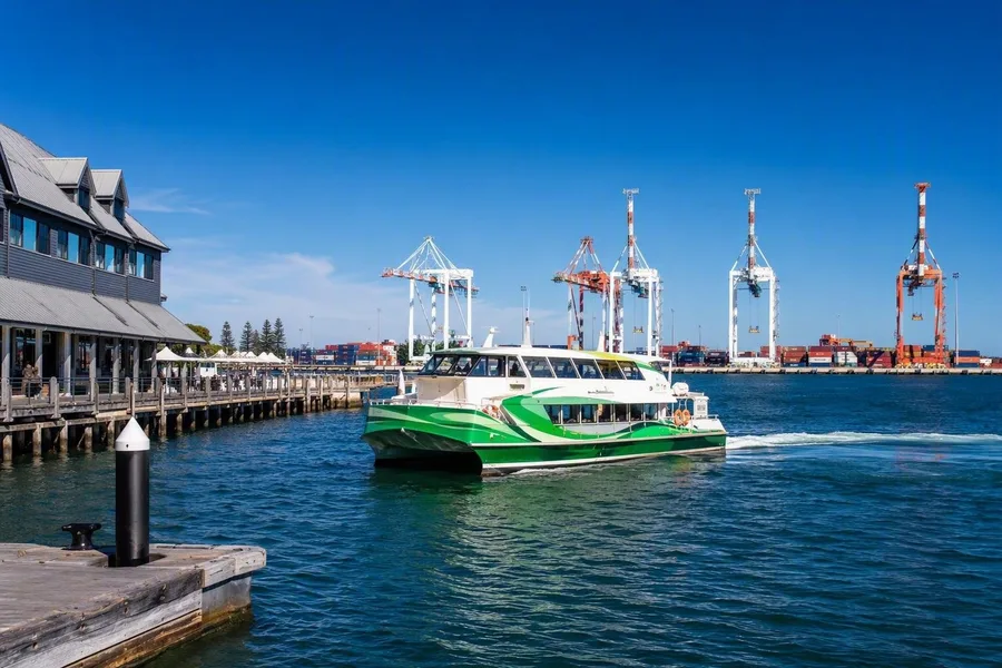 A ferry crosses the basin at Victoria Quay, with North Quay container cranes beyond.
C.Y. O’Connor began reshaping the Swan River mouth in 1892. Engineers built north and south moles, removed rock and dredged a protected basin; the Inner Harbour opened in 1897. Larger shipping businesses, customs services, importers, exporters, hotels and maritime trades then gathered around the harbour and the West End streets behind it.
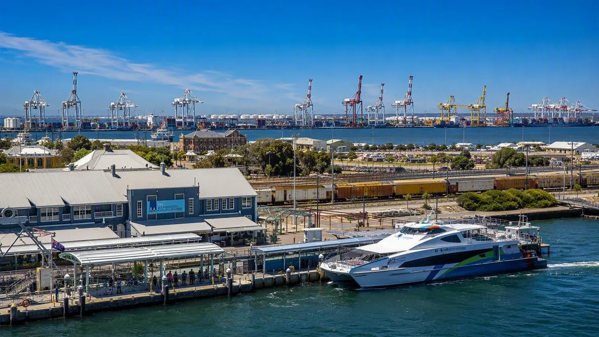
Victoria Quay has two distinct faces. Its western section is public waterfront, with the WA Maritime Museum, ferry facilities and heritage sheds. Its eastern berths remain an operational area with restricted public access. Ferries travel to Wadjemup, while tugboats, research vessels, naval ships, vehicle carriers, cruise ships and general-cargo vessels use different parts of the harbour.
Across the water on North Quay, cranes and container terminals handle almost all of Western Australia’s container trade. Freight continues by rail and road.
The public route reaches the water beside the museum, ferry landing and old transit sheds. Ferries cross the basin, rails run behind the quay, and container cranes rise across the harbour at North Quay.
Keep exploring