Drumheller: where Alberta’s dinosaur beds meet the badlands
Around Drumheller, the Red Deer River valley cuts through pale sandstone, dark shale and bare, fluted slopes. Those exposed beds preserve part of a Late Cretaceous coastal plain, where wetlands, forests and dinosaurs stood in place of today’s dry badlands.
A young valley through ancient beds
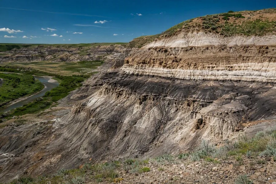 Eroded badlands ridges expose pale sandstone and dark shale in the Red Deer River valley near Drumheller.
The valley around Drumheller is much younger than the fossils in its walls. About 13,000 years ago, meltwater from the retreating Laurentide ice sheet cut rapidly into soft Late Cretaceous rocks. Rain, wind, frost-thaw cycles and the Red Deer River have continued to reshape the slopes.
Short, heavy downpours send water over clay-rich ground and cut new ribs, gullies and ravines. Shale, siltstone, mudstone and weakly cemented sandstone erode at different rates, producing the badlands' steep ridges and sharply carved faces.
Much of the rock near Drumheller belongs to the Horseshoe Canyon Formation, whose type section lies in the Red Deer River valley. The formation dates from about 73.1 to 68 million years ago and contains alternating beds of sandstone, siltstone, shale, mudstone, coal, ironstone nodules and bentonite, a clay formed from volcanic ash.
These layers record a shifting coastal plain beside the Bearpaw Sea. Rivers and deltas laid down sand. Quiet floodplains and ponds received fine mud, while peat swamps later became coal. Freshwater and brackish deposits sit side by side, and the older Bearpaw Formation below records an earlier marine phase.
Fine sediment could bury animal remains quickly, which helped preserve fossils. Later erosion cut into those beds and exposed them again. Bentonites contain zircons that researchers can date radiometrically, linking fossil-bearing layers to a more precise part of the Late Cretaceous.
The dry valley gives a false picture of the earlier landscape. Fossil evidence instead indicates a warm, wet lowland of rivers, ponds, marshes and forest, with a warm inland sea farther east.
The Royal Tyrrell Museum and the work behind the cases
The Royal Tyrrell Museum stands in Midland Provincial Park, beside the badlands that expose this geology. Its galleries show only 0.5 per cent of the collection at a time. The research collection holds more than 160,000 fossils and geological specimens, including more than 350 holotypes, the specimens used to define species.
That gap between gallery and collection matters. A fossil's position in a layer, its neighbouring material and its exact findspot help researchers date it and reconstruct the conditions in which it was buried.
In Cretaceous Alberta, four Albertosaurus stand in a dry riverbed scene based on research at Dry Island Buffalo Jump, where at least 12 Albertosaurus sarcophagus skeletons were found in one bonebed. The display rests on a documented concentration of bones in rock from more than 69 million years ago.
Dinosaur Hall gives a wider comparison, with mounts that include Triceratops, Camarasaurus and Tyrannosaurus rex. Not every animal comes from the Drumheller valley, but the hall places Alberta finds beside a broader range of dinosaur skeletons.
The Breakthroughs exhibition uses five exceptional fossils to investigate feeding, nesting and evolutionary relationships. Its Gorgosaurus libratus, found in Dinosaur Provincial Park, preserves the hind limbs of two young dinosaurs in its stomach area. It is the first known tyrannosaur specimen with prey remains preserved there.
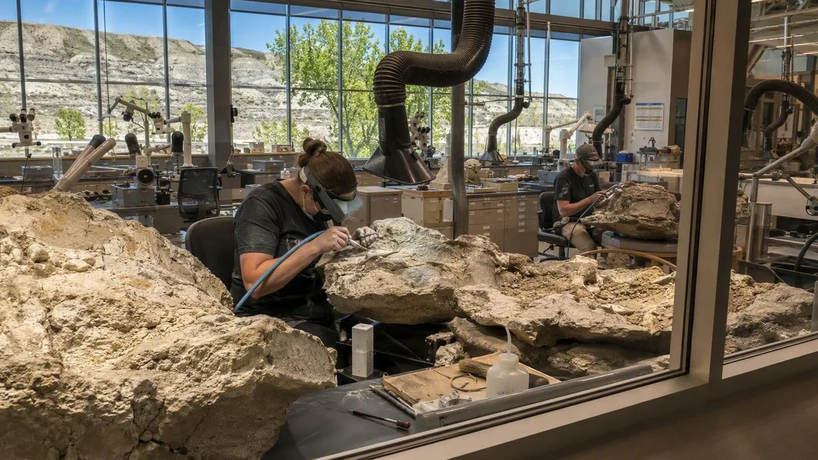
The Preparation Lab shows the slower work after a field discovery. Through its windows, visitors can watch technicians remove surrounding rock from Alberta fossils. Field teams record and collect material; museum staff then prepare and catalogue it for research or display.
The museum's Cretaceous Garden supplies what skeletons leave out. Living relatives of plants that grew in Alberta 75 to 66 million years ago, including dawn redwoods, grow beside the museum, while fossil wood points to a much wetter prehistoric setting than the modern valley.
Hadrosaurs, horned dinosaurs and tyrannosaurs lived in that landscape, along with fish, turtles and crocodile relatives in its waterways. Sandstone, mudstone and coal outside the museum provide the clues for rivers, quiet water and old swamps.
Midland's marked paths
The Badlands Interpretive Trail starts beside the museum and follows a marked 1.4-kilometre loop through Midland Provincial Park. It gives walkers close access to eroded ground without taking them over loose slopes and possible fossil sites.
Walking here is not collecting. Fossils are protected under Alberta's Historical Resources Act, and visitors may not remove them from provincial parks or other protected areas, even when a specimen lies loose on the surface. Excavation requires a palaeontological research permit.
When a possible fossil appears on a walk, photograph it, note the location, leave it in place and report it to the museum. The findspot gives the object much of its scientific value.
The Midland Coal Mine Interpretive Trail adds a later chapter to the same layered ground. It passes a former mine site and explains the valley's coal history, while the coal seams trace back to peat that accumulated in ancient wetlands.
For a flatter route, McMullen Island Day Use Area connects to the River Park trail system between Drumheller and the museum. Cottonwoods grow around the day-use area, and the paved route follows the valley rather than its crumbly side slopes.
Hoodoos and open canyon walls
East of Drumheller, the Hoodoos Trail at Willow Creek passes sandstone columns above dark-brown marine shale. A harder cap protects softer rock below it; rain, wind and frost-thaw action gradually cut away the unprotected sides.
The columns show the badlands' active erosion in a compact form. Their horizontal bands reveal successive deposits, while ultraviolet light, rain and frost weaken both cap and pillar.
The trail and stairs provide the close view. Stay on them and do not climb the hoodoos, whose soft sandstone breaks easily under feet.
West of town, Horseshoe Canyon opens a wider view across deeply eroded badlands. Existing routes descend from the rim into steeper, drier terrain, where the canyon floor has limited mobile reception and exposed ground can become hot.
Practical details
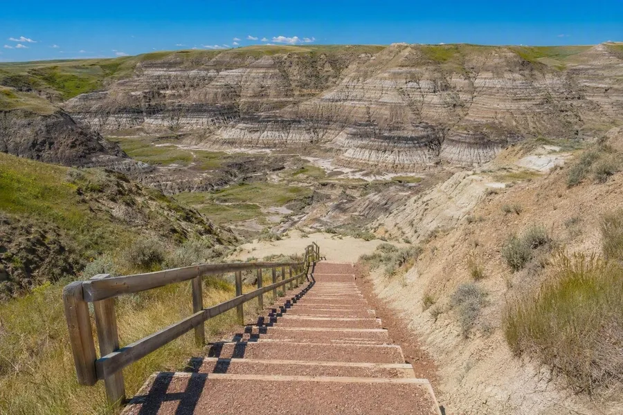 A stairway descends from the rim into Horseshoe Canyon west of Drumheller.
The Royal Tyrrell Museum opens daily from 9am to 9pm from May 15 to August 31, with final entry at 8pm. From September 1 to May 14, it opens Tuesday to Sunday, 10am to 5pm, with final entry at 4pm. Adult admission is CAD25, seniors pay CAD16 and youth pay CAD12; children aged six and under enter free but still need a ticket.
Timed museum tickets are available online, while door entry depends on remaining space. Guided hikes and hands-on programmes have separate tickets and seasonal schedules. The Badlands Interpretive Trail is free, and the Hoodoos Trail has no admission charge.
At Horseshoe Canyon, a stairway drops from the prairie rim to gravel, earth and exposed rock. Bare walls rise from the valley floor, and horizontal bands run across them: the same stacked record that holds Drumheller's fossil past.
Keep exploring