Down into the Frenchman River Valley
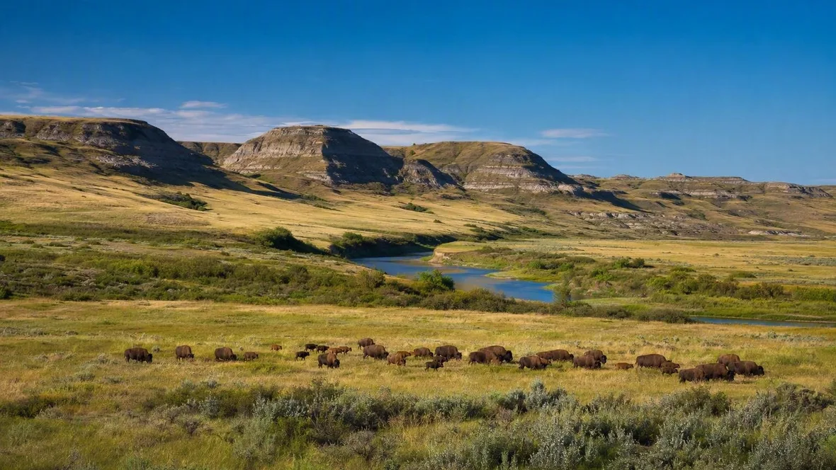
In the West Block of Grasslands National Park near Val Marie, the Frenchman River runs below dry uplands cut by coulees and buttes. Water shaped this corner of southern Saskatchewan, but grass, bison and a long human presence still define it.
Water beneath the grass
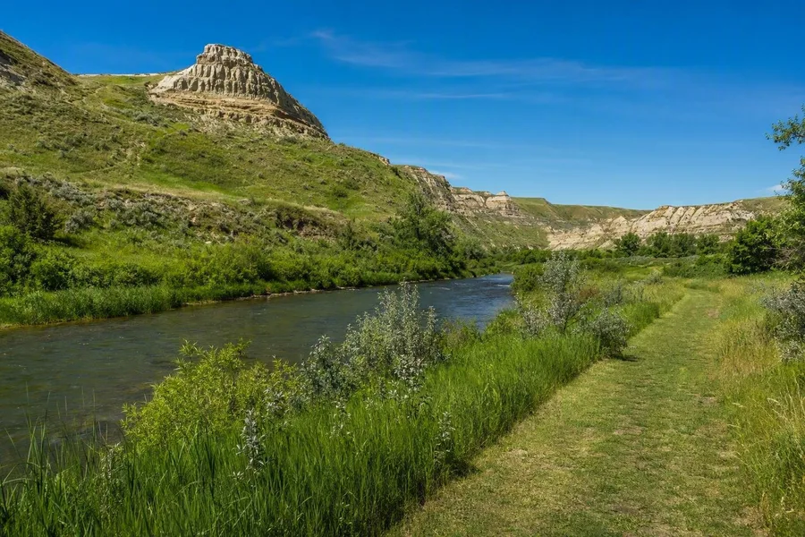 The Frenchman River runs beside the Riverwalk below coulees in Grasslands National Park.
The prairie around Val Marie looks broad from the road. Then the ground drops away. Coulees run down towards the Frenchman River, buttes stand above the valley, and smaller creeks follow channels cut into the soil.
Meltwater carved the main valley near the end of the last ice age, more than 10,000 years ago. Heavy runoff also cut the surrounding coulees and waterways, while the Frenchman River now flows south into the Missouri watershed. Those landforms show that this is not a level sea of grass. Water has cut and sorted the terrain as surely as wind has dried it.
Sparse rainfall keeps the uplands open. The river and the lower, more sheltered coulees hold more moisture, creating wetter habitat within a dry grassland. Cool-season and warm-season grasses share the higher ground, while sagebrush, greasewood and prickly pear grow in lower valley country.
This is mixed-grass prairie, not a single species repeated to the horizon. Blue grama was historically favoured by bison, while needle-and-thread grass carries sharp awns. Prickly pear opens its pores at night, an adaptation that limits water loss in a dry climate.
The 70 Mile Butte Trail gives the landforms a useful scale. Its short, steep sections and switchbacks rise above the Frenchman River valley. Lower down, the Riverwalk follows the river past bankside vegetation and small cliffs, where the valley floor carries a different cover from the exposed grassland above.
A grassland full of animals
The West Block holds pronghorn, greater sage-grouse, burrowing owls, prairie rattlesnakes, swift foxes and greater short-horned lizards. It also contains Canada’s last colonies of black-tailed prairie dogs. These animals belong to particular pieces of the prairie rather than to an undifferentiated open space.
The Top Dogtown Trail passes through a prairie dog colony. Prairie dogs keep vegetation short and create bare ground around their burrows; burrowing owls use this open habitat too. A burrow, cropped grass and a low owl point to the same dry-prairie system.
Season and heat change what is visible. Many animals seek shelter during the hottest part of the day, so sunrise and dusk generally offer better chances to see wildlife. In summer, small mammals, birds, frogs and butterflies add movement to the grassland. Rain can fill shallow bison wallows, creating temporary water for insects and plants that need moist soil.
A wallow begins with a bison rolling in dry soil. The animal leaves a shallow, bare depression, and rain or snowmelt can later collect there. That small patch of wet ground is one of the clearest signs that grazing animals alter the prairie beyond the grass they eat.
Bison on the move
Plains bison returned to Grasslands National Park in December 2005 after more than 120 years of absence. The first 71 animals came from Elk Island National Park, spent the winter in a holding pasture, and entered the larger bison area of the West Block in May 2006.
Their return brought back a large grazer that helps maintain varied prairie habitat. Bison crop some areas closely and leave other patches longer; McCown’s longspur uses short grass, while Sprague’s pipit favours taller, less intensively grazed ground. Moving bison also spread seeds, and their loose hair can provide nest material.
The herd does not stay near a fixed viewpoint. Bison select feeding areas according to forage, season and space, and research in the West Block found that females generally avoided roads when population density was low. The unpaved Ecotour Scenic Drive runs through the Frenchman River valley, past coulees, prairie dog colonies and the bison area. It gives drivers a way to look for animals and grazing patterns without following them across the grassland.
Wildlife watching here needs restraint. Keep at least 100 metres from bison, never approach or feed them, and leave them a clear route to move away. If bison stand on the road, stay in the vehicle, wait, and do not sound the horn or try to push them on. Head shaking, pawing, snorting, a raised tail or a short charge signal that a person has come too close. Back away calmly.
A lived-in prairie
People have lived in and travelled through this grassland for roughly 10,000 years. The A’aninin, Nakoda, Nehiyawak, Niitsitapi, Dakota and Lakota used the region seasonally, often moving in relation to bison herds. The Frenchman River valley and its coulees formed part of a working landscape of travel, hunting, camps and shelter.
More than 20,000 tipi rings remain in the park, alongside bison drive lanes, arrowheads and thousands of other archaeological sites. A low circle of stones marks where a temporary home stood. It records repeated family life, work and movement through the seasons, rather than a vague human presence at the edge of wilderness.
Coulees also provided shelter. After the Battle of Little Bighorn, Sitting Bull and his followers sought refuge in this region; they followed bison in summer and used wooded coulees and ravines for winter camps. Métis hunters pursued bison around places including Pinto Horse Buttes, and some Métis families later settled near Wood Mountain and Lac Pelletier.
For many Indigenous peoples of the Northern Plains, bison provided food, clothing, shelter, tools and trade materials, and held ceremonial and spiritual importance. Those cultural relationships continue. The bison herd in the West Block therefore belongs to more than an ecological recovery.
Leave stones, artefacts and other traces where they are. Cultural sites in the park are protected, and an object loses its meaning when it is taken from the ground and separated from its setting.
Access from Val Marie
Drivers reach the West Block from Val Marie via Highway 18 and an unpaved access road; the Ecotour Scenic Drive is unpaved as well. In 2026, the Val Marie Visitor Centre is open daily from May 1 to October 12, 9am to 5pm. Admission from September 8 is CAD 7.25 per adult, CAD 6.25 for seniors, or CAD 15 per vehicle for a family or group of up to seven; visitors aged 17 and under enter free. Frenchman Valley Campground beside the river has reservable powered sites and oTENTiks, with advance booking recommended.
The descent to the river
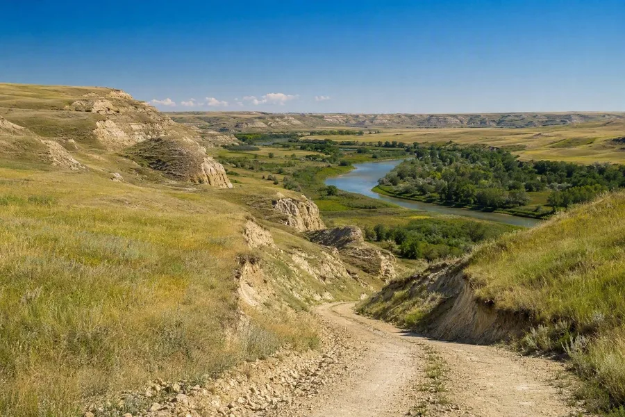 The unpaved Ecotour Scenic Drive descends through coulees toward the Frenchman River.
The Ecotour Scenic Drive follows the valley past coulees, buttes, prairie dog colonies, archaeological places and land later used for ranching. Near Two Trees, a trail crosses rolling upland grassland with views towards the Three Sisters Buttes. The Riverwalk then drops to a mown path beside the Frenchman River.
At the bottom of that descent, the view narrows between the valley slopes. Riverbank plants and small cliffs replace the broad upland horizon, while the Frenchman River runs through the strip of moisture that has long supported a denser, different life.
Keep exploring