Cycling Wadjemup, from Thomson Bay to the limestone coast
Thomson Bay provides the landing point for a day on Wadjemup/Rottnest Island: white sand, moored boats and a compact settlement sit beside the Main Jetty. From there, a bicycle reaches reef-ringed swimming coves, salt lakes, a lighthouse climb and the exposed western coast.
Thomson Bay: a harbour with a hard history
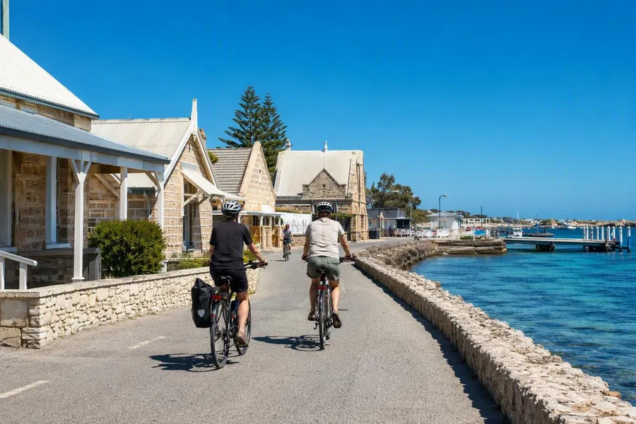 Helmeted cyclists leave Main Jetty beside Thomson Bay’s limestone buildings and sea wall.
Thomson Bay is the island’s harbour, village and cycling base. The Main Jetty stands beside the visitor centre, cafés, a swimming area and bicycle services, while roads and cycle paths run out from the settlement. It is an efficient place to get organised. It also repays attention before the first turn of the pedals.
Low limestone buildings line Vincent Way and the Sea Wall, a waterfront largely intact from the 1840s. Aboriginal prisoners provided most of the forced labour that built the roads, sea wall and limestone structures here. Those stone walls are not simply a picturesque backdrop to the harbour.
Wadjemup is the Noongar name for the island: “the place across the water where the spirits are.” It holds continuing spiritual importance for Whadjuk Noongar people. Before rising sea levels separated it from the mainland, Noongar people used this area for gathering, ceremony, hunting and trade.
From 1838 to 1931, colonial authorities used Wadjemup as a prison and later a forced-labour camp for Aboriginal people taken from across Western Australia. Many prisoners were leaders, Elders and knowledge holders, and their removal caused lasting harm to their communities. At least 373 prisoners died in custody and were buried at the Wadjemup Aboriginal Burial Ground, initially in unmarked graves.
The former mill and hay store now contains the Wadjemup Museum. Its Truth Telling Space holds a millstone once used by imprisoned Aboriginal men and boys to grind wheat. Nearby, the former cell complex known as the Quod and the burial ground are places of remembrance and Aboriginal-led truth-telling. The Quod remained tourist accommodation until 2018.
Practical: Ferries run to Main Jetty from Perth, North Fremantle, Fremantle and Hillarys; the Fremantle crossing takes about 25 minutes. Reserve the ferry in advance, and book a bike ahead for summer, weekends and school holidays. Admission to the reserve is included with a ferry booking. Bike hire on the island includes a helmet and lock; riders may also take their own bike if they add it to the ferry booking. Helmets are compulsory.
The Basin and the northern bays
The 4km Rotto Mini Loop gives a gentle first ride from Thomson Bay through bushland to The Basin, then along Longreach Bay and Geordie Bay. It suits a short day or a slow start, with swimming stops close together and no need to commit to the full circuit.
At The Basin, an eroded limestone reef forms a natural swimming bowl. The reef softens winds from the south, southeast and southwest, while shallow water covers white sand, seagrass and coral close to shore. The bay suits a swim or a first snorkel better than a session in open water.
Fay’s Bay feels tighter. Limestone outcrops hold a short strip of soft sand, and a shallow reef protects seagrass beds below the surface. Caves and channels in that reef make the bay suitable for beginner snorkellers. Longreach Bay has calm water and soft sand, while boats in Geordie Bay sit below the dunes.
After Geordie Bay, the loop turns inland past the golf course and salt lakes. A boardwalk skirts Garden Lake, and a short walk from the bike reaches Vlamingh Lookout. Winter rain refills the lakes before the route returns through bushland and wetlands towards Thomson Bay.
Quokkas are not photo props
Quokkas occur around the settlement, but sheltered scrub and tea-tree thickets show their ordinary habitat more clearly. These small wallabies rest in shade by day and tend to feed or move around in the early morning and late afternoon. Their familiar upturned mouths do not make them tame.
Quokkas are vulnerable wild animals, and Wadjemup holds the largest part of their population. Do not touch, feed or give them water. Human food can make animals ill, dependent or aggressive. If a quokka comes within two metres, step back, and keep food scraps and rubbish packed away.
Stay on roads and marked cycle paths, and ride carefully where quokkas or lizards cross the tarmac. Ospreys, cormorants, terns and wedge-tailed shearwaters use the coast, while shelducks and waders occur around wetlands and salt lakes.
The southern road and Wadjemup Hill
The longer southern route leaves the settlement past Kingstown Barracks and Bickley Battery, then follows the coast through Henrietta Rocks, Porpoise Bay and Parker Point. Henrietta Rocks has a shipwreck offshore. At Parker Point, an underwater trail uses information panels on the seabed, and Little Salmon Bay continues that underwater focus in shallow, protected water.
Little Salmon Bay lies within the Parker Point Marine Sanctuary Zone, where fishing is prohibited. Its limestone reef keeps the water relatively calm and accessible for snorkelling. This is a good place to stop before the road leaves the shore.
The steady climb to Wadjemup Hill forms the main physical effort on this side of the island. The lighthouse stands at the island’s highest point. Digby Drive then descends past reflective salt lakes and wetlands, where banded stilts, Australian shelducks and crested terns occur.
West End, then the long way back
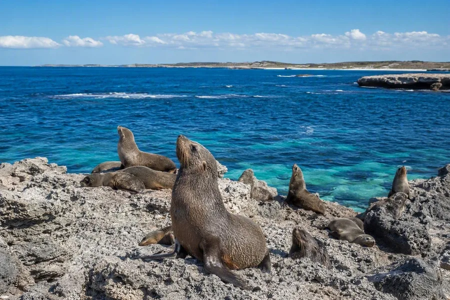 Long-nosed fur seals rest on the rocks below Cathedral Rocks viewing platform.
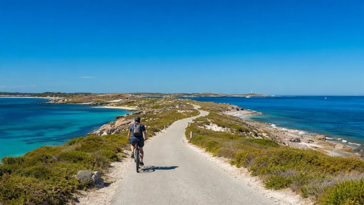
The complete Island Ride covers 22km. It includes winding roads, steep hills and some unsealed sections, so the distance asks more than its number suggests. From the southern coast, Narrow Neck carries the route west across a slim strip of land, with coast visible on both sides.
Rocky Bay marks a shift from small coves to a broader dune line, rock shelves and lagoons above coral reef. Its north-facing shore offers shelter from stronger winds. Farther west, Cathedral Rocks and Cape Vlamingh have viewing platforms over open water. Long-nosed fur seals regularly gather at Cathedral Rocks in winter, and humpback whales may pass in winter and spring. Watch seals and sea lions from the platforms; swimming with fur seals at Cathedral Rocks is prohibited.
The north-coast return passes Catherine Bay, Little Armstrong Bay and Parakeet Bay before it bends around the salt lakes towards Geordie Bay and Longreach Bay. At Rocky Bay, pale dunes meet the rolling limestone shelf. Clear blue lagoons lie beyond it, with coral reef under the surface.
Keep exploring