Across the Daintree River to Cape Tribulation
The ferry crosses Julaymba, the Daintree River, and lands beneath the forested Alexandra Range. From the northern bank, Cape Tribulation Road runs through rainforest to a coast where the Wet Tropics and the Great Barrier Reef sit side by side.
A vehicle ferry provides the only crossing into the northern Daintree. It carries drivers and foot passengers across the Daintree River, then sets the route on its way towards Cape Tribulation.
The crossing also takes place within Eastern Kuku Yalanji Country. Julaymba is the local name for the river, part of a cultural landscape that includes rainforest, mangroves, beaches and sea.
Cape Tribulation Road climbs almost as soon as it leaves the ferry. On the Alexandra Range, higher ground gives a view back towards the river mouth and Snapper Island before dense forest closes around the road again.
Over the Alexandra Range
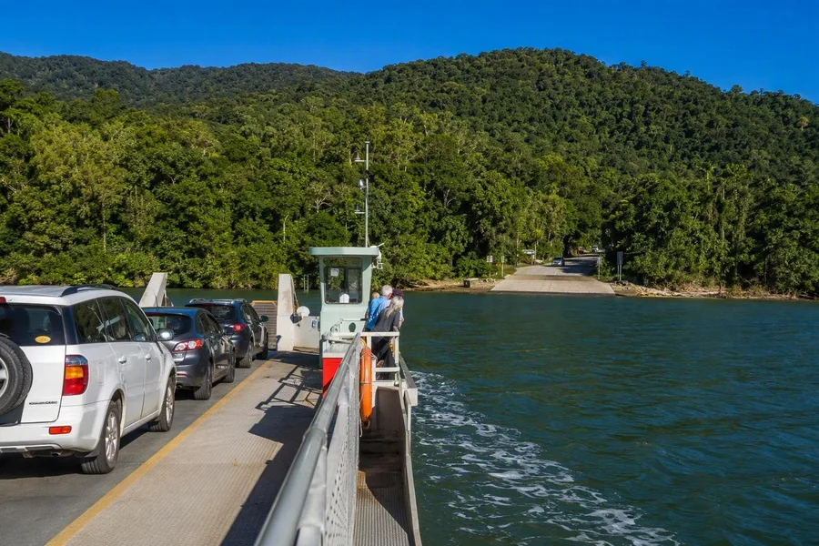 The Daintree Ferry carries vehicles and foot passengers across the Daintree River.
The coastal mountains help explain the thick cover of vegetation. Moist air from the Coral Sea rises against the steep ranges, bringing frequent rain that feeds the forest, rivers and creeks. Mountain rainforest, lowland forest and mangroves occupy a remarkably narrow strip of coast.
The forest has clear layers. Tall trees close over a darker understorey of climbing plants, ferns and epiphytes, while wet summits and deep valleys sheltered plants and animals during earlier dry periods. Many plant lineages in the wider Wet Tropics reach back to Gondwana, making this region an unusually complete living record of land-plant evolution.
A few plants show how restricted some habitats are. The understorey tree Noahdendron nicholasii grows beside only a few narrow creeks, while Idiospermum australiense, an ancient relict tree, grows in lowland forest near Cape Tribulation. Neither is a dependable sighting. Their small ranges say more about this forest than a checklist ever could.
At the foot of the range, Jindalba boardwalk passes through dense lowland rainforest. The path gives the canopy its proper scale: high above, the branches meet; below, the forest floor stays enclosed.
Cow Bay, scattered through the trees
Cow Bay lies about halfway between the Daintree River and Cape Tribulation. Its buildings stand scattered among trees rather than around a compact village centre, reflecting a past shaped by cattle farming, logging and grazing. Buchanan Creek Road turns towards the beach, while the wooded hills of the Alexandra Range remain visible from the main road.
Animals sometimes appear on roads and forest edges, but none can be counted on. Southern cassowaries occur in the area, and drivers should slow down and keep their distance if one appears. The large birds eat rainforest fruit and carry seeds over long distances, helping trees spread through the forest.
Orange-footed scrubfowl and Australian brush-turkeys are more often seen working through leaf litter. Scrubfowl build large incubation mounds from leaves, branches and soil. Bennett’s tree-kangaroo lives higher in the trees and remains an unlikely sight, while the smaller musky rat-kangaroo forages on the ground by day.
Eastern Kuku Yalanji seasonal knowledge connects plant changes with animals and food gathering. Flowering mat grass marks the season associated with scrubfowl eggs, while fruit on blue ginger indicates the time for brush-turkey.
Country reaches from bubu to jalun
Eastern Kuku Yalanji Country extends well beyond the forest beside the road. It runs from Mossman Valley towards the Upper Annan River and Black Mountain, west to the Great Dividing Range, and includes rivers, coast and sea. In Kuku Yalanji language, bama means people, bubu means land, and jalun or jalan means sea.
Kulki is the Yalanji name for Cape Tribulation. Mountains, waterways and coastal places can carry cultural or spiritual significance, and only the appropriate people may speak for or approach some places. For the Eastern Kuku Yalanji, Country includes living responsibilities to land and sea, connected with Ngujakura, the time of the creating ancestors.
In 2021, Daintree National Park and three other parks returned to the Eastern Kuku Yalanji as Cape York Peninsula Aboriginal Land. The Eastern Kuku Yalanji and the Queensland government now jointly manage Daintree National Park. At Cape Tribulation, the Jabalbina-owned Bamanga Muruku Tourism Hub and Yalada Tours offer a local way to learn about rainforest and reef through an Eastern Kuku Yalanji perspective.
Creeks, mangroves and Myall Beach
North of Cow Bay, the mountains press closer to the coast. Steep, forested slopes rise behind creek valleys, rocky headlands and long sandy beaches, with one of Australia’s last large continuous areas of lowland rainforest lying between the road and the hills.
Madja boardwalk makes one ecological shift easy to read. It passes from dense lowland rainforest to a creek edged by mangroves, carrying the path above soft tidal ground. Mangroves grow along the brackish margin between freshwater forest and coast, and the Wet Tropics supports an unusually rich mangrove community.
Farther north, Dubuji boardwalk crosses a spring-fed creek, runs through mangrove swamp and reaches sandy ground beside Myall Beach. Rainforest, wetland and beach follow one another here without the cleared land that separates them along many developed coasts.
Practical details: The Daintree River Ferry runs daily from 5am to midnight. Tickets are available online or at the crossing by card or cash; school holidays can bring queues, and river and tidal conditions can affect the service. The sealed road to Cape Tribulation is suitable for ordinary cars. A four-wheel-drive vehicle is only needed for travel farther north on the Bloomfield Track. National park campsites require an advance permit.
Kulki at the Coral Sea
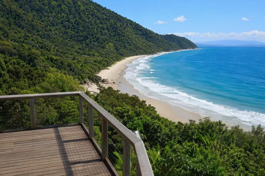 The Kulki boardwalk platform overlooks Cape Tribulation’s sandy beach, rocky headlands and rainforest slopes.
Cape Tribulation occupies a narrow coast between the steep McDowall Range and the Coral Sea. Rainforest covers the slopes behind the beaches, while creeks carry water through the lowlands to mangroves and the sea.
The reef does not begin at the sand. Fringing reefs lie offshore and are particularly well developed along the coast between the Daintree and Bloomfield rivers. The Wet Tropics World Heritage Area reaches the shore, while the Great Barrier Reef World Heritage Area continues into the water, placing two major ecosystems almost side by side.
Mangroves and seagrass beds fill some of the shallows between forest and reef. Dugongs feed on those seagrass beds. Turtles, dolphins, dugongs and whales may sometimes be visible offshore from Kulki, although none is assured.
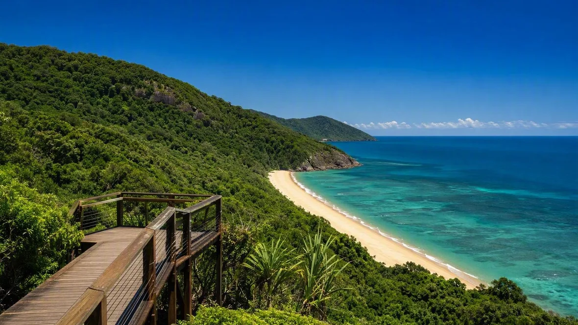
The 600-metre Kulki boardwalk ends at a platform above a long sandy beach framed by rocky headlands. Behind it, steep rainforest slopes descend to the shore. Beyond the bright strip of sand, the Coral Sea carries across the coastal reefs.
Keep exploring