Where the Bay of Fundy Empties Beneath Your Feet
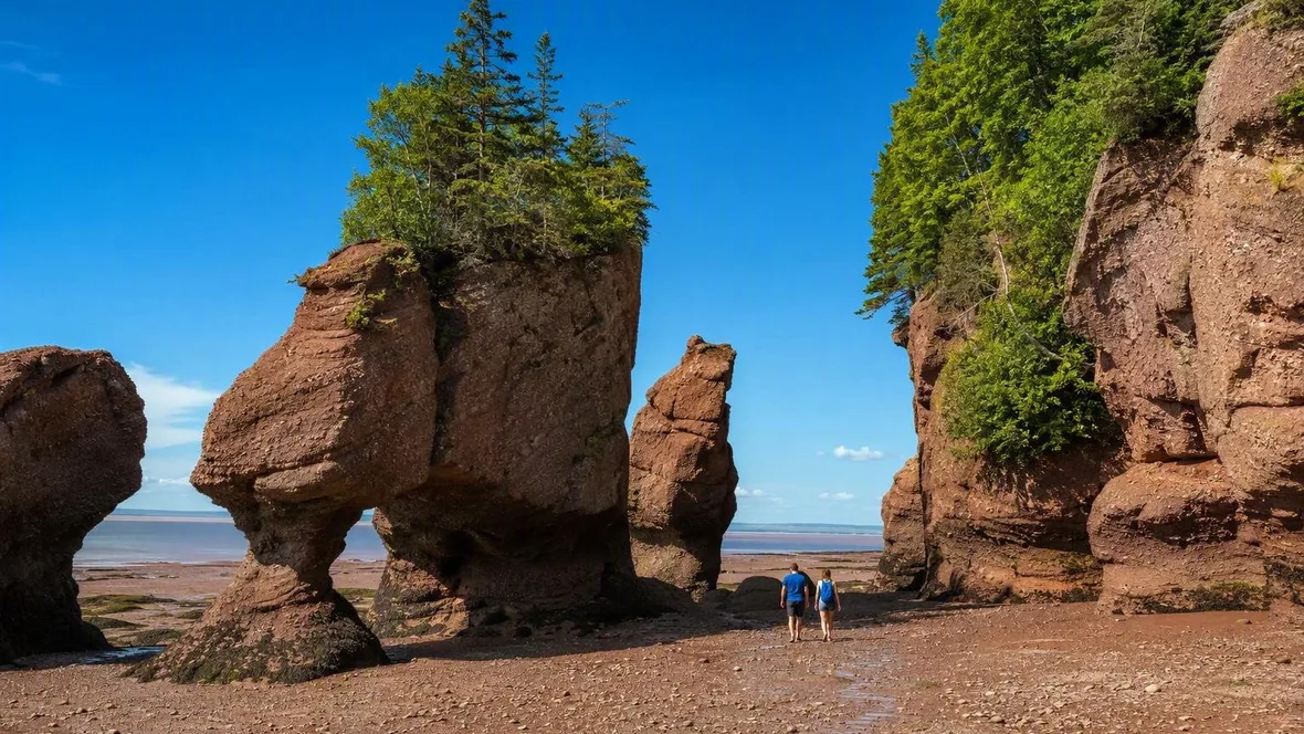
At low tide, visitors walk across the seabed beneath the red-brown pillars of Hopewell Rocks. Roughly six hours later, seawater covers that ground and surrounds the same formations.
A seabed beneath the flowerpots
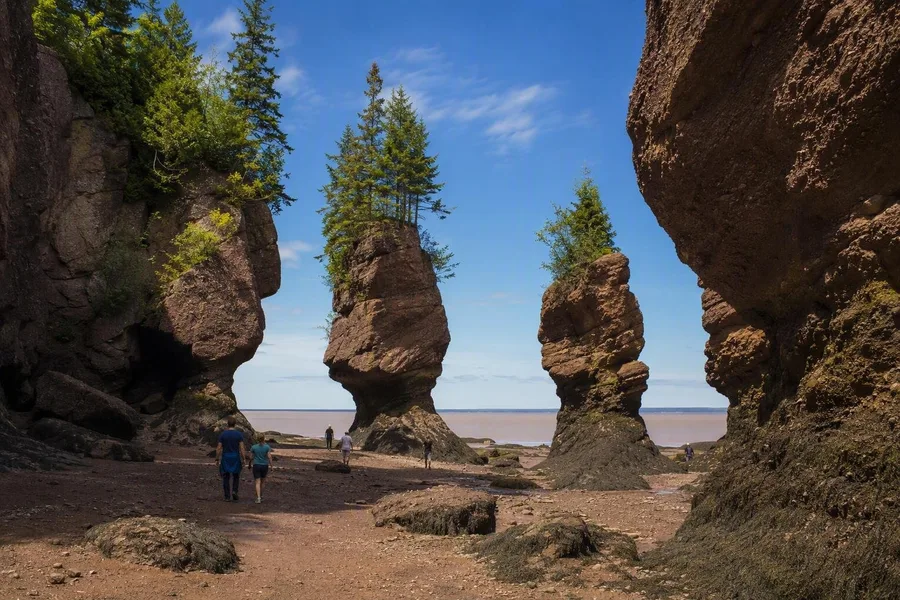 Visitors walk between exposed sea stacks at low tide in Hopewell Rocks Provincial Park.
Hopewell Rocks lies on the New Brunswick shore of the Bay of Fundy, where the usual difference between low and high water reaches roughly 10 to 12 metres. The beach below the park’s cliffs shows that change in direct, physical terms.
At low tide, stairs lead down to an exposed coastal floor. Visitors can walk between the sea stacks, follow the inlets beside them and examine their narrow bases from ground level. Red-brown rock rises on either side. Some isolated pillars still carry vegetation on top, which gives them the familiar outline of tall flowerpots.
High tide removes the walking space. Water covers the seabed and the bases of the formations, while paths and viewpoints above the shore provide the view. Rock that appeared connected to a broad coastal floor at low tide now stands as a separate stack in the water.
The contrast does not depend on a distant view or a number on a tide chart. The ground beneath the pillars becomes water within about six hours.
Why so much water moves through Fundy
The Bay of Fundy forms a long, narrowing basin. Toward its inland end, the bay also becomes shallower, so the incoming Atlantic water occupies less room and rises higher along the coast.
A second process amplifies the rise. Water in the bay has a natural back-and-forth rhythm of about 13 hours, while the Atlantic tide enters on a cycle of about 12 hours and 25 minutes. Each arriving tide adds force to water already moving in the bay, rather than cancelling that motion.
Together, those conditions make Fundy a natural resonant basin. At Hopewell Rocks, they turn one stretch of shore into a place that alternates between a walkable coastal floor and water around the stacks.
The moon and sun alter the range further. Around new moon and full moon, their tidal forces reinforce each other, producing spring tides; at Hopewell Rocks, the difference between low and high water can then reach about 13 metres or more. The most extreme ranges occur farther inland in the bay, where spring tides can combine with a moon passing close to Earth to produce differences of around 16 metres.
The tide’s return remains visible at the rocks. Water spreads over the exposed floor, reaches the undercut bases and fills the gaps between the pillars. When it falls, the same gaps open again and the lower rock reappears.
Red rock shaped into stacks
The Hopewell Rocks consist of red-brown sedimentary rock from the Carboniferous period: conglomerate, sandstone and mudstone. Long before the present coast took shape, rivers carried pebbles, gravel, sand and silt from the Caledonia Highlands. Those sediments accumulated in layers and hardened into rock.
Conglomerate gives parts of the cliffs their rough, mixed surface. It holds rounded stones and gravel in a finer matrix of sand and silt. Sandstone and mudstone sit beside it in the layered rock, and they do not all resist water equally well.
Later tectonic movement tilted the original layers by about 30 to 45 degrees and opened vertical cracks. Rain, frost and snowmelt worked down through those weaknesses from above. After the last ice sheet retreated, Fundy’s tides began attacking the exposed cliffs at their base.
That work comes from both directions. Water and ice widen the cracks from above, while tides wear most quickly into porous sandstone and other softer material along the shore. More resistant conglomerate can remain above the eroded lower layers. Recesses become sea caves, blocks detach from the main cliff, and isolated pillars remain.
The flowerpot form records this unequal erosion. The lower rock erodes faster than the broader cap, leaving a narrow stem beneath a heavier top. Vegetation on some surviving tops makes the shape even clearer. These are temporary structures on a changing coast: erosion forms new stacks and eventually brings older ones down.
Low tide puts the process close to ground level. Cavities, tilted beds and narrowed bases appear above the exposed floor. At high tide, water hides those lower details and isolates the wider tops as separate forms.
Planning around the water
For the 2026 season, Hopewell Rocks Provincial Park is open from 15 May to 25 October. Hours run from 09:00–17:00 in the earlier and later parts of the season, 08:00–20:00 from 21 June to 29 August, and 08:00–18:00 from 30 August to 26 September. Adult admission costs C$18.15 before tax; tickets for seniors and eligible students cost C$15.56, tickets for ages five to 18 cost C$10.37, and children four and under enter free.
A standard admission ticket is valid on the day of activation and the following day, within opening hours. That makes a low-tide visit one day and a high-tide return the next a practical option. Tide times change daily, so use the park’s date-specific tide calendar and make sure both phases fall within the day’s opening hours. Ordinary day admission has no published advance-reservation requirement; camping and group visits have separate arrangements.
Walk on the seabed only during the permitted low-tide period and stay on designated routes. Leave when staff close a stairway or shore section; the incoming tide rises quickly. Wet, uneven rock calls for shoes with good grip. The park is closed outside opening hours, and swimming or launching private kayaks, canoes or paddleboards from the grounds is not permitted.
When the walking ground disappears
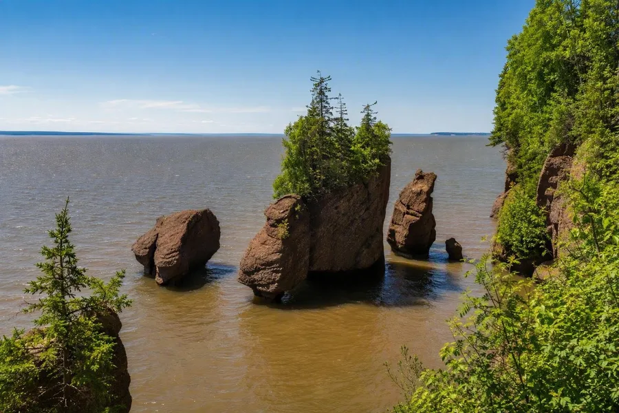 Floodwater surrounds the red-brown sea stacks at Hopewell Rocks, hiding the former walking ground.
At low tide, the cliff, stacks and exposed floor read as parts of one eroded coast. Visitors can stand beside the undercut rock and see the slim base below the wider cap.
Then the usable ground contracts. Seawater reaches the outer pillars, fills the inlets and covers the passages between them. From above, the red-brown stacks remain, their planted tops rising over the floodwater as it closes around their bases.
Keep exploring