Twelve Minutes Across the Saint Lawrence
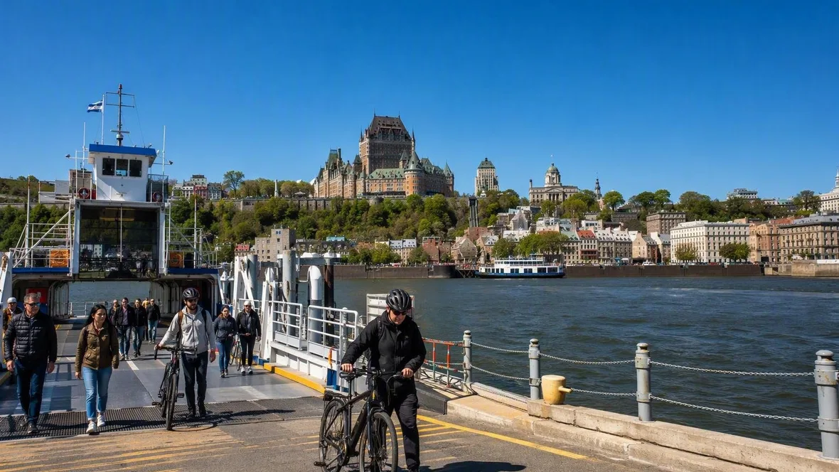
At Québec City, cars queue below the old town while pedestrians and cyclists take the separate route to a ferry across the Saint Lawrence. Twelve minutes later, the ramp drops at Lévis, with Québec’s lower town, cliff and upper city spread across the water behind it.
Beneath the old city
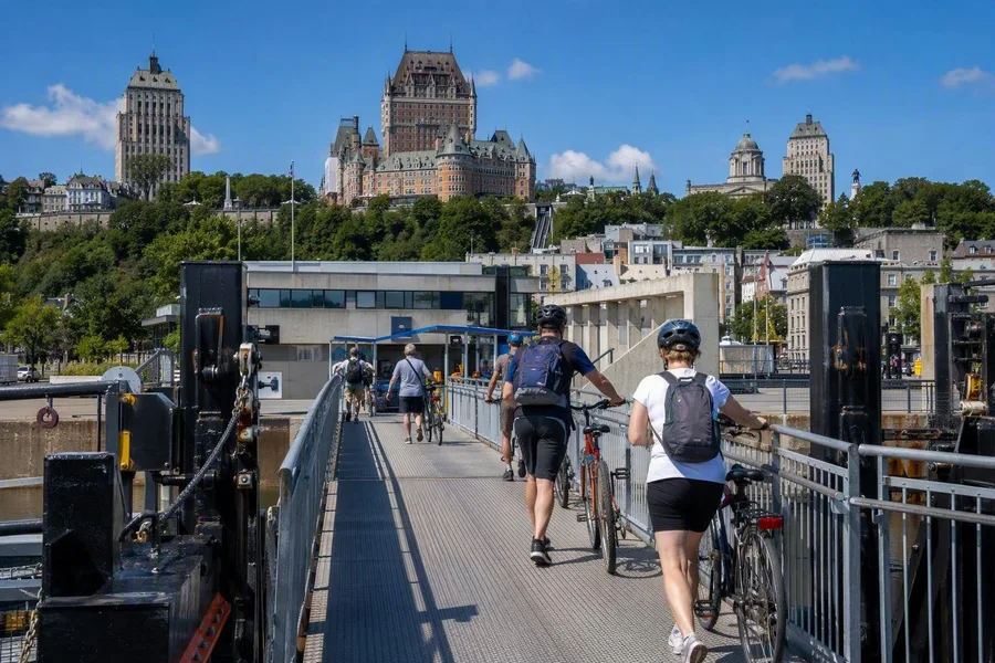 Pedestrians and cyclists board the ferry at Québec’s riverside terminal below the old city.
Québec’s ferry terminal stands at the river’s edge in Vieux-Québec, down in the lower town and below the heights of Cap-Diamant. Built in 1975, the low concrete building carries Brutalist touches that make a blunt, useful contrast with the stone, brick and steep roofs above.
The terminal sits in the Vieux-Port rather than on a sealed-off tourist pier. Restored customs buildings and warehouses show the scale of the old commercial harbour; promenades, a marina and public spaces now bring walkers and cyclists to the water as well. In warm weather, cruise ships, event visitors and people heading for the ferry share this compact stretch of quay.
Boarding has its own plain choreography. Pedestrians use their own route, cyclists walk their bikes over the ramp, and drivers wait for a green signal before crew direct them onto the vehicle deck. The ferry carries walkers, cyclists and motorists, and its half-hourly service links with bus networks on both shores. That is why the crowd at the terminal has the purposeful look of a connection being made, not just an outing being begun.
This routine grew from a much rougher crossing. During the French period, people hired boats and canoes when they needed them; by about 1800, specialist ferrymen made the passage in bark and larger wooden canoes. A steam ferry arrived in 1818, and horse-powered paddle boats later took passengers, goods and horse-drawn vehicles across the river. When the railway reached Lévis in 1854, ferry sailings began to meet trains. Fixed departure times followed in the 1860s.
Québec takes shape from the water
The boat leaves the Québec quay, and the lower town first holds the frame. Harbour buildings and the streets around Petit-Champlain sit close to the Saint Lawrence. As water opens between ferry and shore, the city’s construction in layers becomes clear.
Basse-Ville occupies the narrow strip beside the river. Cap-Diamant rises behind it, carrying Haute-Ville, the fortifications and Château Frontenac. Québec first grew along the waterfront as a residential and trading district, while religious and administrative institutions took the higher ground. The ferry shows the result without requiring a diagram.
The fortifications run for 4.6 kilometres around Haute-Ville and follow the steep terrain. From mid-river, wall, Citadel, cliff and hotel sit one above another. Château Frontenac is the conspicuous landmark, naturally. The more useful sight is the full slope beneath it, which explains why the city never reads as a flat waterfront skyline.
The Saint Lawrence keeps the crossing honest. Tides, river discharge, the riverbed and strong winds all affect surface currents here. Summer wind can cut across the open deck, while evening lights break into shifting lines on the waves. This is public transport, but it is still a river passage.
About 1.5 million passengers use the service in an average year, alongside roughly 300,000 vehicles and 100,000 bicycles. Before docking, passengers clear the stair areas; once the crew opens the way ashore, the groups separate again towards buses, streets and workplaces. The Frontenac may rank among Canada’s great hotel silhouettes. It also hangs over a perfectly ordinary trip across town, which is rather better than seeing it only from a postcard rack.
The Lévis quay and its steep back street
Lévis reverses the arrangement. The terminal and Quai Paquet sit low on the south bank, while Vieux-Lévis climbs quickly behind them towards a plateau. Across the river, Québec comes into one broad side view: lower town at the waterline, the cliff above, then the upper city.
The Lévis terminal uses wood and glass rather than Québec’s concrete. Its upper-level waiting room faces the river, and the angular roof recalls ice floes; outdoor seating above the landing works leaves the opposite shore visible while people wait. It is a transport building that happens to provide a very good belvedere.
Next door, Quai Paquet occupies a former working quay. The open paved space, promenade and fountain draw walkers, cyclists and picnickers during summer; 169 jets can rise to nine metres, with lighting after dark. Farther along the Lévis shore, the Davie shipyard site retains low brick buildings, a marine railway running to the water and a floating dry dock. Those working structures suit a riverbank that long handled transport and industry.
The steep shore shaped the town above it. Fishing, transport, tanneries and later industrial activity used the less farmable riverside, while the urban core developed on the higher ground of what is now Vieux-Lévis. The Côte des Bûches connects the ferry sector to that plateau with almost 140 steps and rest points; heating keeps the stairway usable in winter. The flat quay ends, and the climb begins.
Open water, broken ice
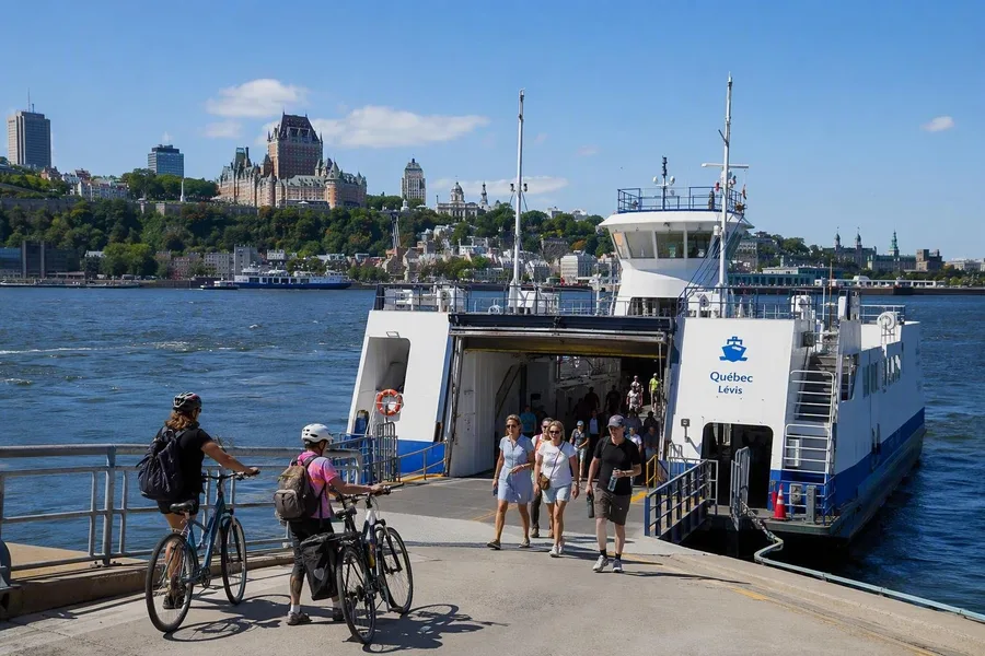 Passengers and cyclists disembark from the ferry at Quai Paquet in Lévis.
Summer gives both waterfronts their busiest public life. Québec’s promenades and marina fill with people, bicycles reach the ramps, and cruise ships add another scale to the harbour. At Lévis, the fountain and broad pavement at Quai Paquet turn the arrival area into a place where people linger beside the water. Autumn changes the trees around the city profile and keeps ship traffic visible along the port.
Winter changes the river more sharply. The Saint Lawrence does not become a reliable white road between the cities. Icebreakers and vessels keep a channel open through moving ice, leaving fractured bands and ridges that fresh snow can partly hide. Ice blocks can knock together audibly around the ferry.
Before efficient icebreaking, a marked ice bridge sometimes carried pedestrians and horse-drawn sleighs between Québec and Lévis. Between 1620 and 1910, it formed in fewer than one winter in three, so it was never a dependable annual route. More powerful icebreakers and purpose-built winter ferries established a continuous water connection from 1910.
Light changes the same crossing again. Around the winter solstice, Québec receives about 8 hours and 35 minutes of daylight, compared with about 15 hours and 55 minutes near the summer solstice. The midday sun reaches only about 19.6 degrees above the horizon in December, against 66.5 degrees in June. Low winter light separates quay, cliff and upper town in hard bands; summer holds the panorama in higher light for much longer.
Practical: The crossing takes 12 minutes. Adult pedestrians and cyclists pay CAD 4.25 one way; tickets are sold at the terminals, reservations are not available, and the service is designated accessible. Ferries run daily, generally every 30 minutes by day, but check the live timetable before travel because departures can change.
At Lévis, the ferry settles against the landing and the ramp meets the quay. Pedestrians step towards the waterfront, cyclists roll ashore and cars wait for the crew’s signal. Across open water or broken ice, Québec remains in view from riverfront to cliff.
Keep exploring