
Beyond the Twelve Apostles: west along the Shipwreck Coast
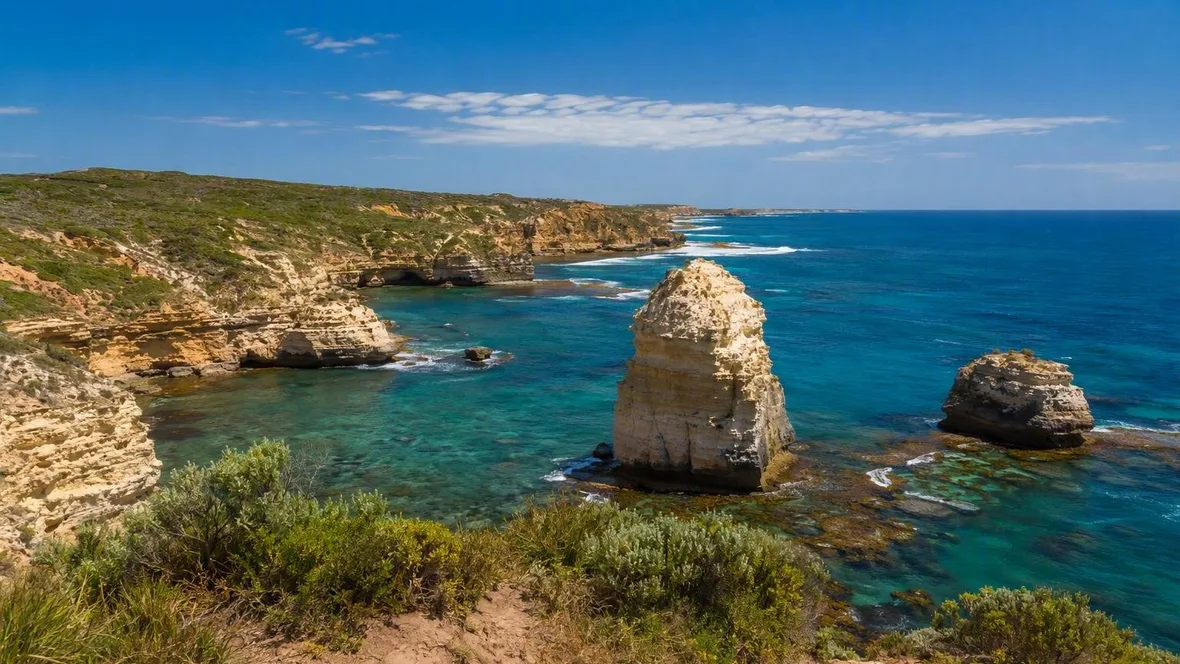
West of the Twelve Apostles, the Great Ocean Road follows limestone coves and scattered sea stacks through Port Campbell and Peterborough, then reaches the wider coast around Warrnambool and the working river harbour at Port Fairy.
The coast after the Apostles
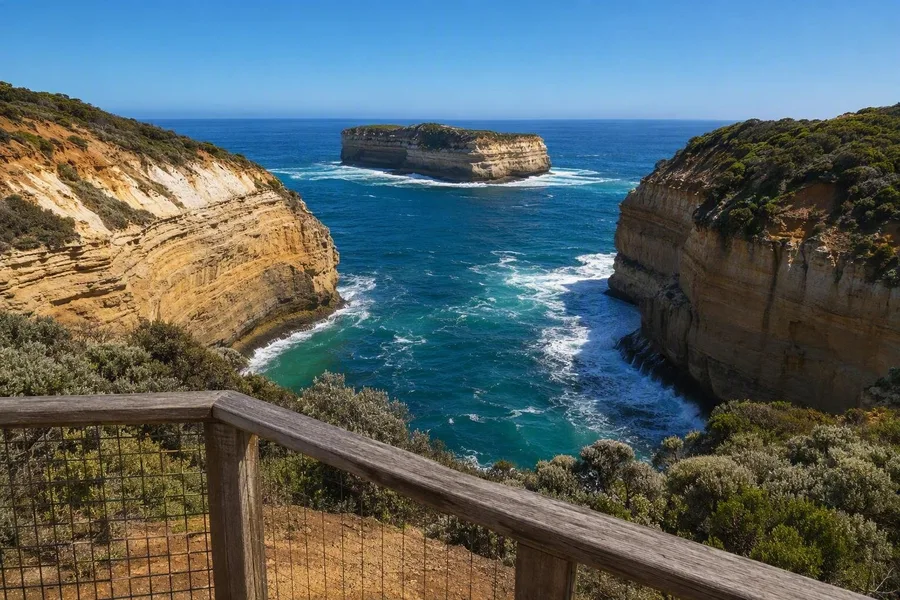 A clifftop overlook frames Loch Ard Gorge and Mutton Bird Island on the Shipwreck Coast.
The Twelve Apostles are not the end of the geology. West of them, the Southern Ocean continues to cut caves, arches, pillars and small bays from brittle limestone.
Dark Gellibrand Marl sits beneath the yellow Port Campbell Limestone along this coast. Horizontal bands in the cliff faces mark old seabeds, while the slight tilt of the layers and small faults show later uplift and compression. After the last ice age, rising seas exposed the rock to waves, wind and rainwater. Water widened cracks into caves and tunnels; some tunnels became arches, and collapsed arches left stacks standing offshore.
That erosion continues. Marked paths and viewing platforms keep people back from cliff edges that can fail without warning, and they give a clear view of the striped stone and the breaks opening through it.
Before Port Campbell, Loch Ard Gorge brings the geology and the coast's maritime history together in one narrow inlet. The iron clipper Loch Ard struck Mutton Bird Island in mist in 1878. Of the 54 people aboard, only the teenagers Tom Pearce and Eva Carmichael survived, reaching the sheltered beach inside the gorge. The Shipwreck Walk leads towards the cemetery, while the clifftop overlooks face Mutton Bird Island and the wreck site below the water.
The name Shipwreck Coast is plain but earned. Wind, waves, reefs and difficult headlands made this exposed shore dangerous for ships approaching Victoria.
Port Campbell's useful bay
Port Campbell occupies one of the few workable landing places on this stretch of coast. The town took shape in the late 1870s, when its sheltered inlet supported a pier and nearby wrecks made rescue equipment a practical necessity.
The jetty still has a working role. A crane lowers local fishing boats into the bay, while anglers use the same weathered structure. The old rocket shed stands nearby; rescuers once fired lines from this kind of equipment to stranded ships. Port Campbell's visitor centre displays a model of the Loch Ard and a kedging anchor from the wreck.
Shops and places to eat sit directly behind the foreshore, where wider pavements and outdoor seating now connect the main street with the bay. Port Campbell works as a compact service town as well as a stop between coastal lookouts.
West of the bay, London Arch records a change within living memory. It was once part of a double arch, until the span nearest the mainland collapsed in 1990 and left the outer section isolated. At The Grotto, a sinkhole, cave opening and rock pools show an earlier stage of the same erosion.
Peterborough at a smaller scale
Peterborough has a general store, pub, caravan park and working fishery rather than Port Campbell's larger visitor trade. Sandstone headlands soften some of the open swell on the village's southern side, creating a sheltered cove beside the coast.
The cliffs remain close. From the golf course area, the Peterborough Walk follows the coast past Worm Bay towards Halladale Point. Parts of the route are narrow and uneven, with steps down towards small bays. Coastal heath, gravel paths, broken inlets and offshore stacks replace the concentrated view at the Apostles.
Halladale Point takes its name from another wreck. Mist made the land appear farther away to the crew of the four-masted Falls of Halladale, which ran ashore here in 1908. All 29 crew members escaped in boats and rowed towards Bay of Islands. The remains lie offshore, so the clifftop path looks over the bay and wreck location rather than a hull above water.
Historic Shipwreck Trail markers in and around Peterborough add names and dates to the coast. Most wreckage now lies underwater; the coves, paths and headlands give the clearer account above the surface.
Bay of Islands Coastal Park
Bay of Martyrs and Bay of Islands form one coastal park, but each shows the limestone differently. Bay of Martyrs has a sandy inlet beneath high cliffs and stacks. Bay of Islands opens onto scattered pillars and sheltered coves spread along the shore.
The view here is less a single landmark than a sequence of broken headlands, small beaches and detached rock. The sea has cut around weak points in the limestone, leaving stacks and bays between the remaining sections of cliff. Short clifftop paths provide the useful way to see this stretch. The beaches are unpatrolled, and hooded plovers nest in the dunes, so the marked tracks and overlooks keep feet off sensitive ground.
Southern right whales are regularly recorded off Peterborough from May to October, although a sighting always depends on the season and the day. The fixed feature is the pale, layered limestone above the moving water.
Practicalities in one place
Follow the B100 west from the Twelve Apostles through Port Campbell, Peterborough and Bay of Islands to Warrnambool, then continue to Port Fairy. Port Campbell is 12 kilometres west of the Apostles, and Warrnambool lies about 50 kilometres from the Peterborough area. The principal lookouts and clifftop paths are free to access and need no reservation. Park camping is not permitted, so overnight stays belong in the coastal towns. Conditions can affect paths near unstable cliffs; use marked tracks and stay behind barriers.
Warrnambool changes the ground
Around Warrnambool, limestone cliffs no longer define every stop. At the Merri River mouth, sand, reef and rock platforms meet the water. At low tide, pools appear among algae-covered stone and sea snails cling to the rock against the waves.
Warrnambool also holds a tangible link to the eastern coast. Flagstaff Hill displays the glazed Minton peacock recovered from the Loch Ard cargo. The object makes the shipwreck history physical without pretending that the wreck itself sits on shore.
Beyond the city, Mills Reef marks a sharp change in material. Black basalt outcrops replace pale limestone, with dunes and wetlands extending towards Port Fairy. Hooded plovers breed around this shore, and fenced areas protect nesting ground.
Port Fairy's working river
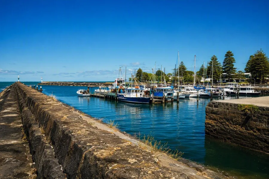 Fishing boats and pleasure craft share moorings at Port Fairy’s Moyne River mouth.
Port Fairy grew around the sheltered mouth of the Moyne River. Commercial fishing boats, yachts and recreational craft share the moorings, while ramps, a slipway and a fish-cleaning area keep the waterfront in daily use.
The harbour carries much of the town's earlier history. Whaling began on Griffiths Island in the 1830s; the island later served as a shipyard and lighthouse site. Along the Moyne, wooden jetties stand near early houses, hotels and trading buildings, many built in local limestone. The former lifeboat station retains its original rowing lifeboat and associated buildings.
At the river mouth, bluestone training walls run towards the open sea. Behind them, fishing boats and pleasure craft lie in the protected Moyne marina, beyond the exposed limestone coast to the east.