
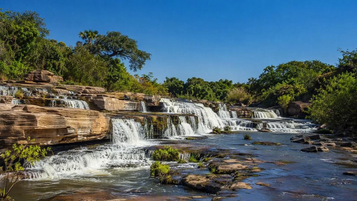
Banfora’s rock, water and rice fields
Northwest of Banfora, the Comoé drops over sandstone ledges at the Cascades de Karfiguéla before water enters the cultivated plain below. A short local connection leads on to Fabédougou, where layered sandstone domes rise above the same farmed country.
Banfora is the urban starting point for this small stretch of southwestern Burkina Faso. Karfiguéla lies roughly 10 to 12 kilometres northwest of the city, and the Dômes de Fabédougou stand near the village of Fabédougou, about 15 kilometres from Banfora. The three places sit close together, but they show different parts of one landscape: a river crossing rock, flat ground that holds and receives water, and sandstone that has resisted erosion.
The local route runs from Banfora towards Karfiguéla, then follows a nearby piste towards Fabédougou. Sugar-cane fields appear along this rural corridor, while the lower, wetter ground around Karfiguéla carries irrigated plots and rice.
Leaving Banfora for the cultivated plain
The land beyond Banfora does not split neatly between farms and sights. The Comoé feeds the falls, but farmers also divert its water into the Karfiguéla plain through an intake and a gravity-fed network of concrete channels. Smaller earthen channels take water from those main lines into individual fields.
The plain sits on alluvial deposits of fine sand, silt and clay, with some gravel. Beneath it, shallow groundwater lies in layers of sand, gravel and clay. That ground produces a visible patchwork rather than one continuous crop. Lower loam and clay soils hold water for flooded rice plots, while lighter strips support maize, okra, beans, sorrel, peppers and bananas alongside rice.
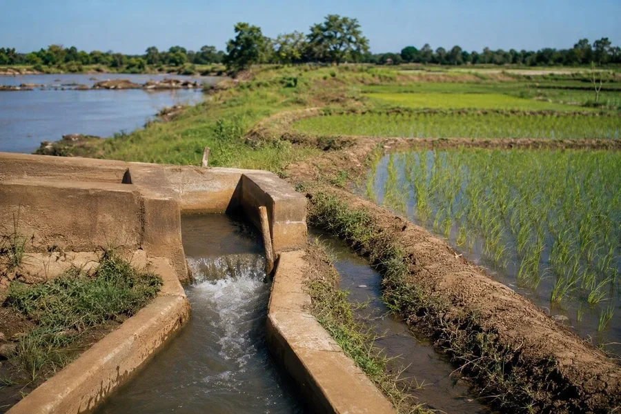 Irrigation channels carry Comoé water into rice fields near Karfiguéla.
People from Karfiguéla, Banfora and nearby villages work these fields. They clear weeds from channels, reopen small earth branches and share out available water between plots. Vegetable growers lead water through short furrows, and some farmers cut riverside grass for livestock. The falls and the fields therefore occupy the same daily ground.
Rain changes the work as well as the colour of the plain. Banfora receives most of its rain from about May to October, with August the wettest period; November to March is much drier. During the rains, rice fills the fields and the channels must carry away surplus water as well as supply crops. Silted or damaged sections can leave one plot waterlogged while another receives too little. In the dry season, farmers rotate cultivation because the irrigation system cannot water every part of the plain at once.
The Comoé at Karfiguéla
The Cascades de Karfiguéla are also known as the Cascades de Banfora; maps often use the spelling Karfiguela. Here the Comoé descends from the sandstone Chaîne de Banfora towards the lower plain. The river crosses a succession of rock thresholds and falls rather than dropping in one single curtain.
The stepped course reflects the larger geology of the area. Sandstones occur alongside finer sedimentary layers and older crystalline basement rocks across the Karfiguéla plain, so the land does not form one uniform rock face. At the cascades, the river moves over the sandstone chain before carrying fine material downstream onto the alluvial plain.
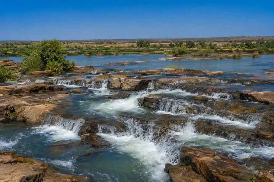 The Comoé flows over sandstone thresholds at the Cascades de Karfiguéla.
The wet season gives the water its strongest flow. The Comoé then spreads more forcefully over the rock steps, and spray leaves the exposed surfaces very slippery. In the dry months, water still runs through the cascades, but more calmly and clearly; the natural pools are easier to reach then. Patches of riverside woodland remain near the water, though cultivation and woodcutting have reduced that vegetation in places.
This is also where the agricultural plain begins in earnest. Water is diverted below the falls towards the rice fields, while vegetable plots follow the riverbanks. The broad, level ground below the rock steps has a practical value that the steep sandstone does not.
Practical details for the Banfora–Karfiguéla–Fabédougou route
The road from Banfora to Karfiguéla measures about 10.3 kilometres by the fastest published driving route, while Fabédougou lies about 15 kilometres from Banfora; a piste of roughly three kilometres links the cascades area with the dômes. Published entrance prices list 1,000 CFA francs for non-Burkinabè visitors at each site and 500 CFA francs for Burkinabè visitors; Karfiguéla also lists 250 CFA francs for students. Karfiguéla has published hours of 08.00 to 18.00 and prohibits camping, while the dômes have no published fixed hours. Local guides may be available at both sites, but no verified source makes one compulsory. Opening, payment and local access need confirmation before departure. The current US advisory says “Do not travel” anywhere in Burkina Faso because of crime, kidnapping, terrorism and limited medical care.
Fabédougou’s layered sandstone
Near Fabédougou, the flat fields give way to rounded sandstone masses, known as the Dômes de Fabédougou or Dômes de Fabedougou. Their striped surfaces record layers of sand laid down in sequence, then compressed and cemented into rock. The bands are not decoration. They are the remaining sediment layers.
Rain, wind and temperature changes have worked unevenly on fractures, joints and weaker beds. Erosion cut more deeply into the vulnerable sections, while more resistant sandstone remained in place. That slow difference produced the stacked, dome-like forms: some faces are rough, others smoother, and narrow clefts separate rounded blocks.
The dômes rise in a landscape where rock and cultivation occupy different ground. Farmers use the accessible, water-fed flats around Karfiguéla and Banfora; the sandstone formations stand above that working land rather than serving as fields themselves. Strong green blocks of sugar cane can be seen from the formations, and plants grow from soil pockets in cracks in the stone.
The season sharpens the contrast. Wet-season paths around the dômes can turn muddy and slippery, and small streams and pools may form at their base. In the dry season, those pools disappear and the ground hardens. Bare, banded sandstone then stands above the dry-brown plain, with vegetation held in the clefts.