
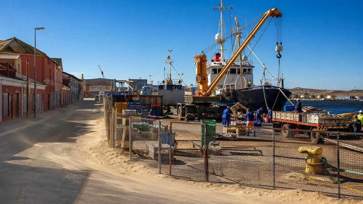
Along Lüderitz’s Working Harbour Edge
Hafen Street runs beside the fenced commercial quay at Robert Harbour, where fishing vessels, cargo equipment and service lines sit close to Lüderitz’s older streets. The harbour’s compact shape comes from a sheltered bay, a rocky seabed and very little level ground behind the quay.
Hafen Street at Robert Harbour
The public side of Hafen Street follows the edge of Lüderitz’s commercial harbour. The working yard lies behind a fence and gate, not on a promenade, but the 500-metre cargo and container quay remains close to the street.
The port handles containers, general cargo, dry bulk, fuel and fish. Ships’ cranes and mobile cranes move cargo at the quay, while haulers and a reach stacker carry containers across the yard to storage or onward transport.
 Workers sort and weigh fish on Robert Harbour’s commercial quay in Lüderitz.
Fishing gives this machinery a daily purpose. Vessels land hake and horse mackerel here; workers sort, weigh and pack the catch before it enters cold storage for export. Other vessels take on provisions and fuel, so the same narrow waterfront carries fish, supplies and freight.
The bay explains the location. The commercial quay occupies Robert Harbour’s western side, while stronger wave action affects the eastern shore. Fishing boats also use the main port when swell makes berths by the fish factories unsafe. The water offers enough shelter for regular work. Wind still crosses the open yard.
That wind has practical consequences. It strengthens from late morning into the afternoon, and cranes, stacked goods, containers and mooring lines work under that exposure. Tipper trucks can carry ore to temporary storage or directly to a ship’s hold; bulk bags and crates move through the same constrained ground.
A vessel at rest can also mean repair work. Lüderitz Boatyard repairs fishing vessels in the harbour, including the removal, workshop inspection and refitting of trawl winches and net drums. A winch or net drum on shore belongs to the next departure as much as to the previous trip.
Hafen Street and the wind
Lüderitz stands on a dry Atlantic coast shaped by the cold Benguela Current. Salt mist, wind and salts in the soil speed the deterioration of concrete and metal, so quay walls, pipes, gates and fences need regular maintenance to remain usable.
Strong southerly and southwesterly winds carry sand and dust. Easterly winds can push substantial amounts towards buildings west of the harbour. The harbour edge and the first streets behind it therefore show a working coastal condition rather than a separate industrial district.
The buildings give that condition a material form. Local stone appears in plinths, while rendered or brick walls rise above it; imported timber was used in roof structures, verandas and landings. Corrugated metal covers roofs and, in some cases, utility façades. High steps and deep shutters helped keep sand and dust outside.
The street sits close to the working ground because the harbour and town developed together around the bay. Shallow water, rocky seabed and limited land behind the quay have kept ships, storage and cargo handling concentrated beside the built-up centre.
The waterfront’s old power station
Hafen Street leads towards the Lüderitz Waterfront, where public buildings stand beside the port boundary. The former electricity station, built in 1911, now houses the maritime museum.
Anchors, propellers, masts and winches stand at the museum’s waterside. These are harbour tools displayed outside the controlled port area, where access requires permission.
The waterfront also includes Harbour Square market stalls and Market Square’s mixed homes and workplaces. These newer public uses sit beside service buildings and storage ground. The commercial harbour continues to handle fishing and cargo immediately alongside them.
Older buildings near the water date largely from Lüderitz’s early twentieth-century growth and retain German-influenced forms. Their stone bases, rendered masonry, timber elements and corrugated roofs suit neither a museum set nor a uniform architectural style. They show the materials available for building on this exposed coast.
Bismarck Street behind the harbour
Bismarck Street begins a few minutes’ walk from the harbour gate and carries port traffic between Hafen Street and the town centre. In its first blocks, fencing and service buildings give way to shops, the post office and older façades.
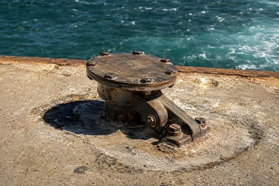 A metal bunker connection remains bolted to the concrete jetty at Robert Harbour.
The transition is short because the port has no remote industrial hinterland. Road traffic runs inland through Keetmanshoop towards Windhoek and South Africa, while an internal rail system links the port to the national network. Freight still passes through streets close to homes, shops and older buildings before it reaches those wider routes.
Practical note: The commercial yard is fenced and requires permission to enter. Hafen Street and the public waterfront provide views across the working edge, while Bismarck Street forms the short continuation into the centre.
A short return towards the water reaches the concrete jetty, where fixed points supply ships with water, electricity, fuel and waste services. One bunker connection remains bolted to the quay while the wind moves around it.